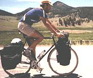
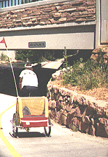
Journey to Colorado, Part II
The trip so far: I have traveled by bicycle from
Alabama through Tennessee, Kentucky, Illinois, Missouri, and Kansas to
reach Colorado. I took an extra day's rest in Pueblo before starting
again.
 Day
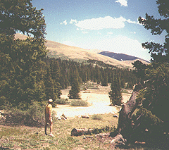
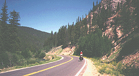
twenty-seven: After leaving Pueblo, the Bikecentennial
route does not head directly to Cañon City, but goes out to Wetmore
first. On this ride, I continued to follow the Arkansas River on
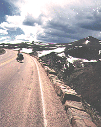
highway 96. Then I climbed somewhat to a large reservoir, and the
road continued to climb past that point, eventually reaching some tight
curves and steep grades. The terrain was very dry with only occasional
shrubs. Day
twenty-seven: After leaving Pueblo, the Bikecentennial
route does not head directly to Cañon City, but goes out to Wetmore
first. On this ride, I continued to follow the Arkansas River on
highway 96. Then I climbed somewhat to a large reservoir, and the
road continued to climb past that point, eventually reaching some tight
curves and steep grades. The terrain was very dry with only occasional
shrubs.
I turned north
at Wetmore, with the Sangre de Cristo (Blood of Christ) Mountains ahead
of me. This route would be an excellent start on a trip to Gunnison
or Leadville, but it was eleven miles out of my way to Cañon City,
although it did bypass twenty-one miles of four-lane. On the ride
into Florence, I saw some cliffs with remarkable impressions on their face,
almost as if some giant dirt daubers had constructed huge nests there in
some bygone age.
Past Cañon
City, I ran into a touristy area and a good bit of traffic. The road
was also steep, as I climbed over 1,000 feet approaching Royal Gorge.
Once I turned north on highway 9, I found little traffic. I continued
to climb along Currant Creek as the day got later. There did not
seem to be any chance that I would complete this climb before dark, so
I started looking for a place to camp, even though I was traveling through
a fenced semi-desert with no cover.
I noticed that
there was no fence along the Currant Creek side, and the "creek" at that
point was a wide, flat sandy area. On the other side, I saw a scrawny
pine amid cactus plants that would conceal my tent from the road.
Of course, if there was a heavy rain, I wouldn't be able to cross back
easily, but I wouldn't be camping in the creek bed itself.
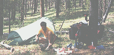
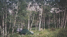
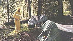
When I pushed my bike over, I was dismayed to find the ground covered with
red ants, since this was my only possible camping site. However,
I realized I was no longer in Alabama and the cold night would soon drive
the ants underground. So, I rested and ate, and when it came time
to pitch the tent, the ants were gone.
Pueblo - Gribble
Mt., 70 miles, 10.6 mph, June 21.
 Day
twenty-eight: The next day, I continued to climb up
along Currant Creek. Since I had not cooked a meal the night before,
I stopped along the way, along the edge of the now-running creek, to prepare
a cooked meal. This climb seemed endless, although I did have a couple
of steep downhills before I began climbing again. At one point I
stopped at a hostel marked on the map where I got a drink and talked with
the owner. Day
twenty-eight: The next day, I continued to climb up
along Currant Creek. Since I had not cooked a meal the night before,
I stopped along the way, along the edge of the now-running creek, to prepare
a cooked meal. This climb seemed endless, although I did have a couple
of steep downhills before I began climbing again. At one point I
stopped at a hostel marked on the map where I got a drink and talked with
the owner.
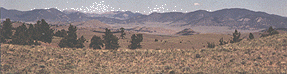
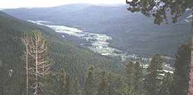
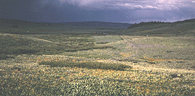
I crossed over
a ridge, where I was in a national forest briefly and then descended into
South Park, a huge, high, mostly dry, "level," treeless area in the middle
of the Rockies, the source of the South Platte River. However,
my climbing was far from over. I found I was traveling uphill and
up wind all across South Park.
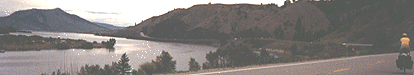
 Finally,
I reached Hartsel, a few stores on the South Fork of the South Platte River.
Even though a beautiful stream of water flowed a short distance away, there
was no water in this community, as the water rights for the stream had
all been sold to Aurora, Colorado. It was even illegal to drill a
well. The fact that all the water rights in South Park have been
sold downstream explains the large fields, close to water, that have been
left uncultivated, although the high altitude is most likely another major
factor. To emphasize the water restriction, the only toilet in town,
a pay toilet at that, was just a dry hole. Finally,
I reached Hartsel, a few stores on the South Fork of the South Platte River.
Even though a beautiful stream of water flowed a short distance away, there
was no water in this community, as the water rights for the stream had
all been sold to Aurora, Colorado. It was even illegal to drill a
well. The fact that all the water rights in South Park have been
sold downstream explains the large fields, close to water, that have been
left uncultivated, although the high altitude is most likely another major
factor. To emphasize the water restriction, the only toilet in town,
a pay toilet at that, was just a dry hole.
After leaving Hartsel,
my upward course resumed. I enjoyed the day's travel immensely, and
I loved this ride along a beautiful stream, but I also was suffering from
a very long, hard day and high altitude. At one point, before I reached
Fairplay, I pulled off to the side of the road, and Jim and Robert stopped
their vehicle beside me. They explained that there was no place for
me to camp in Fairplay, and they offered to give me a pickup ride to their
cabin, where I could spend the night. While I appreciated the offer
of a place to stay, I was by no means willing to accept a pickup
ride over pedaling the distance myself. However, they pointed out
that their cabin was too far for me to get to before dark. We finally
agreed to meet in Fairplay and for them to return me to Fairplay in the
morning. Since I was very close to complete exhaustion, it was not
hard for me to agree. In fact, when I reached Fairplay, I started
stuffing candy into my mouth as fast as I could, a sure sign that the gas
tank was almost empty. Then I gave Jim and Robert a call.
This week would
had been easier for me if I had had more water and more experience with
semi-desert conditions to help me relax. The week contained the three roughest
days I have ever spent on a bike.
Gribble
Mt. - Fairplay, 58 miles, 8.1 mph, June 22.
 Day
twenty-nine: In the morning, Jim took me back to where
he had picked me up. I then climbed from Fairplay to Hoosier Pass (11,542
feet), taking pictures along the way. It was also not a fast trip
because 1) I was still tired from the day before, 2) the road was getting
steeper, and 3) I was not yet adapted to the thinner air at high elevations. Day
twenty-nine: In the morning, Jim took me back to where
he had picked me up. I then climbed from Fairplay to Hoosier Pass (11,542
feet), taking pictures along the way. It was also not a fast trip
because 1) I was still tired from the day before, 2) the road was getting
steeper, and 3) I was not yet adapted to the thinner air at high elevations.
During the last
few
days, I had toyed with the idea of using a bandana to protect my ears,
which were badly cracked and burned, but I didn't want to spent the money
because I wasn't sure if I would actually wear one or not. Then,
I saw a bandana on the ground, and it wasn't even dirty. The bandana
was a great success. As the trip progressed, I found two more bandanas
and lost a greater number.
 At
Hoosier Pass, I took several more pictures, including ones of me playing
in the snow. Then I dropped down into Breckenridge, noting a downhill
rider (people pay "outfitters" to drive them to the top and then ride downhill).
In Breckenridge, I got onto the bike path, practically an interstate highway
for cyclists, with miles of pavement. I then turned off the path,
at Swan Mountain Road, to circle Lake Dillion, and get back on a bike path
on the other side, leaving the Bikecentennial trail to visit Denver.
After I joined the highway climbing up Loveland Pass, I saw many camp sites
on the side of the road in the national forest, so I stopped to camp, the
only camp site where I had more tent stakes in the morning than the night
before. At
Hoosier Pass, I took several more pictures, including ones of me playing
in the snow. Then I dropped down into Breckenridge, noting a downhill
rider (people pay "outfitters" to drive them to the top and then ride downhill).
In Breckenridge, I got onto the bike path, practically an interstate highway
for cyclists, with miles of pavement. I then turned off the path,
at Swan Mountain Road, to circle Lake Dillion, and get back on a bike path
on the other side, leaving the Bikecentennial trail to visit Denver.
After I joined the highway climbing up Loveland Pass, I saw many camp sites
on the side of the road in the national forest, so I stopped to camp, the
only camp site where I had more tent stakes in the morning than the night
before.
Fairplay - Keystone,
40 miles, 10.1 mph, June 23.
 Day
thirty: I slept in late and finally started at 10:00.
Part of the reason was not having slept well at Jim and Robert's (they
stayed up very late), part was being tired from the previous days, and
part was a real desire to push less and enjoy my trip more. Gears
were turning inside my head, and I was beginning to rethink my trip. Day
thirty: I slept in late and finally started at 10:00.
Part of the reason was not having slept well at Jim and Robert's (they
stayed up very late), part was being tired from the previous days, and
part was a real desire to push less and enjoy my trip more. Gears
were turning inside my head, and I was beginning to rethink my trip.
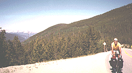
On my climb up
to Loveland Pass (11,990), I really took my time, stopping to take photos
at every opportunity, including ones using the tripod, thirteen photos
in all, none of them snapshots. On her way up, a young woman cyclist
stopped to check to see if I was OK, and then on her way back down, stopped
again, really worried about me. She just really didn't seem to accept
the fact that I could be enjoying climbing the mountain in a different
way from her. She was wanting to climb the mountain at a fair average
pace, and I was wanting to taste and to carefully digest every crumb of
the morning.
However, she wasn't
so preoccupied with speed that she couldn't slow to talk. I saw many
other cyclists who crossed the top of Loveland Pass without bothering to
look right or left, their eyes focused solely on their cyclometers.
 I
then dropped to the interstate and mostly motored my way to Denver, with
my speedometer reading in the 30's for miles at a time (to be exact, I
averaged 23.5 mph for 17 miles, 17.6 for 13, 9.8 for 6, 11.7 for 8, and
18.9 for 15). Part of the way into Denver is on the interstate, part
of bike trails, and part on roads that parallel the interstate. It's
not all downhill, although I was dropping well over a mile in elevation.
Riding a bike on the interstate is not only legal in Colorado but is also
recommended by the state over other roads in places (I was using the
map furnished by the state for cyclists). I saw one of the dangers
of using the interstate, however, when motorists started coming over onto
the shoulder with me to pass some slower vehicles. I
then dropped to the interstate and mostly motored my way to Denver, with
my speedometer reading in the 30's for miles at a time (to be exact, I
averaged 23.5 mph for 17 miles, 17.6 for 13, 9.8 for 6, 11.7 for 8, and
18.9 for 15). Part of the way into Denver is on the interstate, part
of bike trails, and part on roads that parallel the interstate. It's
not all downhill, although I was dropping well over a mile in elevation.
Riding a bike on the interstate is not only legal in Colorado but is also
recommended by the state over other roads in places (I was using the
map furnished by the state for cyclists). I saw one of the dangers
of using the interstate, however, when motorists started coming over onto
the shoulder with me to pass some slower vehicles.
On the way to Denver,
I talked with my mother on the phone. I told her that I had decided
not to try to reach the West Coast or even Missoula. I had been bucking
headwinds too long and dreaming about camping out in the woods. Because
my speed had not been high enough, I had no chance of making the coast
and the trip back to Alabama. Rather than completing a rough trip
with few pleasures, I would linger to enjoy my Rocky Mountain high.
In Denver, I spent
two days with my uncle and aunt and visited with members of the family.
During that time, I didn't ride at all.
Keystone - Wheatridge,
67 miles, 12.7 mph, June 24.
 Day
thirty-one:
When I started again, I made my way to REI, where
I looked at bicycle and camping gear and purchased a few items. On
leaving my uncle's house, my idea was to head south to Colorado Springs,
the Garden of the Gods, and Pike's Peak. However, as I traveled,
I decided that I would rather head north to Boulder instead, so I made
sort of a circle. I took the South Platte bike path north to its
end, then I took city streets to Broomfield and then Louisville, and then
I traveled on to Boulder. Day
thirty-one:
When I started again, I made my way to REI, where
I looked at bicycle and camping gear and purchased a few items. On
leaving my uncle's house, my idea was to head south to Colorado Springs,
the Garden of the Gods, and Pike's Peak. However, as I traveled,
I decided that I would rather head north to Boulder instead, so I made
sort of a circle. I took the South Platte bike path north to its
end, then I took city streets to Broomfield and then Louisville, and then
I traveled on to Boulder.
Bicycling
had made a big fuss about Denver and Boulder, placing them among the best
cities in the US for cycling. But I discovered that in both cities,
cycling was dangerous on the roads and impractical on the bike paths.
In Denver, most cities streets are four-lanes marked 50 mph, and cycling
is dangerous on them even when the traffic is light, and the traffic was
usually heavy. On the bike paths, 10 mph is a high speed, and every
intersection is a major problem except on the South Platte route, which
goes under the river bridges. Most of the Denver "bike paths" were
just plain sidewalks anyway, and the rest had heavy pedestrian use.
In Boulder, bike lanes were provided in some of the streets, but I did
not find the traffic very tolerant. The bike paths that I saw were
amusing and suitable for small children.
I arrived in Boulder
near dark, and a young woman cyclist proceeded to guide me into town, saying
it was just a little ways out of her route. Women in Colorado were
astonishing to a man from Alabama; they would come up to me and start conversations
without any hesitancy. Of course, it helped too that I was certainly
not an oddball in traveling by bike in Colorado. But the difference
in behavior has certainly given me something to think about. I certainly
enjoyed their forwardness in Colorado.
Since the Boulder
police would not let me camp near town, I climbed up a canyon to camp beyond
the town limits. There I met Kevin and Kim, two nomads (and members
of the Rainbows) who live in a truck in the national forests and ride their
bikes everywhere. I pitched my tent next to their truck, and we talked
both in the evening and in the morning.
Wheatridge - Boulder,
62 miles, 11.1, June 27.
 Day
thirty-two: In the morning, I visited a Boulder bike
shop, but found nothing to buy except a water bottle. While I was
waiting for the bike shop to open, another young woman started a conversation
with me, asking about my trip. Day
thirty-two: In the morning, I visited a Boulder bike
shop, but found nothing to buy except a water bottle. While I was
waiting for the bike shop to open, another young woman started a conversation
with me, asking about my trip.
Leaving Boulder,
I rode north to Lyons, a very hot ride. In Lyons, I met another bike
traveler named Jon, who was also going to the Rocky Mountain National Park,
and I tried to persuade him to accompany me. Jon did not seem to
dislike the idea of traveling with me, but he was undecided about which
route he wanted to take. Since I had met reluctant companions before,
I said good-bye and continued on.
I traveled mostly
up a valley towards Estes Park and camped in a small patch of national
forest along the highway (I had picked up the national forest maps along
the way). While I was traveling up a steep hill, a roller blader
passed me going downhill at a terrific speed. He was pushing one
of those three-wheeled carts, I supposed to provide a brake.
Boulder - Lion
Gulch, 36 miles, 9.4 mph, June 28.
 Day
thirty-three: In the morning, I climbed for five more
miles and met two Aussie bikers who were traveling south. I then
dropped down into Estes Park, and met Matt. I talked to him about
climbing together, but he wanted to travel on an incline first, so we separated.
I started the long climb through Rocky Mountain National Park alone, but
he passed me while I was well off of the road, eating some lunch.
Then, after I started, I caught up with him, and we cycled together.
Matt was from Connecticut and was traveling from coast to coast; he told
me he had recently sent back home a pile of gear, including even his rain
coat. Day
thirty-three: In the morning, I climbed for five more
miles and met two Aussie bikers who were traveling south. I then
dropped down into Estes Park, and met Matt. I talked to him about
climbing together, but he wanted to travel on an incline first, so we separated.
I started the long climb through Rocky Mountain National Park alone, but
he passed me while I was well off of the road, eating some lunch.
Then, after I started, I caught up with him, and we cycled together.
Matt was from Connecticut and was traveling from coast to coast; he told
me he had recently sent back home a pile of gear, including even his rain
coat.
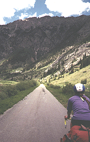
This ride is definitely
one of the most memorable trips one can take on a bicycle. As the
road winds up from Estes Park, there are many opportunities to look back
and ahead. Gradually the world left behind shrinks to insignificance
in the distance. In the meantime, new features become more important.
The surrounding forests, flowers, birds, and animals occupy one's attention,
many of the animals and birds quite tame. The rocks and snow remind
one of how alien this environment really is. Finally, there is the
road itself, always winding upward, always an effort.
At one point only,
shortly before the high point at 12,180 feet, I found the road too steep
and had to walk. A passing motorist yelled, "Get a truck!"
I guess it made him feel pretty big and self-sufficient.
At the top, the
highway is above 10,000 feet for ten miles. We put on warmer clothing
and only made brief stops, realizing the dangers of hypothermia and high
elevations.
 Then
we descended at high speeds. At one point, Matt, who was ahead, disappeared,
and he reported, after we rejoined, that a family had shared their meal
with him. He wasn't gone long, but when did it ever take a
cyclist more than a few minutes to eat a meal? Then
we descended at high speeds. At one point, Matt, who was ahead, disappeared,
and he reported, after we rejoined, that a family had shared their meal
with him. He wasn't gone long, but when did it ever take a
cyclist more than a few minutes to eat a meal?
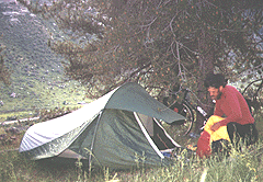
A major concern
was whether we would be able to find a place to camp at Timber Creek, the
national forest campground, and the only place we could reach before dark.
When we got there, we discovered that the last site was long taken.
However, the ranger encouraged us to find someone willing to share a site,
and the owner of a VW camper told us that we could have his tent site for
nothing, so we pitched our tents together.
Lion Gulch - Timber
Creek, 47 miles, 8.5 mph, June 29.
Day thirty-four:
Matt had heard that if we got up extra early we would see herds of elk,
so we left at 6:30 and saw the animals that he predicted. Unfortunately,
they were some distance from us, so I didn't even try to get a photo.
Matt and I had
realized the night before that we would soon be parting company.
He had made plans to go on a rafting trip for the day. When we got
to Grand Lake, his primary goal was reaching his destination, and mine
was making up for the lack of dinner the previous night. Matt went
on to the Pacific before ending his trip.
 After
parting from Matt, I spent the day resting on the edge of the lake, cooking
myself a feast, and eating to my heart's content. In the afternoon,
when it was time to hunt a camping site, I met Lane, traveling on a mountain
bike. He liked the idea of a free camping site. Using my forest
maps, we found a place where we could camp by traveling a short distance
up a dirt road. We were on the slope of a hill, but the slope was
not enough to make sleeping uncomfortable. After
parting from Matt, I spent the day resting on the edge of the lake, cooking
myself a feast, and eating to my heart's content. In the afternoon,
when it was time to hunt a camping site, I met Lane, traveling on a mountain
bike. He liked the idea of a free camping site. Using my forest
maps, we found a place where we could camp by traveling a short distance
up a dirt road. We were on the slope of a hill, but the slope was
not enough to make sleeping uncomfortable.
Timber Creek -
Shadow Mt., 22 miles, 10.3 mph, June 30.
 Day
thirty-five: In the morning, when we reached the intersection
near Granby, Lane wanted to go one way and I another. But it
was no big deal, we said good-bye and waved to each other from a distance. Day
thirty-five: In the morning, when we reached the intersection
near Granby, Lane wanted to go one way and I another. But it
was no big deal, we said good-bye and waved to each other from a distance.
Then, I turned
northward and climbed up 125, along Willow Creek. This was a great
ride, with forests on either side and very little traffic. Along
the way, I stopped, washed some clothes, and bathed. I tried to use
the portable shower, but I discovered that it heated very slowly in the
sun; plain old water bottles that have been riding in the sun are far superior.
This was another example of something that seemed like a good idea until
I tried it, along with the solar battery charger and the bike alarm.
 Just
before reaching Willow Creek Pass (9621 feet), I stopped to camp for the
night, pushing my bike up an embankment and way back into the woods, the
loveliest spot of the trip. While I was setting up camp, I heard
some cyclists going by, but I was unable to get out to the road in time
to stop them. While there, I filled up my water bottles from a beaver
pond across the road, enjoying the water's edge, and I also took a long
walk in the surrounding woods. Just
before reaching Willow Creek Pass (9621 feet), I stopped to camp for the
night, pushing my bike up an embankment and way back into the woods, the
loveliest spot of the trip. While I was setting up camp, I heard
some cyclists going by, but I was unable to get out to the road in time
to stop them. While there, I filled up my water bottles from a beaver
pond across the road, enjoying the water's edge, and I also took a long
walk in the surrounding woods.
Shadow Mt. - Willow
Creek Pass, 34 miles, 10.7 mph, July 1.
 Day
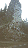
thirty-six: Right after starting, I crossed over the
pass, two miles away. In traveling that short distance, I discovered
a layer of rock, standing on end like a pillar or chimney.
Down the other side, the road left the forest and entered the sagebrush
terrain of North Park. At Rand, I was able to buy some donuts and
a drink. Soon afterwards, I met Al, cycling southward, and not far
behind him, his son Mark. They were traveling together as far as
Denver, and Al was continuing to the east coast. I assume that Al
finished his trip because I saw his name in a hostel register in Kentucky
the next year. Day
thirty-six: Right after starting, I crossed over the
pass, two miles away. In traveling that short distance, I discovered
a layer of rock, standing on end like a pillar or chimney.
Down the other side, the road left the forest and entered the sagebrush
terrain of North Park. At Rand, I was able to buy some donuts and
a drink. Soon afterwards, I met Al, cycling southward, and not far
behind him, his son Mark. They were traveling together as far as
Denver, and Al was continuing to the east coast. I assume that Al
finished his trip because I saw his name in a hostel register in Kentucky
the next year.
I continued on
to Walden, Colorado, and then had to travel to the north end of town to
get to the grocery. I was only 20 miles from Wyoming, so it was a
temptation to add another state. However, it also seemed silly to
ride 40 miles just to say that I had been to the state, the
wind was increasing, and the mountains ahead looked bare and uninteresting,
so the decision was not that hard.
 Then
I started back south against the wind across North Park on highway 14,
passing some cowboys on horses along the way. As I neared the end
of the Park, the sky blackened, and I anticipated a storm that never occurred.
In between Muddy (8772 feet) and Rabbit Ears (9426 feet) Passes, I pushed
my bike a short distance into a partially cleared section of spruce and
aspen forest. The ground was wet and muddy. Although mosquitoes
were not a problem anywhere else, they were horrible here. As the
weather was cool, I stayed in my rainsuit until I finally crawled into
my tent. Then
I started back south against the wind across North Park on highway 14,
passing some cowboys on horses along the way. As I neared the end
of the Park, the sky blackened, and I anticipated a storm that never occurred.
In between Muddy (8772 feet) and Rabbit Ears (9426 feet) Passes, I pushed
my bike a short distance into a partially cleared section of spruce and
aspen forest. The ground was wet and muddy. Although mosquitoes
were not a problem anywhere else, they were horrible here. As the
weather was cool, I stayed in my rainsuit until I finally crawled into
my tent.
Willow Creek Pass
- Rabbit Ears Pass, 73 miles, 11.7 mph, July 2.
Day thirty-seven:
The mosquitoes weren't so bad in the morning, although my tire gave me
fits after I added air because the value wouldn't close. Rabbit
Ears Pass had two unusual rocks that looked like Rabbit Ears.
Before going far,
I met Peter and Will, who had all of their gear in small bags in the front,
obviously staying at motels for the night. I hear from time to time
that carrying the weight on the front is superior or that credit card touring
is superior to loaded touring, yet these are the only two bike travelers
I have ever met who were carrying such a small load, although I have met
a number of cyclists who were being sagged (a car or truck was carrying
their gear). Nonetheless, Peter and Will were having a great time.
My ride was mostly
level for a while, and then I had a downhill trip most of the way to Steamboat
Springs, hitting 45 mph (my highest speed in the Rockies) along the way.
Steamboat Springs was trying to turn into a resort area, with new condos
begging for buyers, but it held no attraction for me.
 I
turned south along highway 131 and traveled through dry picturesque country
and three small towns to camp in a grove of aspens on the mountainside
east of Toponas. Along the way, I stopped to watch a herd of sheep
wandering across the railroad tracks below me, I was passed by three loaded
cyclists who would not stop to talk, and I encountered another vertical
wall, this one much bigger and called Finger Rock. I
turned south along highway 131 and traveled through dry picturesque country
and three small towns to camp in a grove of aspens on the mountainside
east of Toponas. Along the way, I stopped to watch a herd of sheep
wandering across the railroad tracks below me, I was passed by three loaded
cyclists who would not stop to talk, and I encountered another vertical
wall, this one much bigger and called Finger Rock.
Rabbit Ears Pass
- Toponas, 68 miles, 11.8 mph, July 3.
 Day
thirty-eight: Leaving my camping site, I rejoined highway
131 and traveled towards McCoy. This was a dry area, the trees mostly
Juniper and Piñon Pine. In Bond, where I bought a snack, there
was a faint drizzle, and I learned it was the first rain this year.
For a ways, I had been descending gently, but after I crossed the Colorado,
I had a hard eight mile climb. Once past that, it was a nice downhill
to Wolcott, located next to the interstate. Day
thirty-eight: Leaving my camping site, I rejoined highway
131 and traveled towards McCoy. This was a dry area, the trees mostly
Juniper and Piñon Pine. In Bond, where I bought a snack, there
was a faint drizzle, and I learned it was the first rain this year.
For a ways, I had been descending gently, but after I crossed the Colorado,
I had a hard eight mile climb. Once past that, it was a nice downhill
to Wolcott, located next to the interstate.
I traveled east,
paralleling the interstate, but then turned south towards Minturn, stopping
to talk to some rafters just before I turned. On my map, there was
national forest ahead where I thought I could camp, but before I arrived
there, I saw that the mountainsides were extremely steep, so camping looked
unlikely. To make the situation worse, I could see that the area
(between Eagle and Vail, and thus called "Eagle-Vail) was rapidly being
taken over by the wealthy. I even passed one subdivision that was
protected by guards, fences, and gates.
 However,
the map showed a ranger station, so I stopped to ask. The ranger
I talked to was sympathetic, and he told me that I could camp off of the
hiking trail if I got out of sight and gave me directions. Not only
was the trail steep to push a heavy bike but also I had to climb a small
cliff to get to the spot. But, I was in a relatively flat area, away
from any other people, and high enough to have a panoramic view of the
valley. Before I went to bed for the night, two fawns came within
twenty feet of my tent. However,
the map showed a ranger station, so I stopped to ask. The ranger
I talked to was sympathetic, and he told me that I could camp off of the
hiking trail if I got out of sight and gave me directions. Not only
was the trail steep to push a heavy bike but also I had to climb a small
cliff to get to the spot. But, I was in a relatively flat area, away
from any other people, and high enough to have a panoramic view of the
valley. Before I went to bed for the night, two fawns came within
twenty feet of my tent.
Toponas - Minturn,
55 miles, 12.2 mph, July 4.
 Day
thirty-nine: In the morning, I went into Minturn,
looking for some groceries, but I had no luck. Since leaving Steamboat
Springs, I had traveled through a number of small towns with a high native
Spanish-speaking population that were not exactly prospering economically.
Minturn was now experiencing rapid growth, but the people were being displaced.
The former grocery found that tourist items brought in more cash, and many
businesses had been or were being sold outright. Day
thirty-nine: In the morning, I went into Minturn,
looking for some groceries, but I had no luck. Since leaving Steamboat
Springs, I had traveled through a number of small towns with a high native
Spanish-speaking population that were not exactly prospering economically.
Minturn was now experiencing rapid growth, but the people were being displaced.
The former grocery found that tourist items brought in more cash, and many
businesses had been or were being sold outright.
This day involved
a lot of climbing, but it was very enjoyable. First, I climbed for
an hour and a half (nine miles) out of the valley, although I continued
to follow a deep, narrow canyon of the kind that railroad modelers love.
Train cars looked tiny below. The edge of the canyon reached the
bed of the road, and there was no guardrail, so I always had a good view.
However, when a passing motorist suddenly jammed on his brakes behind me,
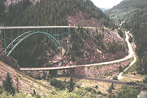
I had trouble breathing for a minute. At Redcliff there is a scenic
bridge.
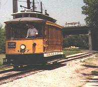
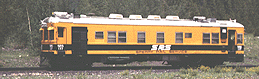 Then
the road leveled out for a while. The night before, I had seen one
of the prettiest railroad cars I had ever seen: it looked more like an interurban
than a train car, and it was self-propelled. Along this ride, I kept
encountering it with several road vehicles, one a crane, which had been
converted to riding on the rails. They obviously were being used
to adjust the track and/or make repairs. Then
the road leveled out for a while. The night before, I had seen one
of the prettiest railroad cars I had ever seen: it looked more like an interurban
than a train car, and it was self-propelled. Along this ride, I kept
encountering it with several road vehicles, one a crane, which had been
converted to riding on the rails. They obviously were being used
to adjust the track and/or make repairs.
Then I climbed
over Tennessee Pass (10,424 feet), a somewhat slower five mile climb.
When I reached Leadville, it began to rain again. I stopped at the
supermarket and bought a ton of food, as I had been on short rations since
Steamboat Springs. While munching food in front of the supermarket,
I meet two cyclists who were riding from Denver to Aspen, 160 miles, in
a single day. After looking around awhile, I headed north, but before
getting very far, I noticed a nice woods on the right side of the road,
so I pushed my bike back in and camped.
Minturn - Leadville,
36 miles, 8.4 mph, July 5.
Day forty:
In the morning, I revisited the supermarket, and then traveled less
than a quarter of a mile past my camping site when I met Betsy, who had
camped at a roadside rest stop. We discovered that we were traveling
the same direction and immediately agreed to spend the day together.
Betsy had started from California early in the year, traveling to Colorado
through the Southwest, and had faced snow in some of the passes.
Her greatest adventure, however, had been a 15 month trip through Europe.
Before we started, however, a bike traveler from Australia arrived, headed
the other way, so we continued our conversation with him.
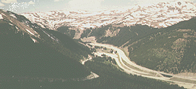
We headed up highway
91 together and crossed Fremont Pass (11318 feet), viewing the mayhem created
by mining on the way up (and on the way down), and stopped at the top for
photos. Betsy told me that she had to laugh at the motorists who
stop to take their pictures at the top of passes, "They didn't climb the
mountain; their motor vehicle did all the work; anybody can get to the
top of a mountain in a car, yet, they still want to take the credit."
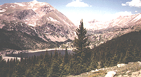
 We
then had a fast ride down to the interstate, where we got on the bike trail
to Frisco and Dillon Lake, much steeper than you'd expect any bike trail
to be (but we were still going down). We stopped at a supermarket
in Frisco and ate on the sidewalk, talking a blue streak. Betsy was
planning to stay with friends in Silverthorne, so she asked me to join
them. We
then had a fast ride down to the interstate, where we got on the bike trail
to Frisco and Dillon Lake, much steeper than you'd expect any bike trail
to be (but we were still going down). We stopped at a supermarket
in Frisco and ate on the sidewalk, talking a blue streak. Betsy was
planning to stay with friends in Silverthorne, so she asked me to join
them.
That night, we
both took turns explaining to our non-cyclists the nature of bicycle travel,
and they were excellent hosts. One funny moment arrived: in talking
about my trips, I mentioned something about my trip in 1965. Everyone's
eyes grew as big as saucers. "How
old are you, anyway?"
they cried. I had forgotten an old rule: Never mention a personal
event that happened before the other person was born. However, I
was tickled about their misunderstanding my age.
Leadville - Silverthorne,
40 miles, 11.1 mph, July 6.
 Day
forty-one: In the morning, I wanted to be the old-fashioned
gentleman and escort Betsy as far as the bike trail around Lake Dillon.
However, I couldn't find it and ended up looking stupid. After leaving
Betsy, I traveled north to Kremmling on highway 9, traveling downhill through
dry terrain and past a long lake. Along the way, I met a young couple
traveling by bike. The girl told me, "There's four old geezers following
us." When I met the "four old geezers," I was tickled to discover
that they were my age. Nothing is better for the soul than having
someone think you are many years younger than your actual age. Day
forty-one: In the morning, I wanted to be the old-fashioned
gentleman and escort Betsy as far as the bike trail around Lake Dillon.
However, I couldn't find it and ended up looking stupid. After leaving
Betsy, I traveled north to Kremmling on highway 9, traveling downhill through
dry terrain and past a long lake. Along the way, I met a young couple
traveling by bike. The girl told me, "There's four old geezers following
us." When I met the "four old geezers," I was tickled to discover
that they were my age. Nothing is better for the soul than having
someone think you are many years younger than your actual age.
After I reached
Kremmling, I turned east on 40, returning to Granby via a deep gorge on
the Colorado River. While stopped in Granby to buy groceries, I met
a couple from California who were touring locally. Then I turned
south, trying to reach a camping site before dark. As I rode into
Frasier, rain began to fall. I stopped for a bigger meal and to wait
out the storm a little. As soon as the rain let up, I continued and
finally pitched my tent in the rain and well after dark above Winter Park.
I was especially pleased with the distance because it had all been traveled
at high elevations.
Silverthorne -
Winter Park, 95 miles, 11.4 mph, July 7.
 Day
forty-two: It rained during the night and was still
raining when I packed up my tent in the morning. After I started,
the rain ceased for a while. I climbed Berthoud Pass (11,307), with
the members of a bike club talking to me as they slowly caught up and passed, and I
stopped for pictures along the way. I guess I should have
been more hasty; at the top, it started pouring rain. Day
forty-two: It rained during the night and was still
raining when I packed up my tent in the morning. After I started,
the rain ceased for a while. I climbed Berthoud Pass (11,307), with
the members of a bike club talking to me as they slowly caught up and passed, and I
stopped for pictures along the way. I guess I should have
been more hasty; at the top, it started pouring rain.
Then I descended
at 40 mph in heavy rain and in heavy traffic. I was descending as
fast as the automobiles (and could have gone faster), but I tried to keep
one car length behind the car in front of me because my brakes were wet.
This, the motorists would not allow, and they kept forcing their way past
me, a scary experience.
Most of my day
was spent in Idaho Springs, washing clothes, eating, and talking, while
the rain continued to fall. Colorado is a very dry state, and I experienced
a year's worth of rain in one day, not to mention the previous days.
I could not leave until 8:00. When the rain stopped, I pedaled up
to the foot of Mt. Evans, traveling past homes on the edge of the national
forest, so "no trespassing" signs were everywhere. At one house,
a llama (not a misprint) had strayed from its pen, but they had large "no
trespassing" signs, so I did not stop to inform them (I did tell some neighbors,
however). Finally, at the bend of the road, I discovered a hidden,
abandoned campground and pitched my tent there for the night.
Winter Park - Excelsior
PG, 42 miles, 10.4 mph, July 8.
Day forty-three: The
next morning was bright and warm, so I stayed in camp until eleven, drying
everything out and getting some sun. I even thought about nude
sunbathing; later, after I started up the mountain, I found myself looking
down on my campground from the first overlook, and I was glad that I hadn't.
I took my time riding up to Echo Lake, stopping at one picnic stop where
my parents and I had stopped back in 1956.
At Echo Lake, I
stopped to cook, delaying the thought of climbing higher, perhaps from
fear of the weather or just of the road, but Betsy found me loitering there.
She had just been to the top of Mt. Evans, and her eyes were shining.
I could hardly avoid the challenge, although she did advise me to wait
until the next day. I decided not to do that, either; it was today
or not at all. So I reluctantly started upward at 3:20, carrying
all my gear in case I needed to camp.
The road wound
gradually upward, giving me views of Echo Lake from time to time.
My average speed was under 5 mph, and I constantly stopped to take pictures.
At times, I felt frightened on the edge of precipices. On the way
up, I found bristle cone pines at the edge of the tree line. Later,
I encountered a herd of sheep, looking shaggy as they lost their winter
wool. At Summit Lake, there was the only downhill for the whole distance.
Beyond that point, I found the road surface badly deteriorated and even
narrower; the sky threatened me with winds and black and gray clouds; the
sun grew dimmer. I found myself crying hot tears as I thought of
a dedication for the photo at the top:
This is for all the SOBS who
tried to keep me down. After passing mile mark 12, I began to
walk because pedaling required too much resting time. I was gasping
for breath in the thin air.
 When
I reached the top at 14,100 feet, I immediately put on extra clothes, took
some pictures, and started down, feeling elated, but gravely worried about
hypothermia. My face is red and raw in the photos due to the altitude.
The trip down was terrifying with the wind, the black clouds, the narrow
strip of pavement full of holes, and drop-offs. For years,
I had had dreams of driving down a road so narrow I could not see either
side and then plunging off. I realized, beyond a shadow of a doubt,
that I had dreamed about this very road, which my dad had driven us up
in 1956 (PS: the dream has never reoccurred since this ride). After
a few miles, I had enough energy to start crying again. When
I reached the top at 14,100 feet, I immediately put on extra clothes, took
some pictures, and started down, feeling elated, but gravely worried about
hypothermia. My face is red and raw in the photos due to the altitude.
The trip down was terrifying with the wind, the black clouds, the narrow
strip of pavement full of holes, and drop-offs. For years,
I had had dreams of driving down a road so narrow I could not see either
side and then plunging off. I realized, beyond a shadow of a doubt,
that I had dreamed about this very road, which my dad had driven us up
in 1956 (PS: the dream has never reoccurred since this ride). After
a few miles, I had enough energy to start crying again.
In many states,
motorists sometimes wave at cyclists, but not in Colorado; there are too
many cyclists. But on the way down, every single vehicle was full
of people waving crazily at me or giving me the thumbs-up. I descended
to a bend in the road above Echo Lake, and then walked down into the woods
to camp. In spite of, or most likely because of, the physical and
emotional drain, it had been a wonderful day. I just had enough time
to pitch the tent before darkness settled in.
For more photos see A Photo Trip up Mt.
Evans.
Excelsior - Echo
Lake, 35 miles, 6.7 mph, July 9.
My "adventures"
when I returned to Denver and my return trip to Alabama through Nebraska,
Iowa, Illinois, Kentucky, and Tennessee is told in part III.
|