Eastern North America Tour Y2K
Day 59: No sooner did I start than I encountered another motorist with a flat, but this one I can't help, as he has no spare. As I ride, I notice that I picked the only possible camping site, at least according to my book.
On Canadian side of the border, I stop to eat the bread I bought the night before. Then I cross to the US to answer questions from the guard. I forget that I am not supposed to laugh, but I make a good impression and get sent on my way without more delay than is needed to satisfy the guard's curiosity.
A sign says that information is ".5 miles ahead," which I consider odd. Half a mile down the road is a store that gives me a fair exchange on my remaining $6.60 in Canadian money and another that sells me two road maps, one of Minnesota and one of Wisconsin.
On the next climb, I discover a good pull-off, and I stop to finish my bread and use the john. Down the other side, I pass the information center. Was that dot a rivet, or did the owner of one of those stores help create the wrong impression?
I pass Grand Portage without stopping.
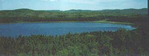
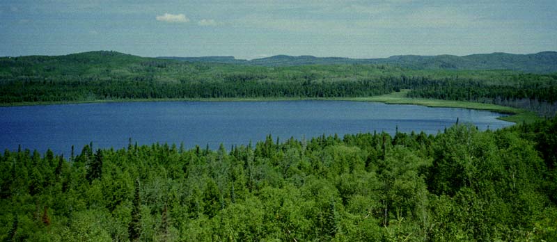
The road follows the shore of Lake Superior but often climbs over a hill or moves inland a-ways, with houses often located between the road and the lake, and usually the houses themselves are out of sight of the road. As I ride today, I remark the number of picnic stops that are marked on the map that don't exist. The next marked stop that I find is an empty lot with no toilet, picnic table, or even shade. Next there's a boat launch, a swimming area, and finally a stop with a picnic table or two, but it's really another swimming area.
At this last stop, a little girl is desperately clutching her privates, obviously needing to pee, and her mother casts a hard look at me, as if I've done something wrong, so I retreat to my bike, but the woman retreats with the little girl in a parallel direction, trying to find a sheltered place for the little girl to hid, and so she casts another evil look at me. The other people around her must be family, as she doesn't seem to mind them. I get on my bike and depart, kind of tickled at the mother's plight.
I need some place to cook a meal, so I finally push the bike onto a beach, with the wheels digging in and barely turning, across the soft stuff, and up onto a slightly firmer hill, where a small tree holds up my bike. After talking with a retired teacher collecting colorful stones, I cook a meal. Then I have to drag the bike back out.
I reach Grand Marais fairly late in the evening, find a supermarket and a Subway, and head out of town. However, I see a municipal camping area, so I stop to check on prices. There's a line, so I don't wait to see if bicycle campers get different treatment, but the normal price is $20 - $27. I stop at the forest office, but the map only tells me that this area is a confusing patchwork of property ownership, private, federal, and state.
I ride along, looking for a site, and I find a grassy slope with signs saying, "Cars not beyond this point." I notice that the grass is higher than my head, so I decided to push my bike into it. Downhill a short distance, I encounter a trail which I had not noticed. Investigation shows that one person or animal has used the trail recently but that it is completely overgrown between me and the lake. I decide that due to the lateness of the hour that no one is likely to come down here, and I proceed to set up my tent.
Then I freeze. Cars have stopped on the road above, and I hear what I believe are men and boys getting out. I imagine them walking straight down the path to me, so I begin putting the tent up. By the time the tent is put up, they have left. However, a short climb up the slope reveals that two cars are still there, only a hundred feet from my site. What should I do? It is too late to find another spot. I decide to wait. After a half an hour, the voices return. Now I am hearing men and women, laughing and talking. They seem to stand around talking forever before getting into their cars and driving off.
So, I set up the tent -- without the fly -- and go to bed.
Hwy 61 - Grand Marais, Minnesota, 64.9 miles, 11.8 mph, July 29, 2000.
Day 60: The morning is cold, but the tent is not the least bit wet. I get started early. At the road, there is another vehicle already parked there. Opposite, I think I see a trail. If I had thought, I would have recognized that the sign about parking cars was an acknowledgement that people park here.
Down the road a bit is a very nice roadside park with all facilities, where I stop for a while. Some of the vehicles there are full of sleeping occupants, despite the "no camping" signs.
Traveling up the next hill, I see a geological sign and stop to read it. A motorcyclist is already there, reading the sign, and I start to talk to him about the interesting geology there, for instance, the volcanic rock on top of sedimentary rock. He tells me, "That's what the sign is explaining!" and sure enough, that's what it is about. The odd thing here is really the sedimentary rock, as the whole coast is volcanic. The sign informs me that this was a rift valley 1.1 billion years ago.
I continue on down the road, the shoulder deteriorating. I pass occasional small groceries. Again, I find that picnic sites are missing or not usable for picnicking, and I wonder where I will be able to cook.
At Tofte, I encounter a man who tells me that he led a campaign to create a paved bike path along most of this shore. He doesn't look like a cyclist, but I accept him at his word and tell him about the trail I saw in Quebec.
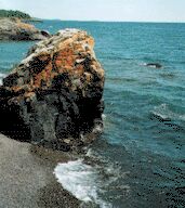
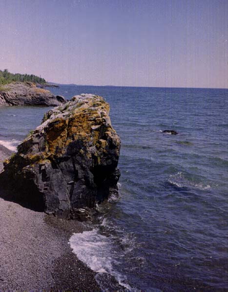
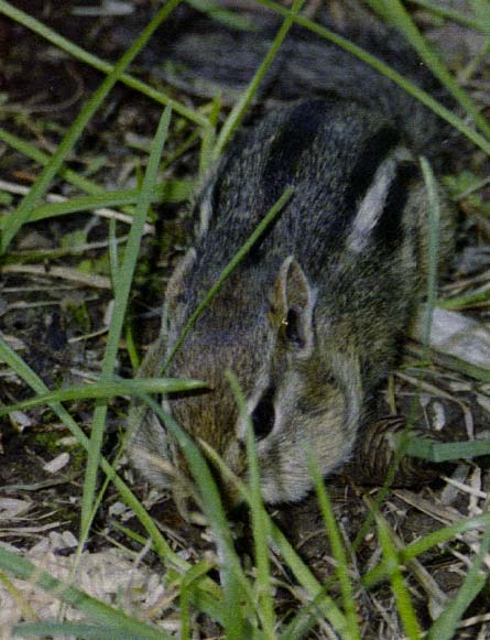
There is a pretty good park here with a rocky beach, although the toilets lack seats. I cook brown rice and lentils, while a chipmunk fills his checks repeatedly with rice that I dig out of the bottom of my panniers. While here, I notice that my rear tire is worn down to the cord. I had not noticed any problem in Thunder Bay. Did I not look carefully? Had the rough, gravelly shoulders or did the sharp gravel beaches cut the cord?
At another stop, I saw a map and read some information about the Superior Hiking Trail, that follows a ridge from Duluth up to the Canadian border. Later I stopped at a state park, where I saw that the vehicle fees were $4 a day and the camping fees $12 - 16 a day. I did not ask if those fees applied equally to cyclists.
Towards the end of the day, I reached Sliver Bay, the last town for the day, but I found I had to climb away from the highway to visit the town. While I did get some food from the grocery, I knew I would be hungry without something more solid, so I stopped for a chicken sandwich and fries, although they did not suit my digestion.
Beyond town, I noticed roads on either side leading to residences, most of the roads marked with Century 21 "for sale" signs. I saw two in a row that lacked mailboxes, the second blocked with some fallen logs, so I pulled off the road and followed the "driveway" to the bottom, where there was an overgrown turn-around. So I pitched the tent there.
Grand Marais - Beaver Bay, 62.4 miles, 10.6 mph, July 30, 2000.
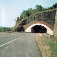
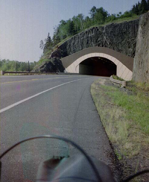
Day 61: In the morning, I pass Split Rock Lighthouse, which I can see from a rest area to the south. As I ride down to Two Harbors, I find sections of the road that are in poor repair with missing shoulders, that are under heavy construction (blasting a new route through the rocks), and that have been modernized and have wide shoulders. I also pass through two tunnels: The first is very modern in appearance, having an oval shape, a wide passenger walkway, and wide shoulders; the second has an older appearance but also has wide shoulders. Both are brightly lit within, and both seem unnecessary, as the road in each case previously continued around the bluff. Perhaps the tunnels were seen as more attractive.
At Two Harbors, I get directions from the info center to the bike shop in town. My rear tire is in terrible shape, with the entire center worn down to the core. I have a spare folding tire, but since no one makes 27" folding tires any more, I am reluctant to use it unless necessary. Unfortunately, the bike shop is closed on Mondays and is going out of business as well. The store next door, as I was told, is a hardware store, so I check there for tires, and the young clerk, a cyclist, is anxious to help me, even phoning the home of the owner of the bike shop when his store has no tire, but the owner is not home.
I leave the store as a cyclist is riding by. He sees me and takes an immediate interest, so I ride over to him and ask him if he knows where I can get a tire, and he says, "Let's go back to the bike shop," which he opens. I not only have found the owner, Stephen Andrewjeski, but a very interesting cyclist as well. In the shop, he has three bikes on the wall that he built himself and has ridden many tens of thousands of miles, a tourer, a fast bike, and a tandem, and he says he has built over 300 bicycles. He knows Bruce Gordon personally, as back in the early days there were few frame builders, and thus they all got to know each other. He shares some of my likes, as his touring and tandem bikes have barcons on them, but not my other preferences, as his tourer lacks fenders, which he considers unnecessary. I show him the flex in my bike's bottom bracket, and he tells me I ought to get a new bike.
He confirms what I had already heard about the bike path, saying that it has been approved from Two Harbors to Grand Marais, although problems exist for extending it farther. He said that there were actually about five people (including him) involved in the project.
His inventory is low as he is going out of business, but he takes a tire off of his own touring bike, explaining that he has traveled only 150 miles on it and selling it to me at cost. He is surprised that I want a 26" tube, so I explain that 27" tubes are always too long, for some unfathomable reason. He is going somewhere, so we end the conversation, and I leave before installing the tire.
At the laundry up the street, I wash all my clothes, except for my rainsuit, as I am wearing it while everything else is washing. Then I change my tire and tube, leaving the old tire and tube in the dumpster. It is my policy to always change the tube when changing the tire if the tube has had at least one flat, as a patched tube in a new tire often immediately starts loosing air. Before leaving town, I also visit the supermarket and Subway, of course.
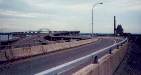
I take the scenic route into Duluth, which has good shoulders and a few scenic views and parks. In town, the info center gives me directions to an internet cafe, the library, and to the bridge I can use to get to Superior, Wisconsin, a bridge with a bike path. Although it's just four, the sky is very dark, and rain looks likely.
I decided, due to the time, that it's a better bet to stop at the internet cafe, which is closer, than at the library. The internet cafe charges 10 cents a minute, but since I have just a little mail, I use it only $3.55 worth. The big news is that my website has had one billion bytes (a thousand megs) of traffic for the month, a new record.
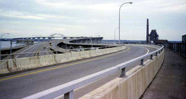
I continue on down the road, finding a Subway, where I eat. The sky is dark due to the storm clouds, it's late in the afternoon, and I have covered nearly 60 miles for the day. To find a camping site, I have to cross the bridge and then travel through Superior. The main road looks less and less traveled and finally funnels into the interstate, but I take a route to the right, remembering the bikeway. Finally, I see it, curving up from the ground to meet the bridge. A few more twists and turns and another quarter of a mile, and I am there.
The bikeway is narrower than the one in New York, but it is more substantial also. Rather than being an afterthought, it was designed into the bridge and has a concrete floor and solid support. As a result, I am able to bicycle the whole way, often at a high speed. However, the narrow width and tight curves would make a collision likely if there was any traffic, either pedestrians or cyclists. Fortunately, the late hour of the day and the extreme length of the bridge both make traffic unlikely.
On the other side, I see a billboard advertising a $19.95 motel and, considering I am likely to end up in campground anyway -- which could cost almost that much -- and also considering that I need to get caught up on my typing and uploading, I decide to stop there. However, the clerk tells me that the last cheap room is already taken and wants me to get a $35 room. To me, this is bait and switch. Down the street is a similar motel, and I am told $27 with a phone. The woman here also defends the first motel saying that it has been upgraded, and the owner is no longer paying for the sign, but I think the first clerk would have said something different in that case.
I spend most of the night typing and making corrections to this account, so it can be uploaded in the morning.
Beaver Bay - Superior, Wisconsin, 57.8 miles, 11.3, mph, June 31.
Day 62: In the morning, I finish getting the account of my trip ready and upload it without time for a final review, and then I get ready to go, very sleepy. I stop and get food, and then pull out of town rather late. On the edge of town, I stop at a gas station for some bean burritos. Before I leave, a car starts to pull out with its hood unlocked, so I frantically stop the car and shut the hood. Then the driver pulls over to the far end of the parking lot before stopping to add antifreeze. Oh well, my intention was good.
Traveling down the highway farther, I come to a "motor vehicles only" sign on the road, so I backtrack on the shoulder to country road E, wondering if it will take me to the same place. Seeing a woman going into her trailer, I stop and confirm that I am on a parallel road. Isn't it strange, however, that signs often order vehicles (big tractor-trailers too!) to turn around without providing room to do so or information about an alternate route?
Down the road a few miles, I am instructed to rejoin the main road, which is now no longer limited access. From there I take a left turn onto highway 2. This highway, by the way, is commonly used by those taking the Upper Peninsula Route.
At Poplar, I get into a conversation with two men, so I ask them about the "no trespassing" law in Wisconsin. A few years ago, the Wisconsin law was changed to make posting a sign unnecessary, which I see as a bad law. However, they both tell me that nothing has really changed anyway, and I have nothing to worry about when pitching a tent. They tell me that only grievous offenders get punished, and there is a common problem from many large hunting parties which ignore property owners' rights. Still, I think it makes little sense to pass unjust laws because the courts are unwilling to convict violators of current laws.
Both men ask me to stay at their places and describe how to get to them, but I am wanting to cover more miles. I end up waiting in Poplar a good while because there is a huge storm to the southeast, but I finally decide it's moving away and go on.
At Brule, I find a great roadside rest, with delicious, flowing water. A crew is busy on a project that makes no sense to me, so I ask their foreman to explain. Rather than explaining in a few words, he takes me to a finished section of the stream and explains that the original streambed was destroyed when the highway was built and that the current channelized streambed is not a fit habitat for fish. So, the men are recreating the original stream conditions by placing spiked-down logs at various angles across the bed to make currents and eddies and also by adding rocks and soil along the stream edges.
I next talk to two young men fishing in the main stream a short distance away by floating worms down the stream on lines attached to fly rods.
At Brule, I turn south on highway 27. It is a great afternoon, but I find myself tired from lack of sleep from the night before. As I pass a tree farm, I notice that the ground is very clear underneath the pines. Given the recent storm and therefore the likelihood of damp ground and invigorated mosquitoes elsewhere, I decide that this is an idea place to camp and push my bike far off of the road.
The light under the trees is most odd, as the sky is bright above and the horizon under the trees is even brighter, but the area between is dark from the many tree limbs. There's almost no mosquitoes. I cook a good meal, eat it, and clean up. I want to write some as well, but I am falling asleep just sitting there, so I pitch my tent and drop off to sleep just as soon as I crawl into my sleeping bag.
In the night, I awake to see that same weird effect of the ground looking brighter than the sky. I am awake only long enough to pee before I crash again.
Superior - Hwy 27, 44.8 miles, 10.7 mph, August 1.
Day 63: I awake to a pretty morning. It's a long ride to the nearest town, but fortunately I encounter a fish and tackle shop with lots of groceries, so I get my breakfast there.
Later on, when I am getting a little tired, I see a sign for a boat launch/park. I turn off of the road, but all I see is a gravel parking lot. However, there's a stop sign at the top of the hill, so I climb up there to discover a great little park by Howard Lake Dam, with cold, delicious pump water. I cook, eat, and talk with some a mother and her little daughter, two cyclists, and the father and brother of the daughter, who are there fishing. I also take a brief nap before I hit the road again. Then I find that the road is under repair, so I ride on dirt for a ways. Then I reach Hayward, a town of less than 2,000 that looks much bigger. There, I get groceries, but no fresh bread; however, I do get a sub.
After traveling another 20 miles or so, I find myself getting tired again. According to the map, if I continue on highway 27, I will be near a town when I hit 60 miles, so I turn south on C, hoping to find a place to camp there. I do see a good place, but I haven't yet gone 60 miles, so I ride down to highway 48. Then I climb a hill, reaching my 60 miles for the day, and start looking for another camping spot.
I see an untraveled lane going back into the woods, so I ride past it to look at what's ahead and then return to camp. The mosquitoes in here are small but numerous, so I have to put on my rainsuit and veil. I can't go back in far because water is blocking my way. Beyond the water, I see a pile of logs, so I imagine that the logs were piled there during the winter, when the water would have been frozen. I'm too far from the road to be seen, so I pitch my tent, crawl in, and listen to the animals around me. Then I hear a dog that sounds too close. Finally I fall asleep.
Hwy 27 - Exeland, 61.7 miles, 11.4 mph, August 2.
Day 64: During the night, I am awakened by animals, especially in the predawn, when a deer is making a lot of noise very near me. He runs off snorting, and I fall back to sleep.
When I awake the second time, a large squirrel is looking straight into the tent from a tree and then from a branch just a few feet away. He makes an alarm sound to warn all the other animals but does not seem to be afraid himself.
When I get started, I have a long hill to descend. The nearest house is a good quarter of a mile away, so I was not too close to the dog. Exeland is a town of 180, so when I see that the general store has food, I go in there and get some wafers and a soft drink. While sitting outside, I notice every kind of business, including a Ford dealership, and I wonder how big the town really is. After I start again, I pass the grocery store, where I should have stopped. I do stop in the town park to use their john before leaving.
When I reach highway 40, I start to cross it and to follow D to highway 27, but then I change my mind after looking at a map and noticing a town to stop for lunch. This ends up being a fortunate choice, as my front rack brace breaks just before I reach Bruce. The damage is not great, as it's only a strap that has broken, but now I no longer wish to bypass Eau Claire, as I will need to either replace the brace or the entire rack before very long.
Bruce, with a population of 800, should not have much in the way of stores, but I find a nice supermarket where I can get some things to eat and sit at a table to eat them. There is no hot bread, of course, but I do get some nice one-day-old donuts at a much lower price than I would find in the cities.
After leaving there, I discover I need a longer break, so I stop at a boat launch on a small lake, kill dozens of mosquitoes, and write about the events of the day. I get sleepy, so I get my pad and managed to nod off for a while before being awakened by more insects.
I am puzzled and worried about my lack of energy on this trip. In one sense, I am very strong, as I am never sore, worn out, irritable, or even fatigued. On the other hand, I just never seem to cover many miles, and I find it too easy to stop and rest. When I began the trip, I was worried about being too fat; now I am worrying about being too thin.
When I reach the next park, I stop and cook a good meal of rice and beans and talk to a new boat owner and his friend. Although I have traveled far less than 60 miles, I am seriously thinking about paying to spend the night here. I'm going to go talk to the custodian now.
I go down to the small trailer of the custodian, a person I haven't seen, although I've been here for a good two hours. He answers my knock without coming to the door, so I have to explain my purpose into the blackness. Finally, he comes to the door, but he tells me that people have phoned in requests for the various sites, and they're all now taken.
One of the men I had talked with said that the sites might all be taken and that it was a shame for me to pay $10 when there were free sites further along. I don't know whether to believe the custodian or not, but I have no choice, and so I head on. My reason for not believing him is that this is a Thursday night, and people wouldn't be coming out until Friday night, at the earliest. He could only be right if people were purchasing the sites for Thursday to beat the people who would wait to purchase them on Friday.
After I leave, I see some places where I might pull off, but they are small and too close to houses. Then I reach open farm country, and I mean open. It is a quarter mile or more to these farmers' front door, and every bit of land is full of crops except for a rare swampy spot.
I reach the next highway and then the turn to Bloomer. In Bloomer, I pass a foot race, and many of the entrants wave at me. I pass a park. What is the attitude towards cyclists sleeping in parks here? This town is more urban feeling than the Kansas towns where I camped in the parks. I keep going.
As I leave Bloomer, I see a stretch of woods that was once tree farm. It now has several drives dead-ending into it. One has a "no trespassing" sign with the reference to "criminal prosecution." Does that sign apply to one lot or all of them? I ride on.
I ride and ride and ride. I was worried about having no energy, and yet I seem to have plenty now. The sun gets lower and lower in the sky. Nothing appears that is suitable. It's really great, riding this far and this late in the day, but I am afraid I will find nothing. If I don't find a place soon, I won't be able to see "no trespassing" signs. I reach a busy highway and stop, worried about continuing into the night. Could I camp on the road margin under these power lines? I switch on my lights and go on.
As I am passing a house, a car pulls in, and someone at the house yells, "Hey, you, stop right there!" So, I stop, but no one says anything further. There's a whole line of cars there and some buildings just out of sight, so I guess it's a farm business. No one has reacted to my stopping, so I decide that the call was to the motorist who just pulled in, and I continue, getting no further calls.
When I turn off of the main road, I am on a roadway with a mixture of farms, houses, and businesses. I am undoubtedly close to town. I finally come out at a busy junction, and further down, I see a motel. I ask the woman "how much?" and she says $45 (before tax), but when I start to leave, she asks me how much I wanted to pay. I explain that I really didn't want to get a motel room, and I really wouldn't want to pay more than $30. She said, "I can't go that low, but I'll let you have the room for $40." "Total?" I ask. "Total," she replies. So I get the room.
The room has a phone, so I'm soon on the internet. I'm not very sleepy, and I find myself working late on catching up on things. Finally, I force myself to lie down, but even then I don't fall asleep until late in the morning.
Exeland - Eau Claire, 77.4 miles, 11.2 mph, August 3.
Day 65: I wake in the morning with a headache and check my email. I often sleep poorly and/or have headaches after staying in a motel, probably due to not relaxing but perhaps also due to allergies.
I go by the supermarket, get myself a sub, and ride into town, looking for Water Street and the bike shop. With some local instructions, I find the street and the Schwinn shop. Terry tells me that he probably has a bracket that will work, which he lets me have for free, also suggesting that I make the change in the shop. His family has owned the shop for 55 years, and the man who told me about the shop highly recommended it. Terry tells me that the last tourer who stopped there was a Japanese man who had quit his job to travel around the world, carrying about 80 kilograms of weight.
When I leave town, it is already afternoon, and I have come only a short distance. I follow highway 12 out of town and into the country. Most of the way, I am following a railroad, so the route is rather flat.
It's an afternoon without much to comment on. I pass through a few towns; in one people are arriving and leaving on four-wheelers. Like everywhere else, Wisconsin is spending a lot of money on trails for four-wheelers along the roadsides. However, riding a four-wheeler is environmentally unfriendly and provides no aerobic benefit. In Merrillan, I find a mock old-fashion gas station.
I don't see any places to camp and evening is getting close, so I hurry right through Black River Falls to the state campground. There a site costs just seven dollars.
Unfortunately, everyone has built a smoky fire, probably due to the mosquitoes. Also, to my north is one individual listening to a ball game who has the volume so loud that I might as well be in the ballpark, and some youths to my south are very noisy and profane. The ball game suddenly disappears from my hearing, but the noise from the youths never dies down. I get into the tent as quickly as possible and go to sleep.
After midnight, I am awakened by the loud crashing of metal and glass and the loud slamming of doors. I know that it isn't bears visiting the trash because the trash is elsewhere, and I know that no one is leaving in the night because I hear no motors starting. Then at five in the morning, I am awakened by my profane friends to the south, who seem to have just as much energy in the morning as in the night. I finally get back to sleep. I hope they have had a good time because I'm sure that no one else did.
Eau Claire - Black River Falls, 65.7 miles, 10.7 mph, August 4.
Day 66: I get up and leave the campground as quickly and as quietly as possible. I first ride back towards town, because I would like to get some more food, but when I realize I will have to cross town to get to a supermarket, I turn back and get a snack at a convenience store.
After I get started, I find myself passing through woods and tree farms that would have been perfect for me; however, some of them have "no trespassing" signs.
The wind is rather strong today, and I just crawl along. A sprinkling rain began as I left town, and gradually more and more rain falls, so I wear my rain coat, but not the pants.
There's very little traffic today, as I am paralleling the interstate. I stop at a parking spot for owners of four-wheelers and, a mile down the road, I stop at a little store, where I buy a breakfast cake and a V-8.
Some miles down the road, I see a sign about a roadside park, and I wonder if I should stop there for shelter and to get out of the rain. I stop a jogger to ask how far it is, and I discover that he is a biologist who lives well out of town, and he tells me the park is far away and behind me. The rain begins in earnest as we are talking.
I ride a few miles to another rest under a bridge and then on to Tomah in the pouring rain, where I stop first for a Subway, and then at a couple of other stores, mainly to get out of the rain.
I stop at one small motel to find that the cheapest room is $67.50
Finally, I see a roadside park with covered picnic tables, and I stop and cook a meal. I also get to use the computer a little, as there is an electric plug.
Riding to the other end of town, I see another motel and stop to ask about the price. It's high, but I have little resistance and end up getting a room.
I can't use the internet here because there is no phone, and I probably couldn't if there was, as Tomah is a small town. I feel a little unwilling to spend my time on my trip account, so I spend most of my energy on revising other web pages and writing new material. I also try to proofread my account so far, but it is too big of a job. At some point (I'm not watching the time), I get sleepy and put the work up and crash.
Black River Falls - Thomah, 34.5 miles, 9.2 mph, August 5.
Day 67: I wake up at about five because the fellow in the room next to mine is outside practicing making heavy noise with his motorcycle. He keeps it up endlessly until there is absolutely no hope of falling back to sleep.
Since I am quite awake, I use the time to work on the laptop, writing and editing material for my website. I finally type up yesterday's account before I leave, not having much to say or feeling any enthusiasm. I leave the motel with a mild headache and mild upset stomach, very unusual for me. As I leave, the two women cleaning rooms show some interest in my trip, which makes me feel better. I leave Tomah without stopping anywhere else or talking to anyone else.
Outside of town, I find a tall climb, which I ascend almost bitterly. I am really in a bad mood today; my trip through Ontario now looks like a pile of fun in comparison. I am bored with diary farms and Wisconsin. [Note: In May 2001, a Wisconsin cyclist wrote to say he was sorry I hated his state. That's not the case. The primary problem was riding week after week in rainy weather, something I had been doing during most of the trip. The secondary problem was lack of sleep.] On the other side of the hill, I descend rapidly down past diary farms to the intersection. East follows 131 and the Kickapoo River down to the Mississippi. Dick Jansen told me via email that it is a good route. However, I said I was going to Madison, so I reluctantly turn uphill.
After the turn, I see a sign about a campground that says it's near a trail tunnel. There is a poor parking lot too, for some kind of trail, I guess. I think it's probably some trail made by the campground or another four-wheeler trail, which I have been seeing everywhere. Then I see another business sign mentioning the trail, but I see no trail.
I start up another steep climb. Once again, I think about going the other way. Surely, this is the lowest part of my trip. If I could somehow get back home today, I would. I realize that I have lost interest in the trip because nothing is happening, just one uninteresting road after another. As I don't even feel like climbing the hill, I start walking. From looking at the trees alone, one could guess that I was in Alabama. On the other side is a steep downhill which leads to a town.
On the way into Kendall, I notice a trail crossing the highway. It looks more like a bike trail than like a four-wheeler trail, as the bed is smooth. In town, I go down to the station to discover that it is a bike trail, about 32 miles long, from Sparta to Elroy. I missed going through a tunnel by not getting on the trail where I saw the signs. I learn that the trail gets about 80,000 users per year.
I talk with a white-haired man who wants my picture and who is building a website. His wife announces that the store will close at one, so I hurry off to buy groceries, but by the time I get to the store, I'm thinking, "Why would any store close at one?" The grocery has a little bakery, so I get some breakfast rolls, bagels, yogurt, bananas, and a drink.
Outside, I talk with a group of trail cyclists about touring, but I think I freak them out when I bring up the trespassing problem. One says, "I didn't even know there were laws on the subject!" Another tells me as they leave, "We've got to get back to the camp now." Before I leave, a cycling couple arrives, and I talk to them too.
Since it costs $3 to ride the trail per day and since I am six miles from the end, I decide to stay on the road. However, inasmuch as Elroy is the beginning of the 400 trail, which is following my route, I decide to get on that trail in Elroy.
On the way there, I pass the bicycle campground, so curiosity has me investigating that. The entrance is through a six-foot diameter pipe underneath the highway, which I consider clever. However, the next task is to climb a paved road far too steep for any cyclist with a touring load. At the top, there is a toilet and a very small pavilion, but otherwise, there are just lawnmower trails through very heavy blackberry bushes. Since I am not camping, I enjoy picking and eating blackberries with the locals, but I would never camp in a place with no shade and no place to park a bike, not even a picnic table. In addition, the state expects $7 for each resident and $9 for each non-resident, which is higher than for the regular campgrounds. Frankly, I wouldn't camp there if it were free, since there is no place to park the bike.
When I arrive at the station house in Elrod, I meet a man who has a good knowledge of the trails and who understands my attitudes towards camping. We discuss the advantages and problems of the trails, and he tells me of available camping sites ahead. Ironically, I find that my $3 would cover any Wisconsin bike trail for that one day.
Finally, it's time for me to leave. The bike trail surface is not too good, but at least the material is fine. I find I can pedal as fast as 12 mph while on other bike trails my speed has been 8 to 10 mph. Nonetheless, on a hard surface, I could be riding at 15 to 18 mph.
Just as I am about to start onto the trail, a woman cyclist does the same. Her bike has rear bags only, so I assume that she's staying at motels. Mary tells me that I am correct and that she has been taking her vacation for many years along this route, riding alone, so she can concentrate on taking photos and writing devotionals. She has traveled 400 miles in nine days. We ride together just a short distance before she reaches her stop for the night.
I continue on, riding past several towns and seeing the provisions they have made along the trail for cyclists. While not as well developed as the bike trail in Quebec, the 400 Trail has restrooms with water, picnic tables and park benches, and a camping area in one town. One section is open to both cyclists and equestrians, supposedly riding on separate trails side-by-side, but I notice that all the horse droppings and hoof prints are on the bike trail. It seems to me that mixing horses and bicycles is asking for an accident.
The trail is rather pretty, as it follows the Bamboo River far away from the highway, with trees overhanging the trail and the river and the ponds alongside overgrown and wild. It's a great place to observe birds and other wildlife.
As it starts to get dark, I pull off of the trail at a picnic site. There I cook a good meal (after using lots of deet) and relax. I don't think, as late as it is, that I have to worry about other picnickers. I put up the tent, get in, and immediately fall asleep, getting my first good rest in three days.
Tomah - La Valle, 41.1 miles, 11.3 mph, August 6.
Day 68: I awaken early and get ready quickly. While I am getting ready, an otter in the river gets very upset by my presence and keeps making warning sounds.
Since I had paid for only one day, I get off of the trail as soon as possible. The next town is the end of the trail anyway. At a convenience store, I get a fountain drink to fill my bottle, so I can suck and ride. I find I ride farther and faster using this method, and I want to concentrate on making miles on this unattractive and unfriendly highway (33 from Reedsburg to Red Lake). When I reach highway 12 heading south, I follow it, finding it to be an even less friendly highway.
I pass a sign saying "Madison 41 miles" and feel discouraged, as I thought the distance was 41 miles from Reedsville. The good news is that the wind is blowing southeast which boosts my speed. At noontime, I reach Sardis City, where I get a sub and then use the library for a couple of hours. Then I hurry south once again.
I reach Middleton before I expect it and pull out my map, surprised. Highway 12 turns into a limited access highway, and there is no indication of which road I should take.
I find a street that takes me into Madison, but I am somewhat lost. I finally decide that I need to go back down towards the limited access roads in order to find stores, as everything up here is residences, often condominiums. After descending a good distance on a winding road, I come into a construction area near the limited access routes, but just before that I see a Subway. I stop and go in, but the prices are a dollar higher than normal, and I've had one sub already, so I decide to move on. I comment about the higher prices to an employee coming in, and he says everyone else is higher than they are, especially to the north.
I follow the street the Subway is on, still headed south, but it winds around in a maddening fashion, so I stop to ask a woman if it goes anywhere. She tells me it goes to ____ Point Road, so I continue and eventually come out at that road. There are some malls and shops, but I don't see any supermarket, so again I head down to the limited access roads. Down there, I find a huge Trek shop, which I explore briefly, but no supermarket. I decide to cross the road, but there is a long line of jammed cars. Finally, I decide to make an illegal left turn by crossing the barrier in the middle of the road, I crash the line of cars, and then I make another illegal turn to get to where I need to be. This is all unlike me; however, the way the road is designed and cars are blocked from turning, I would be stuck there until after the traffic jam is over. After my maneuvers, I am right next to a Taco Bell; however, there is a fence to keep me from walking up to it. To get there, I will have to rejoin the blocked line of cars I had just left. Rather than doing that, I head back up the hill and explore to the south, where I find a huge movie complex. There I stop to rest and to consume the fruit in my bags, as I am very hungry and thirsty.
I continue on southward, but now I come into a zone of new construction. On one side are new condominiums, under construction, and on the other side is a field leading to woods where a road will be constructed. I don't recognize until I've passed it and reached the top of the hill that that would be a place where no one would mind my camping. So I return to the bottom of the hill, follow the beginning of a road, and then walk through the field to a former tree farm. There I notice that I have just half a bottle of water left. Well, it's hot now, but I have been drinking little, and I have just eaten fruit with lots of moisture in it. In addition, I have some already cooked food with me from yesterday. So I decide to chance getting by with the small amount of water, as getting water would be difficult, and I eat some food and rest.
When it's time to camp, I go further back into the thick grove of trees to find a very soft spot where no one could find me.
To my surprise, birds gather overhead and sing me to sleep.
La Valle - Madison, 62.1 miles, 11.7 mph, August 7.
Day 69: I get up in the morning as soon as I awaken, because I wish to leave before any construction workers arrive. Although I was delighted with the appearance of the birds the night before, I now find that they have messed all over the tent. I get everything together and leave shortly before seven, but I have already heard some Skillsaws, indicating that some workers are on the job -- not that they would mind, because I camped a quarter of a mile away from the road and opposite the new houses.
I ride up the hill and down the other side and then take a right, following a new road that goes west. When it reaches another road, I take a left, now heading south. I come to two police cars stopped on the side of the road. A policeman gets out and holds up his hand to stop, and then noticing me, gestures with the other hand for me to keep moving. I didn't look back to see who he was stopping.
The next intersection is with PD which runs east and west, and taking out a map, I decide I should follow PD west to join with the road I should be following south. I travel quite a distance without coming to any road that runs south, and I also cross a bike trail, which essentially runs east and west. Looking at the map, I decide that I have come too far and that earlier I must have been following the road I am looking for now, so I decide to follow the next road of any consequences which heads south.
While topping a slight rise, I notice pennies on the narrow shoulder of the road, dozens of them. Then I see what I think is a dime. So I stop and begin filling my pockets with pennies, using the same method I use with berries, that is, only bending down when I can get half a dozen at one time. Among the pennies I find a Canadian dollar, but no other coins.
At one point, I stand up straight. My feet are parallel to the road and are off of the paved shoulder which is about a foot wide. My bike is on the outside, unusual for me, as I always walk with the bike between me and the cars. A new, small black pickup with black tinted windows comes up the rise at full speed and zooms past me, the right front wheel running off of the pavement just beyond me. The driver expertly makes the curve and is gone, without slowing down. To say that he barely missed me would be an understatement. His truck brushed my shorts which hung slightly away from my legs. In my opinion, the driver was homicidal and was hoping that I would bend down again. Then, if he killed me, he could blame the accident on me. I encounter motorists who deliberately pass as close as possible every day. I think most just want to scare me off of "their" road. This person was not interested in scaring me.
On up the road, I encounter "J," heading south. It's not on my map, but vehicles are using it. It takes me to an intersection with another east-west highway, this one limited access, but there's also a sign indicating that I can get to Mt. Vernon by following "J" south. If that's the case, I have lost only a few miles by coming so far west.
"J" runs into an intersection with "G" and stops. There's no indication of where Mt. Vernon is, but most motorists have gone right, based on the wear on the road. While I am looking at the map, a man using a cell phone arrives in his van on a smaller road, so I ask him, and he tells me to go right. Mt. Vernon is too small to have a store, and I need food badly, but it does have a business, so I stop to ask for water which I need even worse. The men direct me to the park, where I find good water and a john. I dig out some peanuts and eat them.
Then I ride down 92 to the junction with 69, the road following a valley and then climbing unnecessary hills, as roads always do. There's a roadside park at the junction, where I stop to remove my leg warmers. I also read the sign there about the succession of forest trees, which was either placed or written incorrectly, as it does not describe the trees in front of me. While I am there, a man drives up and parks, but does not get out; he just sits there with his engine running. When I leave, he suddenly has to leave too, and when I am about to reach the stop sign, he has to step on the gas to beat me to it. I note with satisfaction the large dent in the back of his otherwise new car.
Highway 69 takes me to New Glarus, a Swiss town turned into a tourist trap. I go into town looking for food to find the traffic helpless snarled, only to find that the supermarket was on the other side of the road. There I am pleased to discover that prices are very reasonable. There is another bike trail here, which I don't bother to take, as it would mean paying $3 to travel five miles. In town the trail is paved and an extension heads towards the park alongside the main road. I note the unnecessary dips in the pavement and that its sidewalk-like location would probably greatly increase the risk of cyclists being hit by turning cars. The road climbs up a hill, steep enough that I am using my triple, while the bike path stays at the base. Then the bike path quickly rises to nearly the same level again. Someone on the path would have a steep climb there.
I stop for a drink at Monticello, and then I head for Monroe, following my custom of getting in some miles in the morning and then waiting out the heat in some town. The terrain has now become flatter.
At Monroe, I go into the library to use the internet, but both computers are being used, so I find a book that compares and discusses the gospels, including those not found in the Bible. When I can, I use the internet for a while and return to my book. Finally I am finished, and I find, guiltily, that it is now 4:30, and I recognized that I have failed to wash my clothes or to get anything to eat. Some directions in town take me to the supermarket, where I buy some food, and to a Subway, where I eat a sandwich. Then I get on the road.
Near the state line, I stop at a rest stop and eat the food which I bought. I try to use the john, but it is so filthy that I can't step inside. I decide to pee in the woods, but there are cars parked where I need privacy, so I go on.
When I reach the Illinois, I get off of my bike and wipe my shoes on the ground. I am so glad to be away from a state where I could be imprisoned for pitching a tent! A few miles down the road, I find another wayside stop, this one in worse condition than the one in Wisconsin. However, the floor is drier, so I do manage to pee.
At Cedarville, I pass a nice yard which I think would be a great place to camp and then I stop at the store and ask everyone if it is OK to camp in the park. Someone says that a sign says it is closed at night. Someone else asks Les K. (if I got the first name right), "Why don't you let him sleep in your yard?" So I am then directed back to the yard which I had admired earlier. There are several homes there, so I met Les' brother and family, and while I am settling in, another neighbor comes over and tells me I can use the shelter of his house if we have a sudden storm. Very friendly people.
Madison - Cedarville, Illinois, 60.2 miles, 11 mph, August 8.
|