A Plains-Ontario Loop, Part II
Day thirty-five:
I pedaled to Sheyenne in the morning in the fog, a ride that was a little
scary due to the narrow shoulders and some truck traffic. After resting
and eating on a bench there, I traveled on towards Devil's Lake, with the
fog gone but the truck traffic now heavy (mostly trucks carrying dirt).
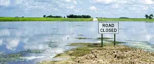
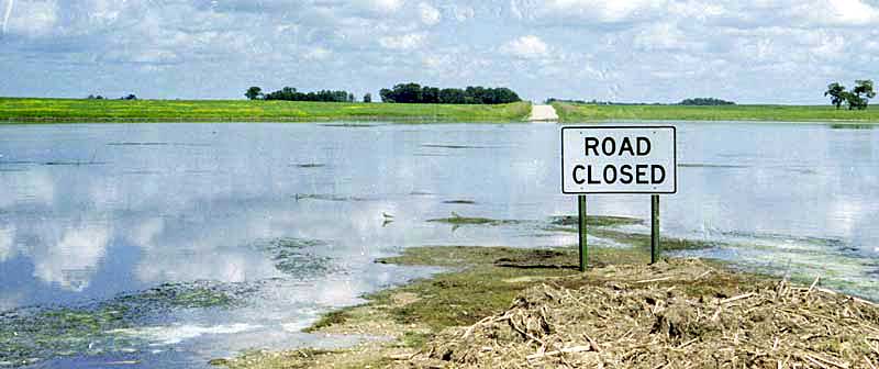
I had intended to by-pass the lake, but the lake had different ideas. The
road to it was closed due to flooding and construction, but the lake now
extended miles beyond its marked location and now reached Minnewaukan,
where I stopped for lunch in the park.
A man who stopped
to rest told me about his high opinion of the Indians and also how he hunted
for artifacts, his prize find being a copper hatchet.
After
I continued, I discovered the lake overlapping the road. A contractor,
taking pictures, told me that all of the roads had had to be rebuilt twice,
and now some of them were being flooded. I traveled for miles along a lake
shore (both sides of the road) that shouldn't even be there. North Dakota
has had heavy rain for several years, including 140 inches of snow one
winter, and many farmers have been ruined. Since Devil's Lake, like the
Great Salt Lake, has no exit, the lake just grows and grows, absorbing
smaller lakes. From then on, I made the joke that North Dakota was about
to be renamed -- to Devil's Lake. People laughed -- nervously.
In Cando, the park
was strictly an RV park, completely unsuitable for cyclists. I left to
get food at the grocery, and I met a man riding his bike and asked him
if he knew of another place where I could camp, so he asked me to come
by his house. Robin is a minister at the Assembly of God, and he invited
me to dinner with his wife Dawn, and his children Luke and Kayla. He and
his family all ride bicycles, and they take a backpacking trip each year.
After dinner, he was very interested in my bags, and he decided to help
me by sewing up the weakest one and by reinforcing my one pair of shorts
(I designed the bags well, but my hand sewing is not always equal to the
task, so I make repairs on my trips. Robin's repairs were first rate.)
We also discussed an internal debate I was having, and Robin was very helpful.
I spent the night at their house.
New Rockford -
Cando, 65.3 miles, 11.5 mph, July 8.
| |
Day thirty-six:
I got a very late start from Cando, partially caused by us visiting
my web site and my checking my mail, but it did not affect my mileage for
the day, as I knew before I began where I would have to spend the night.
I zigzagged up to Langdon on a route that would take me by the most small
towns, so I would have many places to stop and rest and to buy food.
On a 22-mile stretch
of straight road heading east, I achieved my highest level ground speed
of the trip while running in front of a storm. I found myself traveling
at 30 mph for a long period, with the little bits of cottonwood fluff serenely
floating alongside of me.
However, on this
ride, I also noticed again the noise in my bottom bracket which had started
two days earlier. In Cando, I had borrowed Robin's hammer and chisel to
loosen the lock ring, so when I stopped at the park, I took the bottom
bracket apart. I then discovered that the one ball-bearing retainer had
been entirely destroyed and that the race was dry of grease (yes, I had
put grease in the bearings when I reassembled the bike).
Cando - Langdon,
59.5 miles, 13 mph, July 9.
| |
Day thirty-seven:
In the morning, I hunted for grease and was given some for free, so I put
the bearings back together. However, with the retainer gone, there were
not enough bearings on the right side, and the cranks wobbled alarmingly.
In this condition,
I crossed the border into Canada, the border guard asking me about my occupation,
funds, and plans. None of my answers were really satisfactory, since I
did not have a job, my funds were meager, my credit card about to expire,
and perhaps only my competence at traveling by bike getting me through.
Just out of sight of the border station, a rock flattened my badly worn
rear tire, and while repairing the tire, I attempted to improve the wobbling
of my crank by swapping the good bearings to the opposite side, which created
an even worse wobble.
Two miles up the
road, I had another flat, and then I had to climb a high hill, the highest
climb since Nebraska. To avoid excessive pressure on the crank, I walked.
On the way, some men told me that there was a bike shop in Morden.
At the bike shop
in Morden, an extremely attractive young woman (also a cyclist) greeted
me, and the mechanic and I worked together on the problem, discovering
that the one race had become damaged. I also replaced my tire. The costs
were quite reasonable, especially after Vista gave me the exchange rate.
Out on the streets,
I got American traveler's checks exchanged for Canadian currency (about
$1.45 Canadian to the dollar) and found a bakery and supermarket, getting
advice from the extremely friendly local townspeople. Adults of both sexes
and all ages were riding bikes to pick up groceries, although cars were
much more prevalent.
I traveled on to
a very small town and camped in the park.
Langdon - Myrtle,
Manitoba, 68.8 miles, 13.5 mph, July 10.
| |
Day thirty-eight:
In the morning, the wind had turned to the north, and so my long eastward
ride was difficult. However, once I turned north, I started rocketing again.
I made several stops in towns and in one park for the day, but nothing
eventful.
In the afternoon,
the plains (prairies in Canada) turned into small hills with short trees.
I saw a cyclist far ahead and tried to catch up, but the cyclist either
stopped at some house or outdistanced me.
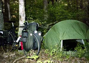
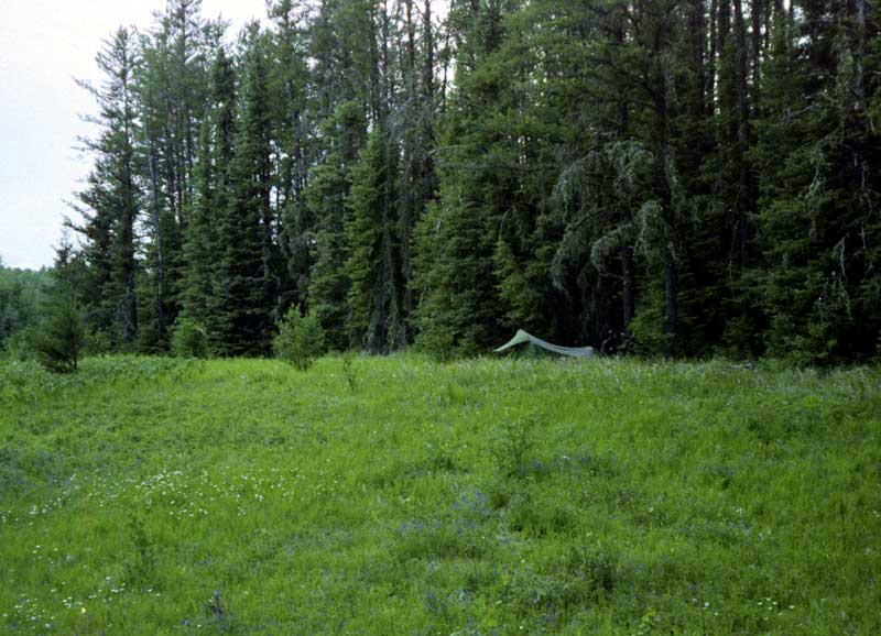
Although I had
reached the woodlands, I camped on the edge of a meadow along the Trans-Canadian
Highway, but invisible from the road due to small bushes. I camped in the
open, so the breeze would help keep the mosquito population down, but I
was also on low ground, so great numbers appeared anyway.
Myrtle - Richer,
85.1, 12.8 miles, July 11.
| |
Day thirty-nine:
In the night, mosquitoes kept getting in the tent through a small hole,
and in the morning, hundreds covered the outside. I put on my rainsuit
before I got out of the tent. The mosquitoes were somewhat sluggish at
first, but started attacking me from their resting places on the bike bags
and tent as I started to pack. I sprayed my socks and cap with repellent,
and I wrapped the bandana around my ears after spraying it, but even then,
great numbers flew directly into my face, mouth, and nose. I think I killed
hundreds before I left.
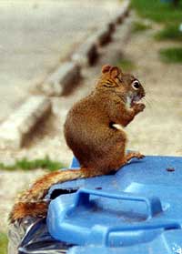
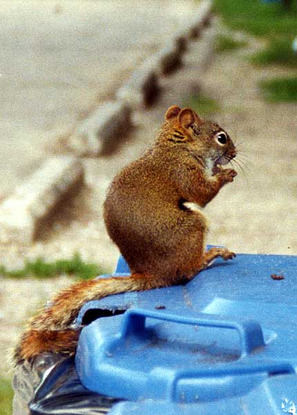
Stopping
at a rest stop, I used the opportunity to thoroughly clean up. Outside,
I was amused by a chipmunk who had learned to gnaw holes in the garbage
cans.
I saw another touring
cyclist, going west, but we were on a divided highway with water between
and heavy traffic, plus he spoke French (which I can understand and speak,
but not fluently), so we had to give up trying to communicate.
That evening in
the hills and woods, I pull off onto the old road bed, where I found no
signs of mosquitoes. I ate blueberries until nearly dark, when suddenly
I was hit by a short but soaking shower, an Ontario specialty. These showers
are usually not like thunder storms: a little, insignificant cloud will
pass overhead and suddenly dump all its water. Then the mosquitoes arrived
in masses, many flocking inside the tent.
Richer - Clearwater
Bay, Ontario, 73.8 miles, 13 mph, July 12.
| |
Day forty:
I once again had to pack with the mosquitoes flying in my face. I then
traveled into Kenora. At the bike shop, I met a second French-speaking
cyclist, traveling my way, but he said he did not want any company while
riding. He also reported that he would skip the portion of the ride from
Thunder Bay to Sault Ste. Marie, the part that I consider the best.
While in the laundry,
I talked with a young woman who had been on three cycling trips with her
father. The number of people that I met on this trip who had traveled at
least once by bike was surprisingly high.
Before leaving
town, I looked for a mosquito veil. The first store was out, but the second
had them on sale because the season was nearly over. With the veil plus
the rainsuit, mosquitoes were a nuisance, not a problem.
On leaving town,
I caught up to and rode with a woman for a short distance and then a teenage
boy caught up to me, and the two of us traveled a longer distance together
and talked about cycling.
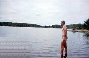
Then
I found a hidden trail to a lake, filled up on blueberries, had my only
nude swim, and took a good nap. Some people arriving in a small pickup
to launch a canoe awoke me, so I journeyed on and camped beside another
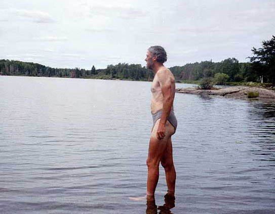
lake where I took another swim. While there, I took a picture of
myself in rainsuit and mosquito veil (my cap and bandana are underneath
the veil to help keep it from lying flat against my face and head).
Clearwater Bay
- Graphic Lake, 52.6 miles, 13.2 mph, July 13.
| | Day forty-one:
Following the advice of Cycling In Ontario 1998, The Annual Handbook
of the Ontario Cycling Association, I had turned south after Kenora
rather than following Highway 17 to Thunder Bay. With one exception, all
of the cyclists I later met had made the same decision, and that one cyclist
confirmed the heavy truck traffic and poor road width on 17. Although I
felt that the booklet must have exaggerated (because it referred to poor
sight conditions also), I decided to travel on 11 so I could see a new
part of Canada. In traveling south, however, I found myself dealing with
a crosswind.
At any rate, I
was not in Canada to hurry. I got off my bike at every opportunity to explore,
and I also filled my belly on blueberries, huckleberries, and raspberries.
In fact, wild berries help keep me from running out of money (during my
two weeks in Canada, I spent, in US money, $60 cash and $38 on the credit
card).
As I approached
Sioux Narrows, the rain started to fall, but I was able to make it into
town, over the wood bridge, and to the store. The other great eating treat
in Ontario is the fresh bread, always in a paper sack, which even the small
groceries have, so I was eating a loaf here when I was joined by another
traveler.
Howard and I had
very similar attitudes which resulted in different decisions. He was less
worried about skin cancer than I was but more worried about drinking water,
thus he didn't use a sun screen but did drink bottled water. We both depended
on lower-cost bicycles, but I bought mine new and used them for years,
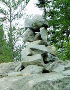
and he bought used ones which the Canadian winter salt rapidly destroyed. I believe
that he was the person who told me that the rock piles, found on every rock outcropping,
were created by native Americans. I had not seen these rockpiles on my bike trip in 1966.
We enjoyed traveling
and talking together but split up in the evening because he was 1) going
to camp in the provincial park and 2) was going to cross into the US the
next day. On the other hand, I wanted to travel a longer distance, so I
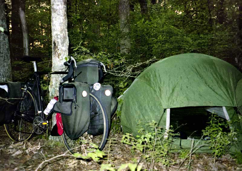
could get past Rainy Lake the next day. I camped on the highway right of
way, but higher than the road and hidden by small trees. This became my
typical camp site in Canada, so I'll only mention sites that were somewhat
different. I chose this kind of site to have a dry, flat camping place
with fewer mosquitoes than in the woods. Much of the woods are what I called
Moose soup anyway: fallen branches and logs, open water holes, and black
soil covered with Moose prints.
Graphic Lake -
Caliper Lake, 62 miles, 10.1 miles, July 14.
| |
Day forty-two:
In the morning, I was in a fine mood and there was little to see on this
flat terrain, so I made tracks into Ft. Francis. People of all kinds were
traveling on bikes in this city, although only a tiny percentage of the
total traffic, as always.
The handbook implies
that Highway 11 is much safer than 17. I discovered, however, that it is
a dangerous highway because it usually lacks paved shoulders and because
of heavy truck traffic and automobiles with trailers for twenty miles on
either side of Fort Francis. In Alabama, the 18-wheeler is usually the
largest truck, but in Canada, I counted up to 11 axles: 42 wheels on the
road.
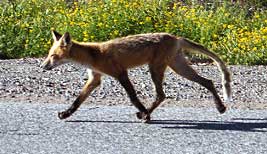
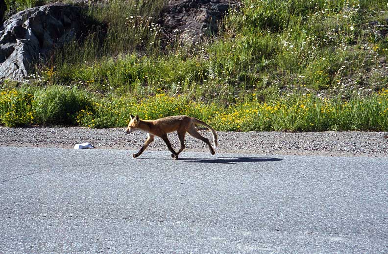
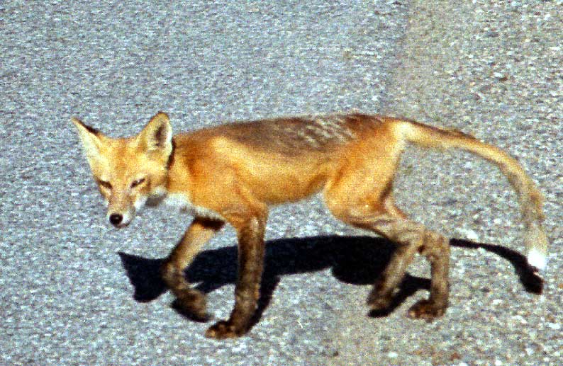
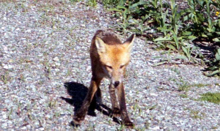
In
the late evening, I encountered a fox on the road. He
didn't seem to be begging, but he showed no fear of me and allowed me to take
several photos ( 794 X 517 A Closer View
744 X 444 The Fox Facing Me).
794 X 517 A Closer View
744 X 444 The Fox Facing Me).
Before I stopped
for the evening, I met John, in his early sixties, cycling west on a decent
bike. He had almost no gear, the tiniest panniers I have even seen, no
sign of a sleeping bag, and must have been wearing almost all of his clothing.
He told me his tent had been stolen, and I learned from another cyclist
that it had been just a tent fly. Because he had no way to camp,
he had been traveling all night (no lights either) and napping during the
day, and he looked like a war refuge as a result. I wondered how he found
the energy to continue, and he confirmed that he was planning to quit.
John
is an extreme example of following the "equipment is bad" philosophy which
has ruined more tours than excess baggage. The body can adapt to carrying
the necessary weight, but it can not adapt to day after day of abuse and
neglect. While not all of my gear is equally valuable, it has saved me
time and again from real problems. For every pound I carry, I save $1.00
per day in expenses, and the money invested on camping gear before the
trip is rapidly saved during the trip. In addition, the equipment will
last for years: most of mine is eight to ten years old and has been used
on twenty to twenty-five thousand miles of cycling trips. And expensive
equipment is not necessary.
Caliper Lake -
Mine Centre, 92.8 miles, 13.2 mph, July 15.
| |
Day forty-three:
I found only a few mosquitoes this morning. I stopped early on another
rock ledge to cook, since I hadn't cooked the night before. In the Canadian
woods, I could filter water from any clear lake or stream, and there were
lots of convenient places to stop for a picnic, including rest stops (which
in Canada always had toilets but usually lacked water). Farther down the
road, I went swimming again, although the weather was a tad chilly.
In the afternoon,
I stopped at Atikokan for food and to read in the library. Here I started
the habit of buying two loaves of fresh bread each stop, as the towns are
quite far apart.
On the way out
of town, I met Alan, who was cycling from England. He told me that I would
encounter a couple and a single cyclist, who were traveling behind him.
Mine Centre - Sapawe,
68.1 miles, 11.4 mph, July 16.
| |
Day forty-four:
In the morning, I found a hiking path to a waterfall, but after traveling
a mile, found I was nowhere near it. A couple who were hiking said I might
be half-way. As I returned to the parking lot, I heard a woman's voice.
At the same time, I heard the woman speaking behind me to her husband.
So, I assumed that another car had stopped. However, no car was in sight.
On reaching a rest stop just a few miles down the road, I saw bicycle tracks,
which were quickly erased by incoming cars. I asked several motorists if
they had seen cyclists, and they reported seeing the single cyclist, but
not the couple. My conclusion was that the couple had been passing by while
I was on the path, and I had heard her talking to him. When I expressed
this idea to one woman, her husband said, "These cyclists sure have a good
imagination!" (
800 X 576 My Resting Spot)
I never did see
the other cyclist either, although I was near the road practically all
the day, and there were very few places to stop.
The
truth is that my chances of meeting a cyclist coming towards me on the
road were only one in seven, since I was only on the road six hours out
of sixteen and the other cyclist would probably be on the road a similar
amount of time (6/16 X 6/16 = .14). The likelihood of encountering another
cyclist traveling the same way can't be solved by mathematics, but would
be even lower. In fact, one cyclist passed me at least twice before I met
him.
It was common for
me to encounter grouse while picking berries, but on this day, I encountered
several together, all acting wounded, plus their chicks.
That night, all
I could buy (that I could afford) was a frozen loaf of bread. I camped
in a wide meadow, created for the electric powerlines.
Sapawe - Sabaqua,
68.5 miles, 12.5 mph, July 17.
| |
Day forty-five:
After highways 11 and 17 joined together, I did not see an enormous number
of trucks; about 20 passed me in 12 miles. I then took 102 which the handbook
claims is a dangerous highway carrying most of the truck traffic, but I
found it very safe, with good paved shoulders, and carrying less than half.
However, a young woman cyclist told me that the road had recently been
improved, and I was traveling on a Saturday morning.
After getting bread
and other food at Thunder Bay, I visited the Terry Fox memorial. Terry
Fox lost his one leg to cancer at 18, yet tried to run 5,000 miles across
Canada in 1981, 26 miles per day, to raise money to fight cancer. He was
forced to stop at Thunder Bay due to the cancer coming back, and he died
a year later.
The traffic through
this area was heavy, and the road bed was poor. I met two cyclists separately,
Andy, a younger man who admired Terry Fox very much, and Rod, a French-Canadian
in his 60's, who was very relaxed about traveling.
My site this night
was very high above the road, giving me a great view.
Sabaqua - Pearl,
74.4 miles, 12.6 mph, July 18.
| |
Day
forty-six: This morning, I forgot to pick up my water bottle,
so I ended up riding six extra miles to retrieve it. Farther up the road,
I encountered Jay, who was hiking west across Canada, about 30 miles a
day.
Near Nipigon, I
pulled off the road for the second time, and Ray passed me on his bike
heading east. So, I caught up with him, and we cycled to Nipigon together.
Ray is 78 years old, and he told me that he could travel up to 68 miles
a day. I hope that I will still be traveling by bicycle in 25 years. We
parted at Nipigon because Ray was taking the northern route, but before
we separated, Ray asked me to visit him in Quebec.
In the evening
after some climbing and after riding along the lake again, I found a trail
going deep in the woods, so I camped back there, even though I had somewhat
more mosquitoes as a result.
Pearl - Gravel
River, 64 miles, 11.9 mph, July 19.
| |
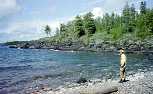
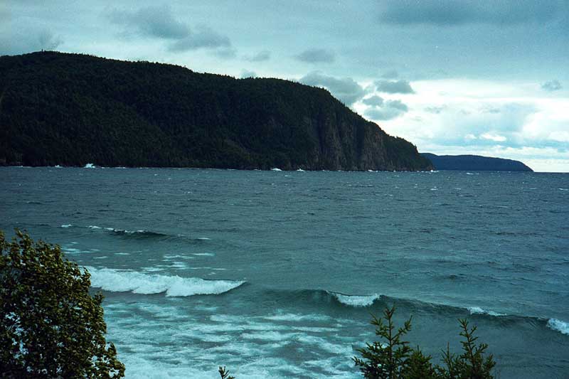
Day
forty-seven: I had a very steep and high climb in the morning,
and then I dropped down to Ross, where I thought about swimming in Lake
Superior at this beautiful spot but just got drinking water instead, due
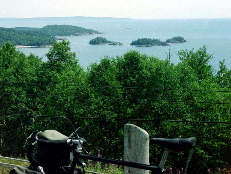
to the cool weather (798 X 600 Lake Superior).
I stopped by a
nearby rest stop to use the toilet, and I encountered a hitchhiking couple
who were drunk and dressed in frowzy, ragged clothing. The woman was loudly
complaining about the man and was waving money for anyone to give her a
ride or to get a taxi for her.
After traveling
nearly to Schreiber, I met a cyclist who felt that he was saved and I wasn't.
I had to listen to a regular sermon from him, but when I wanted to reply,
he told me that he didn't have time to listen to me. He also told me that
he had been struck once by a car on his trip.
At Terrance Bay,
I met a group of college kids traveling together and having fun that reminded
me of my car trip across Canada 28 years ago. They were camping in
the woods and picking up hitchhikers as I had done on that trip.
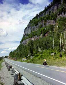
My average speed
was low in traveling from Nipigon to Wawa due to the many steep climbs.
Later, when I said the road was steeper than it used to be (ie 1966), I
was reminded that I was growing older, and I replied by pointing out the
old road beds, that are still visible everywhere. The old highway used
to loop and wind more, making the grades less demanding (677 X 600 Road Bend).
Gravel River -
Ripple, 63.8 miles, 11 mph, July 20.
| |
Day forty-eight:
It rained in the morning but caused no problem. In Marathon, I discovered
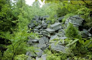
that the huge log piles, which I had seen on my 1966 trip, were gone, probably because logs are no longer being
floated down the streams.
After leaving town
and traveling westward, I saw a tremendous fire behind me and helicopters
and planes circling around. I later discovered that this fire was two days
old. Suddenly, it began raining, and I expected another soaking in driving
rain. However, I found a cliff that blocked the rain and stayed next to
it while the storm raged, so I barely got wet.
That night, I cooked
next to a bridge and a lake, and I thought about sleeping under the bridge
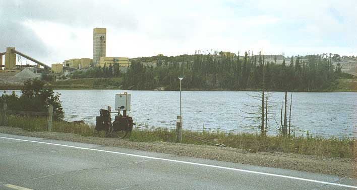
due to the threat of rain and because a gold mine (708 X 378 Gold Mine) and a provincial park
had taken up much of the real estate, plus every spot along White Lake
was marked "no camping." However, the site under the bridge was too rough,
so I ended up camping on a ledge again, just beyond the park, perhaps my
best ledge site of the trip.
Ripple - White
Lake, 74.6 miles, 11.3 mph, July 21.
| | Day forty-nine:
For several mornings, it rained about when I got up, but this morning there
was a rainbow, visible from my tent. I started taking the tent apart, when
the rain came back again, and I had to crawl back inside (so much for the
promise that rainbows make).
I rode on to White
River, not very close to my camp site, and there I met Joe and Jeff, two
young cyclists, who were about to leave westward. They were bothered about
their late start for the morning, so I gave them some fatherly advice about
enjoying the trip rather than keeping a schedule. There were storm clouds
coming in, and I suggested waiting them out. Instead, they took off, and
within ten minutes, a short, heavy rain began to fall.
The night before,
Joe and Jeff had camped with John, traveling east, and when he arrived,
we agreed to travel together.
John, in his early
20's, had taken an excellent route across Canada. Starting at Victoria,
he had traveled north on Vancouver Island, taken a ferry to Prince Rupert,
and then traveled on down through Banff on his trip to the east coast.
In traveling east, John must have passed me twice, and he reported traveling
with Howard before I did. Every rider has his eccentricity (except me,
of course! ), and John's was that he did not shift gears. I would have taken
the opportunity to teach him better technique, but I had enough trouble
just keeping up with him. John had been camping at rest stops (clearly
marked "no camping"), and he said that the police did not mind. ), and John's was that he did not shift gears. I would have taken
the opportunity to teach him better technique, but I had enough trouble
just keeping up with him. John had been camping at rest stops (clearly
marked "no camping"), and he said that the police did not mind.
John wanted to
make it to Wawa, and I wanted to camp at Catfish Lake, close to Wawa. However,
his rear wheel locked up, and I discovered that his bearings had locked
and the left outside nut had stripped away the axle threads. My first repair
left the nut in place, and the bearings quickly locked again. My second
repair removed the nut, but we did not lock the cassette sufficiently,
so again we had to stop.
By that time, Eric
had joined us, and it was too late to seek a camping site, so we camped
on the edge of the road, ironically, close to Catfish Lake. Because of
the lost time spent on the hub, I didn't have time to cook and went to
bed hungry.
White Lake - Catfish
Lake, 68 miles, 12.1 mph, July 22.
| |
Day fifty:
In the morning, the temperature was 40º Fahrenheit. The others finally
got up, and we traveled to Wawa. Eric was an eccentric, even among cyclists.
Young, strong, good-natured, serene, and French-Canadian, he did not seem
to care about the quality and condition of his bike and equipment. His
tent was cheap and tiny; his bike was falling apart. He had piled all his
worn-out tires on his bike and was carrying his front rack, which had failed
earlier in the trip. He wore a full-sized backpack, which John said was
full of souvenirs to give to his friends; things he could have mailed home.
When he left us that morning, his intent was to travel all the way to Batchawana
Bay (well over a hundred miles) even though the weather was poor, his tires
bald, and his front brake inoperable.
We also met a second
Eric, this one traveling west and using a Bob trailer, which he said caused
him no problems. He said he had traveled from Sault Ste. Marie to Wawa
in one day but that the headwinds had been rough!
After
I cooked, ate good meal, and bought some fresh bread, John and I headed
south together. During the day, his wheel tightened up again, and we added
a washer which I had asked him to buy while in Wawa. After that temporary
repair, he had no further problems.
We had a beautiful
ride together (800 X 519 Stopping at a Lake) although we had to hide under a trailer from the rain for
a while. We encountered some steep downhills (800 X 418 Rest Stop), and we saw high waves
at Old Woman's Bay (800 X 533 Old Woman's Bay). That night, we camped in a fantastic spot next
to the beach under a bloody sunset and then a starry sky.
Catfish Lake -
Agawa Bay, 67.5 miles, 10.9 mph, July 23.
| |
Day fifty-one:
The night before, John had told me that he intended to push on to Sault
Ste. Marie in one day, while I was going to take two, but I found him reluctant
to get up in the morning. After getting ready, updating my journal, and
enjoying the beach, I finally started, sure that we would meet later.
While I enjoyed
traveling with John, my more leisurely pace was a delight. I found time
to dry my tent and to change into my shorts before John caught up, and
we traveled together for another hour.
Before
John caught me, I met Jacques, a French-Canadian, on a touring bike with
box stays. Then, right after we separated, John met Tony, a retired Canadian
government intelligence worker, and I joined their conversation. It wasn't
until John had left and Tony was leaving that I discovered that Tony was
riding on the wrong side of the road. I am very hostile to this behavior
because I think it encourages motorists to pass cars while coming towards
us, an extremely dangerous illegal act that is becoming more and more common;
in fact, it happened within an hour. I thought it odd too that someone
with Tony's occupation would believe that the law is whatever you can get
away with, or maybe it's not so odd.
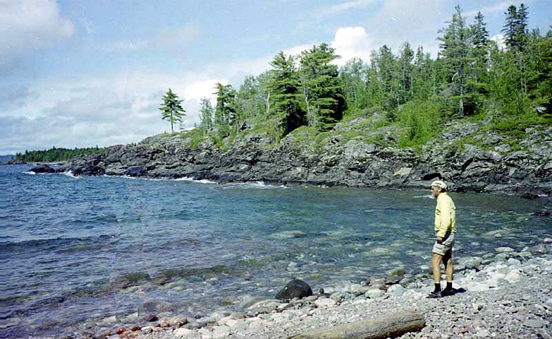
After John left,
I continued to travel more leisurely, stopping at every opportunity to
enjoy the beaches and the berries. At the place shown in my photo, I spent
over an hour climbing on the rocks that extended into the lake. For the
night, I camped at the edge of Lake Superior again.
Agawa Bay - Batchawana
Bay, 51.5 miles, 13.5 mph, July 24.
| |
Day fifty-two:
In the morning, I took a leisurely ride into town, stopping to talk to
a postman (out of uniform) about politics and to a bike shop mechanic about
John's axle (but John had not stopped at his shop). I even stopped to take
a walk in the woods.
On the way into
town, a dump truck, in passing me kamikaze fashion, ran one of the monster
trucks onto the shoulder. In my opinion, the trip from Nipigon to Sault
Ste. Marie had been much safer than the trip from Ft. Francis to Sabaqua
or the trip from Thunder Bay to Nipigon or the trip from Sault Ste. Marie
to Espanol, due to fewer trucks and better shoulders. However, I would
not encourage anyone afraid of traffic or unsteady on a bike to travel
any of these highways.
Nonetheless,
I don't think it takes an unusually self-reliant or
strong cyclist to travel through Northern Ontario. While towns are far
apart, there were lots of restaurants, campgrounds, and motels along the
way, and the grades, while steep, were no worse than 6% (38 mph was my
fastest downhill speed). I considered Kenora to Soo to be much easier than
the Blue Ridge Parkway or the Colorado mountains in terms of climbs, climate,
and food, and comparable in terms of scenery, although the traffic is worse.
Being self-reliant and fit, however, are definite advantages here and everywhere.
Before leaving
Canada, I bought three loaves of bread, which I stuffed into my bags. I
only regretted I could not carry more. I used up the last of my Canadian
money, which had now become quite familiar.
As I traveled to
and crossed over International Bridge, I found myself crying. I felt so
at home in Canada! I so hated to leave! I shall return -- soon!
After crossing
into Michigan, I took the wrong turn, due to a confusing intersection and
an unmarked turn, and traveled six miles east. Rather than backtracking,
I traveled south to the next paved road and then pedaled six miles west.
That night, I camped on thick pine needles in a pine woods that probably
would soon be someone's yard.
Batchawana Bay
- Kinross, 69.5 miles, 11.9 mph, July 25.
| | Day fifty-three:
As I approach St. Ignace in the morning on new pavement, I wondered about
the safety cones lying everywhere, many badly damaged. These cones were
not the cheap ones, but had been furnished with lights, and they had not
placed on the pavement but on the very edge of the dirt shoulder. Yet many
had been badly smashed. When I saw that they had built a casino since my
last visit three years earlier, I understood the destruction.
When the pickup
carried me across the Mackinac Bridge ($2.00), I asked the driver about
how many cyclists he carried across. He said he had carried four already
that day. Two other ways to get across: 1) Ride in a named group of ten
or more, contact the proper authorities, schedule a daybreak weekend crossing,
and you can pedal across the bridge (you will still have to pay the fees).
2) Take the ferry to Mackinac Island and return to the opposite side.
On leaving Mackinaw
City, I headed down the east side of the peninsula. Then, I turned south
at Cheboygan and traveled down to Black Lake, finding a camping spot shortly
afterwards. Although most of my route through Michigan went through woods
and forests, I was generally not impressed. There are too many cabins in
the Michigan woods now, so the experience of being in the woods is almost
gone, and there's always a lot of traffic.
While I crossed
Michigan, there was a terrific wind from the east, making southern progress
slow and western progress very difficult.
Kinross - Black
Lake, 75.8 miles, 11.6 mph, July 26.
| |
Day fifty-four:
I spent a good while at a rest stop because I was constipated. The solution
was taking a long rest stop while drinking lots of fluid; the problem did
not return or make the rest of the day difficult. I was fairly surprised
that this had happened since I had been careful to ensure I drank enough
and "went" whenever I needed to.
The rest stops
in Michigan were the best I've encountered. First, they occurred everywhere,
making them very useful for the traveling cyclist: it was typical for me
to stop at two or three of them each day. Second, while the toilets were
usually primitive, they were always present, and only one of them wasn't
clean. There was also always a hand-pump for water to make cooking possible.
And the site was always well-tended. Unfortunately, camping was not allowed.
After traveling
through Mio, I pulled off into some woods in the national forest to camp,
the prettiest I had see all day.
Black Lake - Mio,
73.8 miles, 11.3 mph, July 27.
| | Day fifty-five:
In the night, I heard an animal trotting by. In the morning, a animal just
shorter than the tall ferns circled my tent. Although I could not see it
clearly, I felt I was in the presence of a wolf: a fox would be much smaller
and less confidant, and a dog would have barked.
When I reached
West Branch, I changed both tires. When I took the rear tire off, I discovered
that the rear axle was broken, so I had to change it as well. Unfortunately,
I was a little hasty and got the axle just slightly too far to one side,
which I didn't think mattered. On the edge of town, I found myself reinstalling
the axle twice again, and the weather had once more become hot and unpleasant.
When I was going
through Wooden Shoe in the late afternoon, I suddenly realized that I was
leaving the last of the national forest behind, so I headed back up another
road. When I encountered an overgrown town park, I pushed my bike back
into the woods on the far end.
Mio - Wooden Shoe,
56.8 miles, 11.3 mph, July 28.
| | Day fifty-six:
Today, the crosswind began to slack off. I traveled south past the interstate
and then followed Pine River down to St. Louis.
In the laundromat
there, I met Eric, a local bike rider also washing his clothes, and I visited
his place to show him my website. He wanted me to stay for the evening,
but I needed to cover more miles.
Back on the road,
I discovered a country bike shop whose owner had parts such as rear axles
in quantity on display. I bought a new rear axle and skewer.
Finding a place
to camp was getting more difficult, but I finally succeeded in finding
a little patch of woods.
Wooden Shoe - Vestaburg,
70.8 miles, 11.2 mph, July 29.
| | Day fifty-seven:
I started early but stopped for a long time at a rest stop due to a dark
sky, heavy traffic, and light rain. When I did start again, I used information
from the rest stop map to follow some back roads to avoid the traffic.
In McBride, I got
into a conversation with a gasoline truck driver. He said he rode a bicycle
himself but should get more exercise, and he told me of some accidents
and close calls when driving a truck. He said that cyclists and buggy drivers
(I was approaching a Mennonite area) did not pay user fees, and yet the
state was paving shoulders for them. He felt that they did not cooperate
enough with motor vehicles, especially trucks, and gave examples of non-cooperation
by both cyclists and buggy drivers (he also told me about some serious
near accidents he had been involved in because of thoughtless motorists).
His comments were especially relevant considering the behavior of motorists
and pedestrians towards me during the previous and next few days. Some
people were wildly waving to me as if I was a hero while some motorists
were honking and yelling angrily at me for no reason. Like everywhere else,
I saw very few bike riders on the road.
In the afternoon,
after eating at my second rest stop for the day, I passed a nice place
to camp, but I had only gone 55 miles, so I decided to continue. When I
didn't find another patch of unposted woods by evening, I decided to ask
to camp in the town park of the second town I would go through. Unfortunately,
the map placed the name "Bellevue" right next to the dot on the map, so
I assumed the second town would be Bellevue. When I entered a town named
"Assyria," I concluded that it wasn't on the map (which had happened before),
so I kept on going until I was in the outskirts of Battle Creek, with every
vacant acre marked with "no trespassing" signs.
I entered Battle
Creek at twilight with the strong sense that I was in trouble. Stopping
at a fire station, I received the information that the police wouldn't
let me pitch a tent anywhere, "although they do let derelicts sleep on
the benches in the one park." It's possible that my informant was prejudice
and not the police; however, my experience tells me that I can forget about
camping in any city. So, I stopped to eat, then put on my lights, and continued
on through the city at night.
On the other side
of town, I noticed a dark area and some trees and high grass along the
ROW. Because the spot wasn't completely hidden, I slept without the tent,
using a little repellent to protect my face.
Vestaburg - Battle
Creek, 94.1 miles, 12 mph, July 30.
| | Day fifty-eight:
I didn't get too far before I had to stop to fix a flat. Then I rode into
Athens where I noticed that they were still selling Spartan food products
at the store, as they had when I camped there 32 years earlier. Rather
eat in the park, however, I just used the picnic table at the library.
At Sturgis, I stopped to read in the library.
Then I crossed
over into Indiana and into an area where the Mennonite horses and buggies
are common (also a lot of cyclists). So, I enjoyed traveling down back
roads with buggies passing me every now and then; bicycles and buggies
are quite compatible since they travel at about the same speed.
Towards evening,
I decided to ask the first likely people I saw outside if I could pitch
my tent on their property, but I found myself going into Ligioner, where
the police thought I must want to pay for a campground. Ignoring their
directions, I traveled out the other side of town where I saw a family
sitting outside. I stopped and asked the man if I could pitch a tent on
the edge of his property, and he readily agreed.
Battle Creek -
Cromwell, Indiana, 74 miles, 11.9 mph, July 31.
| | Day fifty-nine:
In the morning, my host came out to talk to me as I packed my tent. Then
I traveled only a mile or less when another cyclist, on a recumbent, asked
me to stop and visit him. Bob had once made a solo trip starting in Massachusetts
in April when he was younger and had been treated rudely when he went into
the church to warm up. So, he especially liked to stop and talk to and
maybe help bike travelers. We had a nice visit before we each had to go
to work.
Following Bob's
advice, I stayed on the same road as far south as South Whitney, where
I met Bill, who was interested in making a bike trip.
Then I traveled
half a day west in order to bypass Indianapolis on the west and to travel
through state and national forests. I turned south again at Rochester.
While traveling
through Fulton, I thought it was small enough to allow me to camp in the
park. I asked at a store, but the young woman working there couldn't get
the police on the phone, so she sent me by the house of one of the city
council members. The council member showed up at the door wrapped in towels,
as she had been taking a shower, but told me it was OK to camp in the park
if I could stand the mosquitoes.
Definitely, the
mosquitoes were enthusiastic about my arrival, but I was a veteran and
quickly donned my rainsuit and mosquito veil.
Cromwell - Fulton,
70.8 miles, 12.2 mph, August 1.
| | Day sixty:
In the morning, I stopped by the store and for some reason spent a couple
of hours talking to the owner about anything we could think of. I think
part of my problem was boredom. My days in Indiana and Michigan were not
unpleasant, but they did lack excitement.
The only noteworthy
event that happened on this day was nearly getting killed three times in
ten minutes because of drivers ignoring my being on the road, one being
due to a motorhome that passed a vehicle coming towards me, the driver's
nose stuck in the air as he drove over the edge of the road where my bike
had been.
After passing Antioch
on a poorly paved road, I was looking for a place to camp, and I noticed
some small areas along the edge of the road that seemed to be state property,
since they had trees and not crops on them. When I saw such a place with
trees thick enough for me to be out of sight of the road, I stopped to
camp.
Fulton - Antioch,
57.8 miles, 12.5 mph, August 2.
| | Day sixty-one:
Today I felt very bored and even sick during part of the day. I was fighting
headwinds and traveling over winding and unsafe roads as I traveled around
the west edges of Indianapolis on 39. In one town, I bought food and rode
up to the town park to wait out the storm, but it missed me, and I went
on.
In several towns,
I looked for a supermarket, but for some reason, I kept missing them. I
joined highway 37 and followed it until I could turn off onto the old road.
That lead into some woods near the Morgan Monroe State Forest, so I stopped
there to camp.
Antioch - Morgan
Monroe SF, 68.6 miles, 11.2 mph, August 3.
| | Day sixty-two:
In the morning, it began to rain shortly after I started, but I decided
to push on rather than finding shelter, since I needed food. The distance
to Bloomington was farther than I thought and the rain heavy at times,
but I made it to a supermarket to eat and rest. Then I traveled into town
and the library, where I rested until noon. When I left, I stopped to eat
a couple of more times.
On
leaving Bloomington, I discovered an overgrown quarry on the old road,
and I wondered if that was the quarry in the movie Breaking Away. Now it is hidden, and
even the "no trespassing" signs have disintegrated (I didn't pass one until
after I had visited the quarry).
Although I was
traveling late, I kept on going, heading for the national forest. South
of Paoli, I found a rest stop and woods, but it was a virgin woods, so
I had to go on. Crossing a ridge, I found a trail and found a place to
pitch my tent among the briars.
Morgan Monroe SF
- Paoli, 69.5 miles, 10.9 mph, August 4.
| |
Day
sixty-three: In the morning, I stopped at a store at the
bottom of the hill and bought two cookies and a drink -- my last store
until late in the evening! I found my tire flat before I left (from briars
on the hill). I walked up an extremely steep hill before I found a good
place to change it.
My route this morning
was through some back roads in the national forest because the main road
was closed. I stopped a couple of times to get directions, and the second
time, the man said, "But that's nearly four miles!"
When I reached
Birdseye, I felt guilty about stopping for the day because I hadn't gone
very far, but there was a nice park with water for me to cook a good meal.
Good thing I stopped.
Although I had
not been impressed when traveling through the forest, the road down 145
was a delight, even though very difficult, since I kept ascending to the
mountain top and then dropping down to the valley again.
I crossed over
the river into Kentucky at Cannelton. Traveling out into the countryside,
I found a section of woods without houses and stopped.
Paoli - Hawesville,
Kentucky, 68.2 miles, 11.4 mph, August 5.
| | Day sixty-four:
Kentucky is much prettier than Indiana and looked better due to recent
rains. My route was up and down less-traveled roads, and I stopped at little
stores along the way. At one store, I talked with a local farmer for a
good while, and in Roundhill, I stopped to eat and talk at a flea market.
After I passed
Mammoth Cave National Park, I started looking for a place to stop, but
I finally descended off of the mountain into farm country without seeing
anyone. Passing a farm, I noticed a group of men, and I stopped to ask.
Shortly later, one of the men guided me to a camping site between a small
silo and a field of corn.
Hawesville - Smith's
Grove, 79.2 miles, 10.7 mph, August 6.
| | Day sixty-five:
In the morning, I traveled to Scottsville, intending to follow highway
100 into Tennessee, but I turned the wrong way and ended up on 231/31.
Since there was a good shoulder, I decided that this route, which I had
followed in 1966, was OK now. The shoulder disappeared after three miles.
I felt that since Tennessee has good paved shoulders that I should rough
it out to the state line, but the shoulder remained rough anyway. Oh well,
I thought, at least there won't be much traffic on Saturday morning.
In the afternoon,
I found a great place to take a little dip, a stream running on the solid
bedrock with a little pool. Since the heat had returned, the dip felt excellent.
I found a little
patch of woods, rather hard to get into and out of, before reaching the
Cumberland River.
Smith's Grove -
Lebanon, Tennessee, 58.7 miles, 10.9 mph, August 7.
| |
Day
sixty-six: My assumption that there would be little traffic
this morning was incorrect; I finally passed the reason, a large flea market.
Traffic was heavy until I turned off at Murfreesboro; however, I found that
drivers were less offensive and more careful that those farther north.
In Murfreesboro, I did have one young motorist "order" me onto the sidewalk
"where I belong," but people were quite friendly when I stopped.
At
Murfreesboro, I turned onto a less-traveled highway and didn't have the
traffic pressure. However, I did meet a bike rider traveling down the wrong
side of the road, and not on the shoulder or edge of the road either; he
seemed to meet every car head-on. I asked him why he did that, and he told
me that he rode on the wrong side "to look the motorists in the eye." He
then asked me if I would sing something for him. When I asked him why,
he said he thought I had a high, squeaky voice, and he thought it would
be funny to hear me sing. It seemed obvious to me that he got his kicks
from aggravating people.
In the evening,
I stopped for my final new tire, and then I camped in some nice woods outside
of town.
Lebanon - Manchester,
71.7 miles, 10.6 mph, August 8.
| | Day sixty-seven:
In the morning, a storm seemed to be threatening. I traveled into the next
town, but everything was closed. In traveling on, the rain started falling
harder, and I put on my rainsuit and hurried towards the next store, where
I had stopped several times before. While the rain was the hardest, a motorist
stopped and wanted me to get in his station wagon, saying, "I've known
the only four or five cyclists who ever used this road, and one of them
was killed." I begged off, mentioning the store, getting wetter than I
had while cycling. Less than half a mile farther, I reached the store,
and the clerk said he had heard of no cyclists being killed, and sometimes
large groups of cyclists used the road. At times, traffic from a nearby
base is heavy on this road, but there was no traffic to speak of on this
day.
After traveling
through Winchester, I reached the foot of the mountain and walked most
of the way to the top, the road being exceptionally steep. Then, I had
a long nice ride through woodlands into Alabama and down to my cabin in
the woods.
Manchester - cabin,
Alabama, 70.2 miles, 11.6 mph, August 9.
| | Day sixty-eight:
In the morning, I was anxious to finish my trip, so I took the shortest
route home. I had a nice high climb up Sand Mountain, but it did not seem
to hurt my speed that much. However, I once again found myself riding against
unfavorable winds, so my average speed was not that good. This day, I did
not space out my riding, but stopped only as long as necessary, and finished
at three o'clock.
Cabin - Gadsden,
68.7 miles, 11.3 mph, August 10.
| | I learned
or can confirm several things from this trip: The South does not have the
most dangerous roads or traffic. The plains are great for cycling, but
the direction of the wind is unpredictable, although the wind is more often
from the south or west. Northern Ontario is still wild and beautiful and
has changed less than any other area in the last 30 years. It is also the
best place to meet other traveling cyclists (sixteen in two weeks; six
of them French-speaking).
I often give my
trips a second name: this was the Windy Trip, since the wind affected my
average daily speed 4/5ths of the time. Nonetheless, I told my dad on the
phone from Michigan that I thought this was my best trip yet.
I arrived back
home weighing 168 pounds, almost back down to my ideal weight. I
spent a total of $620, including all expenses, tires, film, and photographs:
$8.85 per day or 13¢ per mile. Except for tires and tubes, my
bicycle expenses had been small; however, I had had to purchase seven tires
and almost as many tubes: the inexpensive 27 X 1 1/4 tires I had been buying
did not wear very well (I have since been informed of some better brands).
|

|

