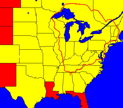
Eastern North America Tour Y2K
Map of Eastern North America Tour
|
Forward: This trip started with the intention of circling North America but, due to rain and cold weather in Canada which increased cost, slowed progress, and made the weather less pleasant, ended up being a trip from Alabama to Maine, across Western Quebec and Northern Ontairo to circle the Great Lakes and return to Alabama. The trip also is my best documented trip, as I used a laptop with a solar panel (see my article on the subject) to keep my accounts up to date. As a result, it is by far my longest account also.
I had a motive for writing such a long account: I wanted those interested in making similar trips to have a clear idea of my problems, mistakes, and solutions to help prepare them. As a secondary goal, I wanted to provide information about the areas I was passing through in case someone should want to follow the same or a nearby route. In regard to this second goal, it must be noted that I was hardly an authority on the places I visited and was undoubtedly wrong in many of my opinions. As a final goal, I hope this account will be interesting to read. I can describe it as a fairly simple account of all the significant events that happened on the trip without a great deal of detail about any one event. Thus it is almost the opposite of my 1966 account, in which I usually chose one event or theme from each day to focus on.
I have added some larger-sized images to this account. Some of them are an enlargement of the photo already displayed, and some are of something else. The link to these photos is always marked with the camera icon ( ) and with the size of the photo (which indicates how long it will take to download). In spite of the larger sizes, I was generally able to keep the file sizes reasonable, due to better software. However, I still didn't think that everyone would want to see all of them. Use your judgment as to which you wish to view. ) and with the size of the photo (which indicates how long it will take to download). In spite of the larger sizes, I was generally able to keep the file sizes reasonable, due to better software. However, I still didn't think that everyone would want to see all of them. Use your judgment as to which you wish to view.
The conclusions that I have drawn about this trip, especially concerning travel time and expense, will be presented at the very end.
The trip has been divided into seven parts to keep the file sizes reasonable. Each page links to the previous (at the beginning) and the next (at the end), but this is the only page (of the seven) that links to all of them:
Part I, Alabama to Virginia (this part), days 1-13.
Part II, Virginia to New Jersey, days 14-23
Part III, New Jersey to Quebec via New England, days 24-36.
Part IV, Quebec, days 37-46.
Part V, Ontario, days 47-58.
Part VI, Minnesota and Wisconsin, days 59-69.
Part VII, Illinois to Alabama, days 70-82.
Day One: I awake before four and use the computer awhile and lie back down. But no further sleep is possible, so I begin the tasks of packing a couple of final boxes, sorting out clothes to discard, taking clothes out to the car, and redding up the house. While putting the clothes in the car, I finally figure out how to pack them into my storage space at U-Haul, a 4 by 8 by 6 foot box. My books had gotten in only because I had removed my commuting bike and piled them over two feet deep before putting the bike back in. Reaching the box, I pull my bike back out, lay the clothes in layers on top of the books, cover them with a sheet of cardboard, and put the bike back in. It isn't the best solution; it is the only solution, as all the other room is taken. Then I discover that I have forgotten to bring the beeswax foundation and have to make a quick second trip, as if it doesn't go in the box, I don't get to keep it, as the house will soon be sold.
Finally back home, I decide it is too late for me to leave during the morning hours. If I leave so close to noon, I will be exposed to the worse solar rays when I don't have a really good tan yet. This spring has been unusually cool and rainy, and I haven't put on the miles that I need, even though I've been cycling as much as possible. Getting a sun burn on the first day could make the first week very rough. Anyway, I still have some food to consume, a piece of chicken, some frozen stir-fry vegetables, and some rice. So I decide to leave at about two, and I work some on the computer while cooking a full meal for lunch. After eating, I clean up the dishes and the kitchen, and finally pack the last of my gear. It is now that I notice that I have too much. Everything fits on the bike OK, but there isn't a bit of extra room to carry food. I haven't expected that because I have always had extra room before. However, to my usual starting load, I have added nicad batteries for the solar charger, an extra flashlight, w/extra batteries, a heavier and bulkier rain suit, seven rolls of film, grease, WD-40, sun screen, cards to give to cyclists along the way, an extra shirt and pants, and a number of unnecessary little goodies. I am just being too good to myself. My situation is made worse by needing to carry the clothes I worked in while moving and a few items I discovered that I should have packed and don't wish to discard. Oh well, I will just carry the extra stuff up to my cabin and leave it there. I am still busy when 2:00 slips by, so I decide to leave at 2:30. Then Mary phones, saying she is on her way up to clean the house, so I wait until she arrives to let her take my picture and to have someone to say goodbye to.
Leaving is much more difficult this time. When I left the house in 1990, for instance, I took a picture of my parents holding the bike, and I knew I had them to come back to. I could leave anything I wanted and pick it up later. Now, my dad (who I had been caring for) is dead, and my mother's last words to me (on Mother's Day) were, "Are you one of my brothers or one of my sons?" She did not seem to particularly care that I was there to see her. Of course, she is not at home, but in a mental ward far away. No, this time when I leave, only Mary is here to say goodbye, and I will never be able to come back again.
Then it ends up being 3:30 by the time I actually pull out. Anyone else, I think, would have waited until the next day, but I still see an advantage in leaving. I know the whole route and where I can camp, and I know I can keep on riding after dark, due to roads with light traffic. Besides, I have taken so long to get ready mainly due to the trauma of leaving, and remaining an extra day would only extend that.
Right away, the chain starts clicking. That's irritating. I had ridden the bike about four miles looking for such problems, and the only thing I had needed to do was to straighten the bottom bracket generator. Now I have the clicking. There is no sense in going back, as I have all of the tools with me. I will just keep riding until I figured out the source of the sound.
The bike also seems to handle strangely. I always said that the bike feels better with a load on it, but now it feels unsteady. Riding a different bike or the same bike with a different load can produce strange results. On two occasions, I needed to carry my heavy van battery to get it charged. While putting the battery on the rear carrier would have less effect on handling, if it started to fall back there, nothing would stop it, so both times, I carried it on the front carrier where my hands and dropped handlebars could stop it. In each case, I had to learn how to balance a bike all over again. The second time, I rode back home without the battery, and I had to learn to rebalance the bike then too! But today, I adapt to the load before I turn off of my street.
I now have a mostly 4% climb for half a mile along a residential street that borders the main road. This is the first of seven long climbs for the day, and I am already huffing and puffing a little. It's easy to get frustrated on a hill, especially when carrying extra weight. The solution for me is to gear down and take my time. I always find a gear that allows me to continue pedaling at the same rate whether going ten, nine, eight, seven, six, or five miles an hour. These speeds may seem slow, but they're faster than walking or even jogging, and the hill is soon conquered.
The hill behind, I speed down the wooded main road into the valley used by highway 11. This valley runs from Chattanooga to Gadsden, a distance of 90 miles. There is no question of its being a single valley in one's mind, as the Lookout Mountain is continuous on the east the entire distance and smaller ridges are mostly continuous on the west. Yet this valley is now drained by several streams, and in geological times, no stream ever ran the entire length. Then how does it exist? The story is strange, wonderful, and much too long to tell here, but in brief, the valley was once a high mountain, and Lookout Mountain is the remnant of the old valley floor. Lookout Mountain looks like a valley from anywhere on the mountain itself as the edges are much higher than the center. Highway 11's valley is not alone; it is paralleled by smaller valleys between it and Sand Mountain, and on the west side of Sand Mountain and the east side of Lookout Mountain are similar valleys, all running parallel.
I travel north up this valley for seven miles on mostly flat roads. Then I turn west, climbing the minor ridge to the west on a road that starts at 4% and gradually becomes steeper. Here the noise from my chain gets louder. It makes sense to listen to noises as they are signs of a more serious problem. I stop to inspect this time, and I discovered that in readjusting my bottom bracket generator that I had moved it too close to the chain. If I continued to ignore the problem, the chain could eventually tear loose some wires on the generator. I find a tree that I can lean the bike against, not an easy task as most are too far from the bottom of the ditch and many are covered with poison ivy. I'm not allergic to poison ivy, but I don't mess with it just the same. Adjusting the generator takes just a couple of minutes using my largest Allen wrench. Besides making sure that the generator is away from the chain, I make sure that it is lined up with the rear tire, that its bracket is straight, and that I tighten it good.
After I start again, I walk a little ways on the steepest part of the road. Some cyclists are real purists, insisting that every inch of a climb must be pedaled. This seems silly to me. I am traveling by human power from A to B, and walking from time to time doesn't hurt that. I always walk up slopes when I feel strained. Doing so conserves my strength and gives me an opportunity to cool off, use some different muscles, and enjoy the wooded hillside better. The thought occurs of camping here, but I am just ten miles from home, so I decide to push on. However, I still enjoy looking to see if I can find suitable camping spots. Pedaling again, I notice that the noise from the chain is almost entirely gone. I assume that the rest of the noise was due to the chain being a little stiff, as I had been storing it unused for a long time. Reaching the top, I shift into my highest gear and pedal downhill. I pedal on the down grades when they aren't steep, as doing so pumps the blood through my legs and gets them ready for the next hill; of course, I pedal lightly, as I'm not really interesting in increasing my downhill speed. Here, after my speed reaches 25 mph, I quit pedaling. The pavement here is rough, so I'm not anxious to see how fast I can go.
At the bottom, I turn right, following 227 along the valley floor. In actuality, I am still in the same valley, although separated by a high ridge from highway 11. The western side of this valley is defined by Sand Mountain, which is another ancient valley floor. After a few miles of farming land, I turn west, following a gently climbing route to the mountain. Seeing the door open, I stop at a tiny store for a drink. Most people would think it was a shed instead of a store. I've been stopping there off and on for 15 years, but the old man doesn't seem to recognize me. I'm surprised that he's still around, as I thought he was older than my dad, and my dad is now gone. His face doesn't look familiar either. Could this be a younger brother or something? Not very likely. I sit with him to drink my drink as I know the store exists to give him a little company. We've talked on a number of topics in the past, but today nothing notable turns up. We do talk about the weather, etc., and he mentions that his grandson is working in the other part of the building. I met one of his sons one time, who turned out to be a student of mine from my early days of teaching, the only former student I've ever encountered.
Leaving the little store, I ride another mile or so before the steep climb begins. Today, I seem to want to pedal most of the way, so that's what I do. I listen to my body, and if my body says, "Take it easy," I will walk without hesitation, but if my body says, "Let's give it all we got," I'll do that too. My body is sometimes wrong, but it's usually a better judge of my physical condition than is my head. In climbing this steep slope, I can only travel at 5 mph and on the roughest parts, only 4 mph. I know without looking at a chart that 5 mph in my lowest gear (20 inches) is a cadence of 80, and I'm not too tired to compute that 4 mph must be a cadence of 64 (4/5th of 80). Near the top, I feel the desire to walk, so I do so for a while. As usual for when I'm in a wooded area, I'm thinking about camping, but nothing looks that suitable, except near the house on the last stretch (but I don't camp near people's houses). Besides, I've still traveled less than 20 miles.
On one of these roads coming down Sand Mountain, but not this one, sheriff deputies discovered an abandoned car one day, containing a holdup note. But no such holdup had happened. Six months later, during the winter, a hunter discovered a body hanging from a tree. Although no one can ever know what happened, one explanation is that the dead man ran out of money and decided to rob a store. But he lacked the nerve and therefore hung himself instead. I think of this sad story now each time I climb this mountain. It seems to me that our society hurts itself by being indifferent to the plight of individuals.
At the top in countryside again, my speed is not that great due to a now contrary wind. I just gear down to an appropriate gear for my 8 to 9 mph speed and continue contentedly. It's fun to travel at 25 mph with a strong tailwind, but I do not allow headwinds to affect my mood. Lots of police cars today, about half the traffic on the road, maybe as many as eight. In the first town, I automatically turn right at the first street, a little shortcut that I and the locals know. Funny, I remember turning many times onto this shortcut, and once changed a flat here, but I can't remember the name of the town right now [Crossville]. The shortcut cattycorners into highway 35, but I have an immediate right turn onto a road with less traffic.
The top of Sand Mountain is an old surface, drained by a number of streams, so while it is a plateau, it's not at all flat. Here though, the hills mainly add variety. Finally, I reach Geraldine, passing the now-closed supermarket where I used to buy my lunch on the trip from my parents' to my cabin. A mile further gets me to a main intersection and a convenience store with some hot food and tables, where I always stop to rest.
Here, one of the customers wants to know how far I've traveled on the bike. This always happens when I stop at this store. I know he'd like to hear that I've come 3,000 miles or something, but I have to confess that I've been just 27 miles. I get a drink and some crackers and rest fifteen minutes. Before leaving the store, I notice that it's starting to get dark in the west from black clouds, so I go back in and ask for another plastic bag. I usually resent the throw-away bags given everywhere, as I see them as wasteful. However, I now use the bag I was given earlier to wrap my computer bag. The computer already had double protection, not counting the panniers, but I add another layer, and, with this bag, I wrap a map I am carrying as well. Then I cross the main highway, heading towards a blackened sky.
This road (a 227 shortcut) carries minor amounts of traffic out to a wider road (227) which also has light traffic. There's farm country on either side. However, there are also four deep stream valleys that I have to cross, each one deeper and wider than the last. These tend to wear me down. At one point, I stop and turn on my rear flasher to make myself more visible. As I'm climbing the next to last one, I am very tired. Daylight is failing, and I wonder if I should try to camp here, as woods are on both sides with no houses. I've gone 37 miles, and I'm tired. However, I've never investigated these woods, and it would be difficult to do so now. And I know of one place to camp within five miles if I choose to go that way. Descending the next hill, I have to keep my brakes on, as I can't see potholes any more, although there don't seem to be any. After climbing out the other side, I have a choice to head for the nearer place or the better place, and I take the latter choice and turn right onto the old road.
This road is much smoother and better paved than the main road for some reason. For the first part of the way down, I travel without my headlight, as I can't even see the beams when trying the light briefly. I keep a careful lookout for cars and am prepared to cut it on, using the foot lever on the generator, if I ever hear an engine or see a light. But no cars appear on this descent. I keep my speed down in order to see potholes. Halfway down, I try the light again, and now it is helping me see, so I keep it on. Every pothole I see has been carefully filled in.
At the bottom of the mountain, I turn north on a narrow road. Not long after I turn, I am passed by five vehicles in in few moments, including an 18-wheeler and a tractor. I wonder if traffic is going to continue to be this heavy, and then I recognize that this strange collection of vehicles is just one group of farm workers traveling together. After riding some miles further, I notice a place where I can get off of the road, far from any house. I push the bike down a black lane until I find a convenient spot to get out my light. In front of me I see a chain with a sign saying "No Trespassing." Oh, well.
More little hills in the dark, occasionally a house, and then I pass by a field and some woods thick with trailers and campers. I suppose I could stop and join their number for a fee, but I never have. I cross a steel-grated bridge in the middle of a causeway, with the lake on both sides, and the mountains beyond them, barely visible. Very few lights are visible, although I can see for miles on either side. After I clear the causeway, I pass "beaches" on both sides that were evidently once popular for camping but now have "NO CAMPING" clearly posted. I don't doubt at all that the owner of the campground I just passed is at least indirectly responsible, as this is the only part of the lake so marked. I travel though a wooded area where I could perhaps camp, then through the little town of Langston, two cars parked side by side for a tete a tete in the post office driveway, and then through some mixed woods and fields and some little hills until I pass a sign that indicates I'm on TVA land. Now, I need to find my camping site. If it were daytime, I would hike through the woods to the lake, but now it's too dark, so I hunt an obscure road. I find one immediately. I discover, after I get my light out, that it has rained hard here tonight, and the road is in poor condition. I park the bike and explore and find a nice spot for my tent amid the trash and destruction wrought by the car campers. I'm right next to the lake on some nice pine straw. I make the tent up, get my mattress and sleeping bag inside as quickly as possible. While doing this, I notice that I am somewhat dizzy, and after I lie down, I notice that I am close to exhaustion. I quickly fall asleep.
Gadsden - Langston, 53.8 miles, 10.6 mph, May 22, 2000.
Day Two: I awake very early but go back to sleep and then wake again. I get up, eat my bananas and crackers, and take a picture of me and the tent, using the tripod and remote. As I start to get ready to leave, I hear thunder, and I recognize that a storm is coming in across the lake. Should I get back in the tent and wait it out, or should I go on through the rain? I decide on the later, get the tent and everything put up, and push the bike just twenty feet before the rain hits. I lean the bike against a tree and put on the rain suit. Then I start out, pushing the bike through the new puddles and streams of water on this already soppy muddy trail.
Back on the road, I ride on through the woods to the main highway. There, I cross over to the store, which is still closed, and remove my raingear. The rain has already ended. After drinking a soft drink from the machine, I start out across the bridge, which is getting traffic from those rushing to work. Without trouble, I ride a mile or so to my turn-off and ride through suburban neighborhoods, where houses are being built, to the supermarket, where I get a piece of chicken and some rolls that were made that morning.
From there, I travel to the library where I check up on my email (but can't reply), explore the internet, and write about my trip so far. I don't leave until the afternoon.
On the way to my place in the woods, I stop for a sandwich at my local country store, and then I am stopped by a friend driving by. He wants me to visit his farm, and so I stay there until dark, eating dinner with them.
When I reach my cabin, I find it in bad shape due to pack rats (because someone left the door open) and vandalism, but I clean up enough to have a place to sleep. One decision I have to make is whether to tear the cabin down and build another on the same spot or to leave it standing and build a new cabin somewhere else on my property. I can't repair it due to termites [actually I later decided that the damage was not that bad]. Because I had wanted to walk around the place some before my trip to help with my decision, I decide to stay one more day.
Lanston - cabin, 26 miles, 10.7 mph, May 23, 2000.
Rest Day: In the morning, I explore my property and think about what I want to do when I return, and then I return to town, mainly for the exercise but also to get more food. That evening, as I approach home near dark, I am stopped once again by someone I know and carry on a conversation until after dark.
Cabin - cabin, 25.4 miles, 12 mph, May 24, 2000.
Day Three: I awake in the night somewhat dehydrated and sip some water. This happens half a dozen times, each time bringing new dreams. Finally, I see day has arrived, and I get up and start packing. I also have to go outside to sit on my porch, and wonder if I should go, and what my choices should be when I get back, especially in regard to the cabin. Finally, I have reached an inner resolution, and now I am free to leave. I make some last-minute choices about what must go and stay, and finish packing. Getting the bike down the steps involves awkward efforts. As I walk out to the road, my mind is still mostly on the cabin, so I forget to take a picture, and I start to leave uphill. Laughing at myself, I swing on to the bike, and gear up as it gains speed downhill. There sure is a lot of garbage dumped on the sides of the road; I guess nothing's changed there.
I stop at the store as always and talk to Dwayne some about his store. Then I drink my tomato juice, eat two pecan swirls, and start out. Almost immediately, I see some of the local residents near their homes and wave to them as I go by. We've had many bull sessions in the little store together.
I'm traveling north now, and I notice how nice the pavement is now. It used to be rougher than a dirt road. I pass houses, woods, fields. I turn onto another road, and then down pass a stream, some catfish ponds, and a long swampy, wooded area. On the other side, I have to discourage some dogs by yelling at them as I turn east. Another mile and a couple of zigzags brings me past some rocks painted to look like animals. When I first noticed these rocks, there were only a few, but now there are dozens. The farmer has found a slightly bizarre and rather humorous way to be creative. Now through some woods, some more zigzags, lots of new houses, and along into the countryside.
I travel east several miles, and then turn north again, and finally I'm climbing up over a saddle. I could have taken a flatter way, but this way is more interesting. It's now ten o'clock and very hot. I decide to dismount and walk up in the shade of the woods. I love walking in wooded areas, so I never resent having to walk as long as I'm not in the direct sun. I see that this ridge has now become a wildlife refuge, which means I won't have to worry about homes going up here, although it's rather steep for that anyway. Near the top, I stop to put on the sunscreen; then I ride down, using my brakes. At the bottom a right turn and some mixed country and woods, including a long wooded section along a stream, takes me to the railroad tracks, which I cross, and then parallel to the tracks into Stevenson along a "main" road with very little traffic. I don't see any place to stop in town, so I turn east and find a quick stop with a visible faucet. I get a grape drink and some cookies and try to fill my bottle at the faucet, but it doesn't work. I should have remembered to have checked first. I cross the main highway, which looks like a freeway now, the stores gone that used to be here.
Going around the bend, I hear a frantic honking. An 18-wheeler is approaching from behind at high speed and making no attempt to slow, in spite of on-coming traffic. So I am forced to hit the ditch. A short distance ahead, I find one lane of the bridge is out, but the workers are happy to wave me across. On the other side, I am supposed to climb the mountain, but the temperature is high, the sun is hot, and my stomach is already cramping. I don't feel up to this three-mile-long, 1,000 ft. climb, so I make a left turn and stop to rest half a mile up the road. If I had rested in Stevenson, maybe I would be up to the climb.
Nonetheless, when I start out after my rest, I follow the new road, which runs between Sand Mountain and the Tennessee River. It's not all flat either. But it does have a lot of woods. I stop at one point to see if a hole in the bluff is a cave, but according to my flashlight, it's just a little hollow, probably created when the river was higher. In fact, there are four of them.
Proceeding on, I come to a hill and just on the other side a "wildlife refuge" turned into a camping area, with the usual mess, including the trail that leads to multiple piles of toilet paper. People in some third world countries defecate right in the street, not recognizing the need for sanitation. People out in the woods in the US behave the same way, even in highly trafficked areas, leaving a mess in middle of the path for everyone to walk through and spread disease. I find a bit of grass along the shore (far from the mess) and, noticing I am sleepy, I take a one hour nap, lying on my air mattress.
Once I awake, I get on the road again, passing the spot where the ferry used to cross, and later passing some fields being planted in walnut trees. I wonder if walnut trees can be profitable. For a while I have some magnificent vistas of Sand Mountain and then I am squeezed between the mountain and the Tennessee River and enter into small woods and limited sight conditions again. Black clouds, high winds, and thunder indicated another thunderstorm, so I pull off the road and put on my raincoat to wait it out. It seems to be an unnecessary stop, as no rain actually falls, but then I go only half a mile when the rain starts down hard. I move into some woods marked "no hunting" and prepared to wait out the rain.
Now, I really wish I had filled my empty bottle back in Stevenson. The rain might not let up for some time, and I have a great place to camp, but I have only half a bottle of water left, not really enough, especially considering the fact that I am quite thirsty. As the rain increases, I huddle, sitting down to avoid putting on my rain pants or zipping my jacket, as I am still hot. I try sucking some water off of leaves, my hands, and off of the plastic bag I had placed on my mushroom (handlebar) bag. But that isn't enough water to be worth the trouble. Should I stay or go? The rain lets up, and I wonder if I'm not just getting the drippings from trees, so I push the bike out into the roadway. Only a tiny amount of water is falling. So, I get the bike and start again.
In a few miles, I cross into Tennessee and soon reach highway 156, running east and west. Heading east, I quickly find another camping area on TVA land, but having the same mud, trash, and piles of toilet paper. I note that I can't get water from the lake due to algae which would choke my filter. Traveling up the highway just a little more, I reach the Nickajack Cave wildlife area, so I pull in, get a drink from the machine and fill my water bottles.
Then I go back to the camping area, but not to camp with the yahoos. Instead, I pick out the one place on the opposite side of the road, between thickets on the right and a bluff on the left, where it is possible to get a bike up onto the higher ground. I need to push the bike up a steep slope about two bike lengths, but to my chagrin and pain, something seems to be catching the front wheel, probably a rock or small bush that I can't see. While I am fighting to get the bike up and to prevent it falling back on me, an older man stops his truck to say, "Boy, do you need any help? It looks like you've been in a wreck or something." (I guess he thinks someone had hit me and flung me up on the bank.) "No," I reply, "I'm just fine," and I quit struggling. He leaves, and then I climb and lift the bike the rest of the way up the bank.
The spot right at the top of the bank would have been fine for camping, but he has seen me leave the road right there and might mention it to someone else, and I noticed that another vehicle nearly stopping at the same time. So, I push the bike to the top of the ridge, a considerable distance from where he had seen me, and a fine camping spot.
I immediately get the stove out and started frying eggs within minutes, putting a dash of olive oil in the pan. I really like my Svea 123, as I don't have to baby it. I haven't used it for two years, and I had made no attempt to prepare it for the trip; I just start it (old gas and all), and it works immediately. The six fried eggs get eaten quickly. My first pangs of hunger satisfied, I start boiling rice, and I put the other six eggs in their shells to hard boil into the boiling water with the rice. I also add flavoring from a ramen noodle packet.
I stay with the rice until it is done because I am tired, but rather than eating at once, I begin to set up the tent, first trying to choose between several likely almost identical spots. The idea is to pick a spot with a mild slope -- head to the top, to move only sticks and stones, and to be on the lookout for unmovable stones or stumps. If the ground weren't been wet, I could try lying down in each of the spots. Of course, I look overhead too for dead branches that could fall in a storm. Finally, I choose a location, and the tent goes up quickly.
Now I go back and eat, but I can't finish the rice and one remaining egg. Normally, I put all the cooking stuff up before going to bed, but since I have food remaining, I let everything wait until in the morning, covering the food with the pot lid.
Down in the camping area below, there has been considerable traffic in and out. It is not a place to rest peacefully. Then, even though it is surrounded on three sides by public roads, some idiot fires a gun. No telling why he's shooting or where, but I keep down in case he fires in my direction. Over the next twenty minutes, three additional shots are fired. Do you understand why I don't like to camp in public areas?
I put up everything except the cooking gear and the sleeping bag, the latter going into the tent. I also put in the laptop and run the extension cord from the batteries inside. I crawl in, hook up the laptop and begin to write. It's a little uncomfortable, as I don't have a backrest and can't use my lap, or a table. However, I do get a fair bit of the day's activities written down before I begin getting very sleepy. So, I put everything up and soon fall asleep.
Cabin - Nickajack, Tennessee, 47.3 miles, 11.1 mph, May 25, 2000.
Day Four: In the morning, I notice that my back is bothering me. I don't think it was lying on the ground but pushing the bike up the bank that is responsible. I must have strained a little too hard. It takes a while to put everything up, including eating the last egg and the rice, but I get the site cleaned up, load everything on the bike, and proceed down the hill, using the rear brake to control the bike. On the steep slope at the bottom, I use the same rear brake, but come down quicker than I like, practically bouncing out onto the pavement.
Then I ride east along the lake, and the road quickly becomes steep and winding. I keep noticing a groove in the embankments, and finally I come to the false conclusion that some over-wide vehicle has been occasionally hitting them, some ten feet off of the road [I later decide the real cause is a mowing machine]. I past a fireworks store, pass I-24, pass another road -- wait a minute, this is the road I'm thinking about taking. I go on a mile to the next store for a drink, some donuts, and some information. The fellow there, who looks like he needs an exercise plan and who tells me the same, also tells me that the road I passed is quicker than 64. So, I go back. I have more of a climb this way, but it's more gradual, not all up and down like 64. On one side is the roaring interstate and on the other is the railroad. Nonetheless, I see a few places here and there to camp. I also see houses too close to the railroad. One, in particular, is at the very base of the gravel pile of the railroad itself; in fact, the yard is mostly gravel. Who would live there? I reach the top, having climbed only one steep section, but then I find a second steep climb. Finally, I start down, and the east side is one continuous slope, but not too fast. I stop and get a drink (V-8) at a gas station and drop down to the bottom of the mountain to highway 11, where I turn north. I quickly reach a Chattanooga boundary sign. I also pass a quarry with two trucks coming in and one going out. With almost no shoulder and poor sight distances on this road, quarry trucks would be bad news. I come to an unfamiliar hill and notice a road heading towards Lookout Mountain. Having been south on old highway 11, I decided it must be east of me and ride over there to a somewhat better road. A short distance further, I reach an intersection and stop for a sandwich. Before leaving, I asked a couple of locals about the road I'm going to take into Chattanooga, just a couple of miles away, and I am amused that they have only a foggy idea. They only know about the interstate.
Leaving the sandwich shop and crossing the busy intersection, I quickly find myself climbing the flank of Lookout Mountain. This is the route we followed when I was a boy, before the interstate was built. I have been this way by bike in 1965 and 1971, although I have passed though here going the opposite direction in 1988 and 1995. It seems to be steeper approaching from the south. Although having little room for buildings and now days little through traffic, the road still has a large number of colorful motels.
At one point, I stop to investigate a cave. The dug-out passage extends just a few feet. However, not far away and within the same groove in the rock is a steel door. I wonder if the door connects to Ruby Falls.
Finally, the road is going downhill, and I ride into town to face all the normal racing downtown traffic. Although I would prefer a less-busy street, I persist, because I know the library is straight ahead and I'm not sure how far. One driver refuses to pass, and when he finally turns, the fellow behind him yells at me for blocking traffic, even though he has no reluctance passing. I stop at the library, leaning my bike against the building, check my messages on the internet but don't reply to any as their computer is working horribly slowly. I get permission to set-up the laptop and write part of this story. While there, the storm I had noticed arrives, and heavy rain falls for some time, which delays my departure.
The security guard tell me that the only bike shop is across the bridge, but my computer map says that there is one on Market Street. When the rain has let up, I ride down there, and I see a bike mounted on the outside of the second floor of a building. However, the store below is empty, with a notice in the window. Rather than retrace my route, I decided to walk the bike up the steep hill, and thus I discover the bike shop has an entrance up there.
Inside, I explain that my toe clips are too big, really foot-clips instead, and that the ball of my foot needs to be over the pedal. The repairman chuckles and says that they don't make them that way any more and gives me an old set for free. So, I replace my clips and leave the new ones.
Crossing town is kinda strange. Rush hour has begun already, and I have to seek roads with less traffic. I notice that some streets are barricaded, evidently to keep rush hour traffic from using them. However, they have neglected leaving a bicycle space, so cyclists could use the streets for commuting. I stop at a store below the McCallie Tunnels to brace up to the climb, and an employee outside notices my panel and asked some intelligent questions. Then a younger guy, who's also riding a bike, comes over and starts asking about what I'm carrying and so on. This line of questioning is embarrassing and something I hadn't anticipated. I don't want to be rude and say "mind your own business," and I don't have any worry of this fellow trying to rob me; however, I don't want to tell every Tom, Dick, and Harry that I'm carrying a laptop. Although I'm sure he's no threat, he could tell someone else who could be a problem, as I'm not traveling very rapidly, and I am in the wrong part of town.
I push the bike up to the tunnel, which runs through Missionary Ridge. This ride is usually a blast, but now the traffic is heavy with every driver on the tail of the one in front. There is an incredibly narrow walkway, far too narrow for my bags and most probably too narrow for the bike anyway. I get out Walden to read the chapter I need to analyze next. Finally, there are occasional thin spots, so I get ready to go, wait until I can see no cars in my lane, and make it most of the way through (a fair climb going east). Traffic on the other side is also heavy, but I can usually ride alongside. At one point, I find myself trapped into the turn lane, so I walk a block with a pedestrian who had walked under the tunnel while I had been waiting for a break. I get groceries and persevere through the madness. Even out near the city limits, the traffic is bad.
I proceed straight through one intersection, well out of town, when I notice a sign saying that the road ends. I check in the store and find that I need to go under the interstate. This detour on highway 11 is confusing from the Ootewah side as well. And in 1965, I ended up taking the interstate for five miles when I thought I had no other choice, and that error probably happened here too. The intersection is backed up for blocks, but I turn right, make a U-turn and pass the cars on the inside, and make another right turn and U-turn and get through the blocked intersection much quicker than the cars. After dodging cars getting onto the interstate, I get onto the quiet, winding by-pass with houses and woods along it. I am looking for the place where I last camped near McDonald, not realizing that I haven't yet come that far.
When my winding road arrives within sight of a number of gas stations at the next interstate exit, I realize that I've run out of wooded areas. I think, mistakenly, that I'm 12 miles further ahead, on the outskirts of Cleveland. I stop and park my bike along the interstate fence and walk into the field on the other side of the road. A sheriff's car passes as I enter the field. Ah! There's a pretty little woods hidden back here. I go back and get my bike. As I'm pushing the bike up the embankment, the police reappear and stop in the middle of the road to talk to me. So I explain about traveling across country, camping in the woods where there are no "no trespassing" signs, building no fires, leaving no trash, and so on. They think I'm pretty weird, but they tell me they were worried that I might be "up to something" and also tell me to proceed. So, I spend a quiet night in a pretty little woods. However, I don't try to use the laptop as there hasn't been a great deal of sun today.
Nickajack - Ootewah, 46.1 miles, 11.4 mph, May 26, 2000.
Day Five: I find out at one of the quick stops that I have camped at Ootewah, not Cleveland. On the ride to Cleveland, I think I spot the place where I camped on my 1965 trip, but it's now surrounded by an old fence with rotten posts. However, 35 years is long enough time for someone to have fenced it in and then for the posts to rot and wire to rust. Maybe someday I'll camp there again. I also pass my 1988 camping site, but a house has been built close to it. This route is mostly small woods and hills too.
In Cleveland, I make a much-needed trip to the only laundry, which happens to be south of town. The restroom floor where I change my clothes is nasty, so I lay on it only the things I'm going to wash. Besides washing dirty clothes, I also dry everything that's damp, including my sleeping bag and rain jacket (but not the tent, which never goes into a drier). The weather has been overcast since I left the cabin, and many things are still damp from the rain I experienced back in Alabama.
I intended to take an secondary road out of Cleveland, but as I am now much closer to 64, I take it, in spite of the traffic. The shoulder is good, but all the traffic is very tiring nonetheless (everone's heading to Ocoee for the weekend). When I reach 411 and turn north, the traffic is also bad. The sun is out bright for the first time on the trip, and I stop several times before reaching Benton to get out of the heat for a spell. In Benton, I meet a knowledgeable fellow on a motorcycle who I ask about the road into the forest. He points and says, "That's the road there, and it's well-paved, but it just takes you down to 64." So, I show him my map, with the turn northward, and he said, "Yes, there's a turn a couple miles in that goes that way." I has been my policy that whenever I ask directions, I always get two people's opinion, but here I do not, to my error. The road quickly take me five miles south to 64 with no branching road. Rather than retrace my route for five miles, I decide to take the next road north. But when I reach that turn, I am told that the turns on it are unmarked and confusing, and that the roads on my map are mostly gravel. The woman I have asked advises me to instead take highway 30.
So I travel around Lake Ocoee. Although traffic is heavy, speeds aren't high, and the road is wide enough for us to ride alongside each other. I came through here by bike in '65, '71, and '88. As I follow the shore of the lake, I even find the place where my (ex)wife and I had camped in '71; the people camping here tell me that it has been their favorite spot for many years.
The road back into the woods follows a stream and has a gentle climb for many miles, gradually getting more ambitious further back. 736X455 I pass some people jumping into the stream. For a long ways, I am in the national forest, with campers along the creek. Then I ride through communities like those in Eastern Kentucky, with the houses squeezed into the narrow spaces along the stream beds. These mountains are concave, meaning that the flattest spots are at the bottoms.
After crossing the Hiwassee River, I begin feeling that it is time to camp so, at the top of a climb, I find a logging road which has no signs of recent use. The weather is still very hot, so I don't feel like cooking. I just eat some turkey sausage and raw broccoli and get ready for bed. However, before I can use the laptop, a storm blows in. I have been careful, as always, to ensure that no dead limbs are overhead, but I do worry about rain getting into the tent during a blowing storm, so I do not try to use the laptop, but cover everything carefully instead. Then I fall asleep.
I awake in the night to growling sounds. There has been a good bit of discussion in touring@phred.org about the danger from bears while camping, with me taking the position that bears are not a problem except in campgrounds, where they find lots of food. The leaves are dripping too much for me to hear movement, but the growling is clear, and only one animal makes those kinds of growls. I can imagine a bear eating the bananas I have left on top of my panniers, and I wonder what I should do if he comes my way. Then I notice that my stomach is making noises. Bad time for a growling stomach, I think. And then I gradually realize that I had been hearing not a bear but my own stomach. I stay awake 2½ hours longer, writing about the day's events, and then go back to sleep.
Ootewah - Reliance, 50.8 miles, 11.3 mph, May 27, 2000.
Day Six: In the morning, I discover my bananas untouched and quickly eat them and a packet of crackers. Then I pack and get started. Before leaving, I have to pump some air into my tire; it evidently received a fine puncture on 64 or 411 on the glass-covered shoulder. I don't try to repair the leak as it is much too small to find at this time. At first I have a lot more up and down riding and then leave the woods and ride into more open areas. Finally, I come out on a small plains, completely surrounded by mountains. My little road ends into a bigger road and that into an even bigger one. Someone in a construction-type truck throws a bottle and hits my front bag, without harm, the first time a bottle has actually hit me. Near Tellico, the passager in a nearly identical truck yells some comment. "Tellico Plains" is actually saying the name twice, since "Tellico" means plains. Here I buy some food and some needles (to make repairs on the panniers) and, after eating a box of donuts and filling my waterbottles, I go across the highway to see about a road map and talk to the bikers.
The bikers have come to ride on the new Cherohala Skyway that has just been completed two years before. It seemed odd to me that I have never heard mention of it when traveling this way four years earlier, as it takes a long time to build a road. It's not on the road maps either, so I don't buy one. But I decide to try the skyway anyway. It will actually be a short-cut over my intented route, only probably more challenging. By the time I reach the sign for the parkway, I realized that I have been taken in a little. The Cherohala Skyway is not a new road but a new name for an old road, which has been on the maps for years.
The first part winds along a major stream and is flat and pleasant. I ride this section thinking that the new road isn't difficult at all. Then the road leaves the stream, climbing a steep grade that requires me to push the bike.
As I climb, I find myself stopping at every opportunity, and although I do pedal a major hill from time to time, I am also walking the longest and steepest parts. At one point, I'm passing an abandoned store, when the thunder, the wind, the dark sky, and some drops tell me that a thunderstorm is coming. I get onto the porch and watch an impressive storm.
Camping Site
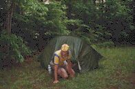
|
When I get going again, my energy has gone, so I find a pull-off "closed to motor traffic to protect the wildlife" and explore it. Around the bend and up the hill on the grass covered road is a nice flat spot, so I move there, first frying eggs with pieces of bell pepper and making sandwiches, then pitching the tent, and finally typing these notes. Now, I have a mess to clean up, and then I can go to bed.
Reliance - Cherohala, 33.6 miles, 10.3 mph (not including walking time), May 28, 2000.
Day Seven: It rains in the night, not hard enough to worry about my gear, but enough to get the tent wet again. I awake in the morning with some droplets falling and wonder if I should go ahead and get up or await a storm. But there is no sign of a storm, even though it's clear that these water droplets are rain, as they are much finer than the dripping from trees.
Most of the day is cloudy and cold. If I wear the rainsuit, I get hot; if I don't, I get cold, so I put it on and take it off several times during the day, often at the wrong times. Most of the time I have to walk, pushing the bike, as the grade is very steep. Soon after starting, I pass a 2000 ft. elevation mark; less than 2 1/2 miles later I pass a 3000 ft. elevation mark; this means that the average grade is over seven percent. Not too much to look at on this climb either. It is a typical paved highway, and most of the trees -- except the spruce -- occur in Alabama. The fog prevents any distant vision.
I can't remember such a long discouraging climb in my life. Sometimes after climbing a good ways, I come to a quick downhill that eats up my hard-won altitude. And I have no idea of how far I will have to go or how high I will climb. I stop and eat the last of the bread with peanut butter. I started with a bottle and a half of water, but I have been watching it gradually dwindle. Finally, I am down to my last swallow. I had passed a stream much earlier but had not stopped because it was so far off of the road. Right after the water is gone, I begin a downhill ride and stop quickly because I see a white plastic water pipe, which indicates that some of the locals get water there. I stop and begin pumping water through my filtration system, which seems to be jammed at first, so the first mouthful takes as much effort as the last bottle. I blow backwards through the filtration tube several times to unblock the filter. While doing this, a big car pulls up and a music store owner from well over a hundred miles away stops to fill a couple of gallon jugs. Evidently, he's come all this way just to drink the water. He swears that the road is only a couple of years old, although I point out that the trees in the road fills are much older.
I stop to cook a meal at about one, eating rice with the last of the broccoli. More important than traveling any distance is getting enough to eat and enough to drink. I am careful not to waste water through boiling, and as a result, my rice is a trifle crunchy. I've got two bottles left now.
While finishing up, I see a cyclist ride by. I shout, "Stop a while," but he responds, "at the top!" Fat chance I have to catch him because he has no gear besides his backpack or camelback, whichever it is. I guess he's one of those that doesn't believe in stopping.
I can't pedal far because the road's too steep, so I imagine he will be long gone down the other side before I get there, or he will soon zoom past me on his way back down. But after a long struggle, I reach the top, and he's still there. I sit next to him and give him my card, but he's one of those who doesn't say much more than necessary; that is, he makes strong statements but then doesn't wish to elaborate. He says that bikes were better in the 60's, indicating that he's about my age. He's heavier set than I am; I would say close to 200 pounds. He's not wearing cycling clothes, other than his old helmet. I find that he doesn't believe in new bikes and is almost belligerent about it, even though his bike is almost new, something he won't comment on. I also discover that he drove out from Athens and rode from the bottom of the mountain, a trip he makes fairly often. He also insists that the road is two years old, even though I also point out the weathered rock and the lichen.
Three bikers show up on motorcycles, and I go to talk with them. They are more fun to talk to. They ask about my solar panel, and I explain that unfortunately it always leads to speculation about what I'm carrying, which I'd rather not share. Rather than being offended, they start making wild guess, such as I'm carrying a microwave and so on. They agree with me that the road is much older than two years, although only recently completed. I give them my opinion that the road is already a dinosaur as the end of the gasoline vehicle is in sight, although probably not during my lifetime. Solar powered vehicles may replace them. One suggests that the cars may be gone, but we will still have motorcycles. I then suggest, to finish on a light note, that I can heard one future biker brag to another, "My bike has a 160 watt engine, what does yours have?"
On the Cherohala Parkway
|
Before I leave, the bikers tell me that it's 700 feet to the top, and that the top is at 5390 feet. It takes me a good while to make that distance, with some of the road bikeable but other sections too steep. After crossing into North Carolina, I find a number of springs, and I finally find one to fill up the one bottle that I've emptied. There's a final steep climb to the top, the top being obvious, and after that, I have another half mile of up and down, and then the descent begins. I stop and wonder if I should put on my rain paints (I am wearing the coat), but I see another climb, so I decide to descend without them. However, that climb was only another descent seen backwards. In fact, on the way down, there are only two "flat" stretches, and most of the time, I'm on a marked 9% slope. I would be rocketing downward, but my bike seems to sway a lot from side to side (even after being careful to repump the slowly leaking rear tire), so I try to hold my speed down. Nonetheless, I hit 38.5 mph at one point.
Soon, I've reached the "bottom" (the end of the Skyway), and I'm not sure whether to go on down to Robbinsville (I'm very hungry) or to head to the Joyce Kilmer Forest. The steepness of the roads decides the issue. If I head for Robbinsville, I will never find the energy to climb back up here, so I head for the forest, even though I am short on food.
I drop down to a four-way road crossing. Here, I am confused. The sign says the forest is right and the campground is left. But which left? Two of the roads turn left, one headed steeply up and the other steeply down. As I'm trying to puzzle this out (a map at a stop here shows the campground halfway between the two), a pickup shows up, and the driver, who seems to have an Asian wife, seems reluctant to go in any direction. So I ask him which road goes to the campground. He asks, "Do you want me to check out one of these roads? It'll only take a minute." "It should be right up the hill," I shout as he takes off. I wait a good while before I check my clock and then wait an additional 15 minutes. During this time, another vehicle goes up the same road and returns. According to the sign, the road ends in just 4 1/2 miles. The fellow who said it would take a minute must have stopped to enjoy the view.
I try the road going down, and I find the campground just out of sight. Here I find a problem. There is a sign that all tents must be on the hard gravel pads. Gravel pads are terrible on the back, and, as a result, really require free-standing tents. Although considerable effort has been made to make the area nice, I find it dirty, although I admit not anywhere as bad as the untended camping areas. Why do people have to be pigs when camping? When I leave a site, it's impossible to know I've been there. I doubt that these people's yards are messy like that. While I'm looking around, the man shows up who's been camping in the number one position. Often this person has been designed to take care of the area. But no, he tells me he's not, and he's sympathetic to my tent pitching problem. "Go on down the road and you'll find camping sites here and there where there aren't any pads, and you won't have to pay a fee either." Because the road is so steep, I check out just the first two and decide that the first is better. I'm not sure if I'm supposed to camp so close to the road, as the path goes all the way down to the stream, but the path is steep, there is only small, steep cleared section down there, and the space up here is just the size of my tent. However, someone has left a nasty campfire up here to indicate some camping has taken place here, so I decide to pitch my tent here too.
I cook my eggs with the last of the bell pepper and eat them, intending to cook some rice afterwards, but I'm too tired, so I make up the tent and go to bed. I try to type some, but staying awake is too difficult, so I go on to sleep.
Cherohala - Joyce Kilmer, North Carolina, 33.1 miles, 13.9 mph (does not include walking time), May 29, 2000.
Day Eight: I awake in the morning not feeling very good. My back is killing me (the ground was hard), and I am hungry. In spite of my hunger, I decide to go see the forest first. It is a very short, steep trip. There are only a few tables, a restroom (not clean), and a map and some photos (in terrible condition) of the route, which can be as little as a mile or somewhat over two miles, depending on whether one completes both loops or not. I lock my bike behind the john and begin, carrying my camera, tripod, and water bottle.
It's a steep climb, but there are steps and bridges, some in very poor condition, others recently replaced. The walk is doing me good as I am relaxing and my back is feeling better. The first loop is through a hemlock/rhododendron area. The bushes are so thick in such areas that the only way to proceed is along a path. I see some nice hemlocks but nothing impressive. The memorial to Joyce Kilmer is next to a large and unusually ugly hemlock, which I find strangely appropriate. I go around the second loop. The ground cover quickly changes to that of a mixed mesophyllic forest. However, most of the trees are quite young. I do pass about a dozen unusually large tulip trees (foresters mistakenly call them "poplars"), but they are the only large trees present. I construct a hasty theory as to what must have happened. Two or three hundred years ago, a fire must have burned this area clean. Afterwards, a mixed population of trees sprung up, but the tulip trees would have been ahead of the others, as they were growing in a clearing made by the fire. Then another fire or fires must have destroyed the shorter trees while the poplars, due to their greater height, were unharmed. Thus we have a virgin forest but not a climax forest. While these trees are unusually big, they are not giants. I definitely have seen bigger hemlocks and tulip trees elsewhere. Tulip trees are supposed to get to be over ten feet in diameter, and none of these are that big. Of course, the biggest trees grow in the bottom lands, where the soil is richer, anyway. Oh well, no one with any understanding of poetry could say that "Trees" is a first-rate poem either. Still, it is a nice poem and a nice walk, and it is unusually to see so many large tulip trees so close together. And the Joyce Kilmer-Sliprock Wilderness might include climax forest further in, far from the road. At any rate, I decide to take the shorter route back to the bike. I see a couple of older couples on my way out. Oh, one other amusing observation: the forest service had included frequent warnings against falling limbs in this unmanaged area; this is obvious bias on their part toward frequent harvesting to avoid such "problems." In actuality, the danger of falling limbs (or trees) exists everywhere in the woods during a storm, although the limbs would be heavier from older trees.
I then ride at great speed (due to steepness) down past the camping area and on down to the lake. It is then a ride of some miles to the intersection. Turning left there, I soon reach a store where I had stopped on my 1996 trip. I immediately buy a soft drink and some twirls to eat because I feel starved, and go outside to eat them on the bench. Then I go back inside and buy a V-8 and a grape juice for vitamins, some rolls, a tomato, and a can of "barbecued" sardines (the store doesn't have a great selection). Unfortunately, three drinks at once are upsetting my stomach, so I eat the rolls slowly and talk to the teenage girl operating the store and a man about my age who are both resting outside too, the man on the bench beside me and the girl on a plastic chair. The girl advises me to take Yellow Creek Road if I want to go to Bryson. She does warn me of one steep hill.
The road starts off gradually but then becomes a little steep. My stomach is still upset, so I stop to rest in the shade of the woods in a hollow before proceeding up it. The rest of the way seems quite easy after that first hill, but it seems to take forever to get to highway 28. I am riding by homes and very small farms. After some miles, the road becomes really steep. I not only find the road too steep to pedal the bike, but I find it also almost too steep to push the bike. In fact, I have to weave from side to side of the road while pushing. I notice that when pushing straight up the hill that my foot hits the ground nearly as far back as the rear tire does. The one advantage to a hill this steep is that I know it can't continue long; if it did, in just a few miles, I would be out into space with the stars. On this climb, I have to stop and rest three times, even though there is no place to rest the bike, so I have to hold it up while resting. Fortunately, the grass has just been cut.
Finally, I reach the top on Yellow Creek Gap, where the Appalachian Trail crosses, and the road rockets downward. The bike is swaying too much to allow me to go flat out; besides the road is terrifying. After a straight-down plunge, there is an unmarked hairpin turn. I reach the bottom in record time nonetheless. Now I encounter some forks in the road. I remember that the girl said something, but what it was is lost now. I decide to stay on the same road, and it comes out on 28. I turn right and within a short distance, I arrive at Tuskegee.
There I buy a drink and a road map of North Carolina (which I haven't had until now). It is a remarkably poor map, especially for $3.50. However, it does have a Smoky Mountain area map, which shows me that Yellow Creek Road saved considerable distance over going the other way, which according to the others' opinions was far from flat. But my route forward is far from flat also, and I find myself dragging again. On the climb before reaching 143 (Johnson Gap), I find myself stopping three times and investigating camping spots. I really liked the last, but it is within sight of a house.
Then I have a long downhill to Stecoah. The climb is gentler here, so I begin to get the idea of making miles rather than camping. Then I start to encounter construction work on highway 28 ( 800X444 road work). I have forgotten this planned bypass of the Nantahala Valley. The construction work makes finding a camping place much less likely, and the places I check are marked "no trespassing," so I travel mile after mile, sometimes having to walk where I could normally ride because there is no room for motor vehicles to pass me. Finally, after taking a picture of a bulldozer working on a suicidal embankment, I see, on the left side, a valley that the highway department had earlier built a embankment against, for unknown reason, perhaps to prevent a flash flood from sweeping across the road. This blind valley is invisible from the road and surrounded by high ridges, yet it has a flat bottom.
Pushing my bike up the embankment and then down into the pocket valley, I find a problem I hadn't noticed: two standing dead trees which I can't topple. Although their chances of falling tonight are small, I won't take the risk. Fortunately, there is a flat space further up, but it's in the middle of the "stream bed." However, unlike the highway department, I recognize that it would be a once in a thousand year event for even a trickle of water to come down here, so the "dam" and the huge drain are absolutely unnecessary. So I first cook and eat, and then I pitch my tent right in the middle of the drainage path, which isn't the slightest bit moist, in spite of the recent rains.
While taking gear out of my bags, I discover that three of the four bags are loose at the bottom, and one is hanging from a single hook. My extra added safety straps had saved me from an accident. No wonder the bike had swayed so much!
Joycle Kilmer - Almond, 31 miles, 11.5 mph, May 30, 2000.
Day Nine: In the morning, I pump up my tire again, walk and then pedal a short distance to the top, and then have a short ride past some more construction, the town of Almond, which I don't even see, and then out to highway 19. On my second downhill on 19, I notice my rear tire is nearly flat, an indication that I can quickly find the leak, and I also see a nice shady space to stop. There, I remove all my bags, turn the bike upside down, and proceed to first correct a loose fender (which occurred late the previous evening). Unfortunately, I drop the small nut and can't find it, but fortunately, I keep a small container of nuts and bolts and soon have a more secure attachment anyway; however, getting it on requires removing the generator. Then I remove the tube and find the hole by overinflating the tube and feeling the stream of air with the hair on my lip. Checking at the same place on the tire, I find a fine piece of wire firmly embedded and awaiting my next tube. So I pull it out with tweezers.
Some fellows are cleaning the area of trash, and the youngest comes over to watch/help. He gets to see me struggle to get the tire back on, and then he gets to watch me fuss over getting the generator on correctly. When I find one size of Allen wrench is missing, he goes off to find it but comes back empty-handed. He tries to help me by holding the bike for me, but now I find I am so nervous with him around that I'm not really sure of what I'm doing. Finally, his friends call him away, and I quickly finish the job. I work much better alone, even when in difficulty.
Just as I'm beginning to load the bags back on the bike, a cyclist comes by, so I yell for her to come over to me. Her name is Kristina, and she is riding on a Murray mountain bike, with two small bags on a small carrier, and a backpack and another bag on her back. We decide to ride a ways together, and she is doing something with her stuff as I continue to put on my bags onto the bike, not exactly a quick operation. She really helps me get over the next hills, as I am psychologically down from too many climbs. At one point, I try using my brakes and discover that I had forgotten to tighten the rear one, so at the top of a hill, I jump off, tighten the brake, jump back on and catch up, without her knowing the difference.
We stop at a supermarket, and I buy onion rolls, a cantaloupe, and bananas, which I share with her. She is very impressed with my generosity; most would see me as cheap. We both get water from inside, and then we eat on the bench, which we have moved into the shade. Kristina tells me that she has been living in Florida, where she has been earning a living selling home-made jewelry and drawing portraits. She left Florida on a single speed trick bike and was given her present bike in Albany, Georgia. Her route to the Smokies included Atlanta. When she arrived in the area, she began a hike from the Nantahala Valley to the top of Clingman's Dome via the Appalachian Trail. After reaching the top, she came down along Deep Creek, making the trip in a single day due to bears. She had returned to get her bike, and now she was going to look for a local job.
She is a very remarkable person and very much like me. However, she is even more of a free spirit than I am. She made the trip without tent, and I see no sign of a sleeping bag. She tells me that much of her food has been picked along the way and that she likes to eat "raw" oatmeal with raisins, rather than cooked food. She says that she lived mainly on coconuts and oranges in Florida. She intends to stay in the mountains some uncertain time longer and then head back to the coast. She says that it is too hot to see about the job now, so she wonders if I would be willing to investigate a swimming hole; however, she warns me that she is not interested in casual sex.
I agreed, so we continue on our way through Bryson City, the traffic having a tough time passing due to the very narrow road. However, she changes her mind about where we should go swimming (not trusting me?) and chooses to ride into a campground instead, asking the people sitting there at a card table for the daily and weekly rates for one or two people and then asking if we could go in the water there without charge. When we get to the water's edge, she tells me that she has to wash her feet first and for me to go in without her. Well, the water was a large river, very cold and fast, although not deep, with large rocks and no suitable place for wading, let alone swimming. So I just soak my feet and cool off for a long time until I become terribly curious about what's taking her so long. Finally, I decide I better see what has happened to her, and I find her involved in cleaning up herself and her clothes. I guess her idea had been to get into the water and to wash her body and her clothes at the same time, but when the site was not suitable, she decided to do the same away from the water, without saying anything to me.
Kristina's Drawing of Me
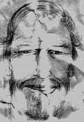
|
Before we separate, we talk some more, and she makes a drawing of me that she thinks I can put on my web page. It is a good likeness; that is, all the details are right, but it doesn't show my personality. Compare it with the drawing on the Who Am I? page, which is technically less accurate. [NOTE: The drawing was made with a very faint pencil on light cardboard. In scanning, I had to darken it and jack up the contrast considerably several times. The color differences and marks on the forehead and chin are impressions made into the cardboard while traveling that show through. The lines were produced by the scanner.] While she is drawing, I notice that her eyes are really tired looking and comment on it. She feels that her recent trip has really drained her, but she thinks she will be back to normal in a few days.
I take a shortcut on leaving the campground, so I am able to take a picture of her as she approaches along the road ( 500X351 Kristina) and after she stops ( 300X333 Kristina). We ride together until her turn-off and try to touch hands as we part but just barely fail.
It is now quite late in the day, and I know that I will have to buy a camping site, since I am in a narrow valley, dense with people and campgrounds. But I ignore campground after campground until I see one that offers "laundry" -- the magic word, as most of my clothes are dirty. After picking a place with nice grass, I make my tent first, so I can change my clothes. Then I type while my clothes are washing and then on the picnic table while eating the dinner I cooked on my stove. Finally, I carry the computer inside the tent and finish up before unplugging it.
Almond - Ela, 18.6 miles, 11.4 mph, May 31, 2000.
Day Ten: I awake fairly early and get ready quickly, feeling fairly rested from the day before. I ride from Ela to Cherokee on the narrow road, but no one causes me any problem or seems unduly patient. The drivers wait behind me until the road is clear and then proceed. I stop and get something to eat, and talk to a man sitting outside; he suggests that he can find someone to carry me to the top of the mountain in a truck. This offer will keep coming up. After my breakfast, I go into Cherokee looking for a store just to find that the stores are back in Bryson. All that's located here are tourist shops. I do find a patch kit for bicycle inner tubes in a gas station however. Everywhere in Cherokee, I see Amerindians operating weed wackers and mowers. I hope they have a better potion of the tourist pie than that.
I ride up to the parkway, and as I am about to start the climb, a vehicle stops and a cyclist and his wife get out of the car. I stop to say hello. It seems that Don will be making the same ride that I will. Knowing that I'm not fresh and am carrying extra weight while Don will be riding a lightweight bike, I tell him that he will probably pass me up the road very shortly, and so I proceed alone. However, before I've gotten very far, I notice that he is right behind me and not gaining any speed, so I wait and we bicycle together.
Don is originally from Ohio but has been living in North Carolina for five years. He does some electrical work, but he doesn't want it to be a full-time job. Instead, he and his wife operate a guide service for those wanting to hike in the Smoky Mountain region. For fairly modest fees that range from a minimum of $20 and a maximum of $50, they pick up day hikers, carry them to the trail head, accompany them on their trip, and ensure that the hikers get to see something worthwhile.
Don is much more of a hiker than a cyclist, and his cycling style shows it. Although his chain is on his middle cog in the rear, his speed up the mountain is about three miles per hour. Therefore, to keep pace with him, I have to ride slowly or walk briskly. However, he has found a pace that he can keep up all day. After twelve miles with just brief stops, I reach a point where I just have to take a longer break, so we separate. I'm thinking I need a half hour or hour, but after twenty minutes, I'm ready again. Although I feel I'm moving faster than Don, I never do catch up with him.
This section of parkway is by no means impressive although it is nice. The grade is mostly about seven percent, which makes it steep but not impossible. There is very little traffic, the least I've seen anywhere on the parkway. There are a number of short tunnels. It is important to always have a rear light in these tunnels as some motorists don't turn on their headlights. After continuous climbing for about 15 miles, there is a downgrade at Soco Gap (junction with 19 going into Maggie Valley) followed by a steep uphill climb. On the upgrade is a water fountain, where I'm sure Don stopped, as he had used more than half of his water while we were together. Although I had been drinking more sparingly, I was on my last bottle at that point. Then there is even more climbing to about a mile in altitude. And finally miles of downhill to the Waynesville exit at Balsam Gap.
The exit itself is a long downhill, and then there is a long downhill to Waynesville. I discover that I am totally exhausted. Although I enjoyed and was grateful for Don's company, if I had been traveling by myself, I would have stopped longer and cooked some food on the trip up. I am too tired now to pedal even a short distance uphill and counting money is beyond me. I stop at a grocery and then at a Subway. At the Subway, a man tells me of a motel at the edge of town. Since I have so few mental and physical resources left, that's where I go after getting a spare inner tube from Walmart.
Ela - Waynesville, 46.9 mph, 11.0 mph (does not include walking time), June 1, 2000.
Day Eleven: Although I went to bed late and slept poorly, I wake up early as I usually do in a motel. As soon as I get over my grogginess, I pack the bike and head out. My first trip is up the hill to the supermarket. That trip is a waste of time, as the supermarket is highly overpriced, even having high prices for its reduced produce. The price of the bananas is high, and they are green. I find two things whose price I can stomach: a bag of mixed vegetables for a dollar and two turnovers at the same price; however, when I get to the checkout, I find that the vegetables are $2.69 (I was sure I saw a sign that they had been reduced), so I just buy the turnovers. They don't taste good and are covered with a heavy syrup.
Highway 209 goes to Hot Springs from Waynesville and is a fairly narrow road with a bit of a shoulder at first but light traffic. After some ways, I come to the beginning of a hill, and a pickup with a trailer stops, and the driver asks me if I want a ride to the top of the hill. I declined politely and proceed upward. Although I have to walk, the climb isn't nearly as steep as some of the brutal grades I've already experienced. And the day is cooler as well, so I am in good spirits as I reach the top and then rocketed downwards, stopping at the store at the turn at the bottom.
The store has bananas, and although they are flecked with brown spots, they are still firm. I get some V-8 too. The really bad characteristic of small stores -- which is now providing true for supermarkets too -- is that there is no inexpensive bread product, other than bread itself, which is almost twice the price it was a few years ago. Those that say that prices are stable are just ignoring the cost of food. I guess it's just as well because if Greenspan did anything about it, he just would hurt most the ones already hurt by high food prices. I get some pecan swirls which are too sweet and have too little taste.
Outside, I find a large dog with short legs very mournfully watching me eat. A young fellow with a little hippie-type beard talks some with me about living cheaply and gives me a small crystal to plant on top of some high mountain.
I find myself climbing a high mountain right away as I leave from the store. This is the longest climb of the day, and I have to push my bike up the great part, but it's not an entirely unsatisfactory experience. The climb is not steep enough to be miserable and not long enough to be discouraging. It is a little hot. At the top of the mountain, the road levels out for a while, and I enjoy the shade and the trees. Then I start down, and the rest of the way to Hot Springs is almost entirely downhill. It's not a steep grade, and the wind is pushing against me, so I have to pedal most of the time, and my speeds are not high. On the way down, I find a store where I can get some more food and then I pass another store as well. The woman at the store reminds me that it is not all downhill, and a few miles outside of Hot Springs, the road climbs high on the the side of the mountain, giving a few views and passing a national forest camping ground before plunging into the town.
In town, I have trouble getting water and finally get some from the national forest office. I wonder where the people get their groceries, as the store I visit has very little selection, less than the stores I had passed on the way down. However, there is an excellent outdoor shop for hikers, due to the nearby Appalachian Trail.
On the way up the mountain north of Hot Springs, I check out some of the sites I had checked before, and finally decide to camp on a unused loop of road near the top, in the national forest, near the Appalachian Trail, but out of sight of the highway and the trail. I cook some eggs with peppers and eat them and then cook some rice and eat most of it; then I clean up and pitch my tent and crawl in. I try to write, but I soon get too sleepy to continue.
Waynesville - Hot Springs, 41.3 miles, 13.7 mph (does not include time spent walking), June 2, 2000.
Day Twelve: I wake up fairly early but do some typing before getting up and packing the tent. Riding down the hill, I encounter a yard sale at the little out-of-business store and buy a drink. The people let me go inside to fill my bottles There are two cute little girls there, and the proud father points out that they are his. I learn from someone else that the sale is to help the girls' mother who has a problem with her liver.
I ride a few miles north along a winding fishing stream, with trout fishers here and there. Then I turn onto 212 which runs to Tennessee. The road follows a stream upward, so the pace is gentle for many miles. I enjoy watching the miles pass away. Along the stream are occasional homes, some pasture, and some woods. My pace is pretty good as the gradual rise of the stream does not slow me much. Finally, I reach the steep rise at the end of the valley, next to a church cemetery full of Shelton's and King's. Having to push up the hill does not bother me, as I have gained some good miles. On the other side, the long descent is also nice. I pass under the new highway and hope I will be able to ride alongside it to Erwin. First 23 and then 19W join my road. The road seems to parallel the new highway without problem.
I stop in a little store for a snack and get a drink and some crackers. I sit at the table inside and make small talk with the locals. Before I leave, they give me directions to my turn to Unicoi, and I draw a map. Outside, I find that a thunderstorm is brewing. Two men and I stand there and waste time, talking about traffic and accidents, while the storm blows and rains hard and others run in and out, getting wet. The only problem with waiting out the storm is that I have taken two long breaks in a row, so now I will not be able to travel as long a distance for the day.
When the rain has stopped, I leave. The route into Erwin is obvious, and I did not need to get directions. I stop at a grocery for yogurt and bananas. And after I get into town, I stop for bean burritos. I talk with a Mexican couple about their baby with black eyes.
The road from Unicoi to Limestone Cove has moderate traffic. Land along the narrow valley belongs to the national forest; however, I am thinking about staying at the campground. Nonetheless, I stop and check out a side road. I often use such roads, on which I wouldn't camp, to get an idea of what the woods are like further in.
On up the road, I stop at a pull-off to look at the national forest posted information. Some animated people have a large cooler two-thirds full of trout which they have caught. It seems that today is release day and that children have the first opportunity to fish. I let them give me the two smallest fish and then go up to the campground. It seems that the campground is both better and worse than many I've seen. The best benefit is that I won't have to sleep on gravel if I camp here. The worse fault is a smoky fire that will leave me coughing and choking if the wind shifts. I also don't like the fact the my tent, bike, and cooking area will be far apart. It also bugs me that I am supposed to pay the same fee as a carload of people, although admittedly I will be using one site, just like them. Going back and finding a camping site for myself away from the campground is also possible and not against forest service rule. However, due to the release of the fish, there will certainly be someone checking licenses, and I have two fish and no license. I'm not even certain if it's legal for me to have them. Weighing all the options, I decide that I will feel safer and happier with my own site, so I ride back. I pass the bridge and camp on the side opposite the stream under a small tree. The tiny space I have seems perfect to me, and I feel safer than I did in the campground.
I clean the fish, bury the heads and guts (but with no paper or plastic), and then start cooking. The fish are huge and overflow my pan. I cook some rice while eating the fish, cleaning up my pan, and burying the bones (in another location). I eat the rice, clean up, and pitch the tent over the spot where I had been cooking. I type for a while before getting sleepy and going to sleep for the night.
Hot Springs - Unicoi, Tennessee, 46.9 miles, 12 mph, June 3, 2000.
Day Thirteen: In the morning I wake and pack quickly. I notice the bike route sign I saw yesterday. Reaching Limestone Cove, I turn left (as does the bike route) and travel over a small hill that is not too steep; however, there are many aggressive dogs on this short stretch of road, some fenced or chained and some not. I have to yell and scream a lot at the animals. On the way down the other side, I have to brake abruptly due to three in the road. The owner, sitting in his car, grins at me. I tell him in a loud voice, "It's not funny! Your dogs have no right to be harassing passers-by!" He responds, "The big dog is not mine, and the others won't bite." It would be a long argument to explain that non-biting dogs can be dangerous, and I won't be back, so I go on. He passes me very shortly. These attacking dogs seem inappropriate on a bike route, and it's odd that there are so many here so close together.
Like yesterday, I find myself going down a highway with a major four-lane highway. Yesterday, I stayed on the parallel road, but today I would have to turn off the road and onto a valley road to run parallel, which the bike route does. But I don't know that the two roads will merge back together, and I have an eight-foot wide shoulder to myself, plus traffic is light, so I stay on the main road for the three miles. However, the shoulder disappears just before I reach town.
I stop and get a Subway before turning right. I get to explain the importance of exercise with the woman who makes my sandwich and who wants to learn more, due to some comments I make about foods.
I anticipate that traveling around the lake will be easy as water is flat, right? However, the road is all steep up and down grades, and I am sometimes near the water and sometimes high above it. There is a climb after the lake before Butler and another one at Doeville, but then the rest of the way is flat or downhill through small farming country.
Beyond Mountain City, I find myself climbing again, something I had forgotten doing when traveling this way before. However, I eventually start downhill, and the rest of the way to Damascus is almost all downhill.
There's a number of Appalachian trail hikers already there, the ones heading north including a couple with an eight-year-old boy plus a dog, having come all the way from Springer Mountain in Georgia, and a group of students from Clemson hiking south, all the way to Springer Mountain in Georgia ( 800X548 Clemson hikers). After I arrive, a couple from the Nederlands arrives by bicycle, following the National Bike Trail west. John and Mariam, who are close to my age, received time off from their jobs to make the trip from east to west coast.
I am very excited about being there, so I go around and talk to the separate groups of people, being careful not to wear anyone out. Finally, everyone else goes to bed, and I take a shower and go to bed too.
Unicoi - Damascus, Virginia, 56.6 miles, 12.2 mph, June 3, 2000.
Rest Days: On June 5 and June 6, I do not ride, but I instead just visit with cyclists and AT hikers, mainly the latter. The cyclists are Pheobe and Susan, two college students, who are crossing the USA together from east to west along the National Bike Trail ( 400X349 Pheobe and Susan). I also briefly meet Robert, who is older than me, and his daughter Alice(?) who have cycled up from South Carolina and will be following the bike route as well. We also hear news that Mariam has had a minor collision with a dog and has injured her face.
I also spend time sewing up my cycling shorts and writing my account of my trip. I buy some leg warmers and a new bicycle seat, which is small and hard. But most of all, I use the two days to completely recover from the trip I have made so far, which is basically what the AT hikers have been trying to do as well.
|
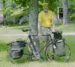
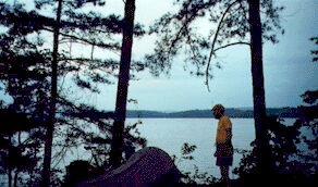
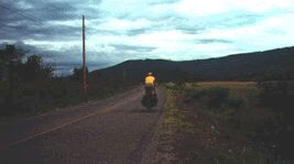
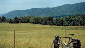
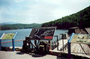
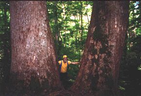

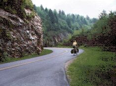
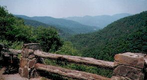
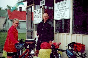
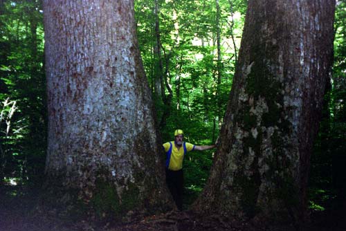
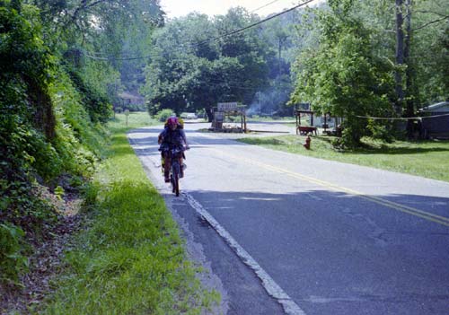
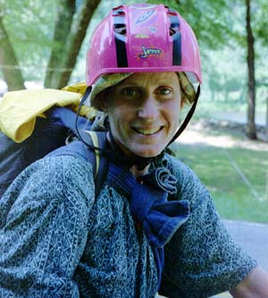
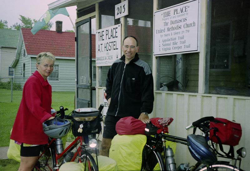
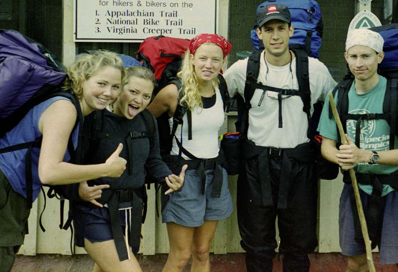