Mixed Surface Riding in Rain: N. Oregon Coast
I’m a lucky guy in a lot of ways. Recently my good luck included being able to spend some time on the Oregon coast, bringing along my daily commuting bike (née mountain bike), and getting in a few hours for riding while my kidlets were otherwise occupied.
A few hours isn’t much in terms of some Rough Stuff rides, usually the seem to involve doing some driving to the rough as well as some extended exploration. While it’s fair to say that our drive from Seattle to the Oregon coast counts for driving it was really great to roll my bike out of the garage, on to the streets and then into the woods without anything else in between.
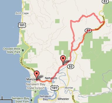
I was near Nehalem, Oregon, 20 or so miles south of Canon Beach, along the 101 Highway. 101’s well known for tours — relatively friendly roads and great views of the beach. Turns out the coast is also well known for dairy farming and logging, meaning lots of nice valley rides with turn offs into logging land. With this in mind, I took 101 south into Nehalem downtown, turned left up the Northfork Nehalem River road and kept my eye out for promising logging roads on my left (uphill, out of the valley). Here’s a rough map of where I went on day 2.
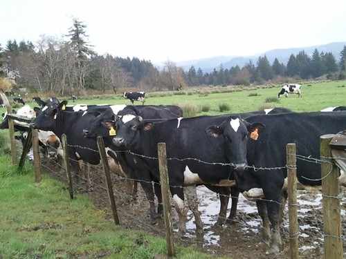
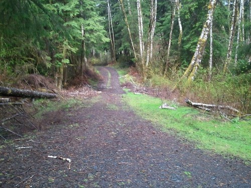
My first ride was pretty much unscripted. Part way up the Northfork road, I stopped to take a photo of some cows, and found myself staring at the Nehalem Quarry road up ahead. Let’s see what’s at the top, and so off I headed. The Quarry road is paved to start, and predictably heads up to a quarry yard after just a few miles. Seen one Quarry yard, seen them all, so I didn’t stay long. A clearing was visible to the north, and at the end was a gravel road that I headed up. Rough, winding and steep it was a full on logging road that wandered through the coast forest with occasional side trips through clear cuts. The road was ‘fractured’ in places, with parts of it sliding downhill from the rest. The biggest fissure was actually a 4 foot side sink hole I’d hate to have plunged into coming back down hill.
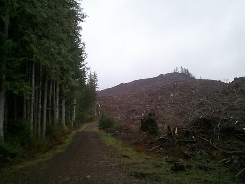
As I went up, the clouds came in closer and squeeged themselves dry on the hills I was climbing. Mindful of the time and the increasingly foul weather I turned back southwards at the top of the road in a unmerciful clearcut, after getting the remainder of my rain gear out of my bag. The trip down and back was the trip up in reverse, just slightly faster and quite a bit damper.
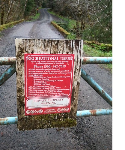
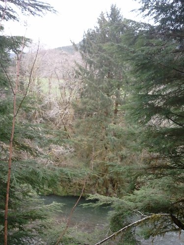
I took advantage of some time in the evening to plan my next route: Up the north fork river road to the Fish Hatchery, then looping back along some logging road. The road out to the Fish Hatchery is 2 lane the whole way (both the North Fork road and Highway 53) is 2 lane, but traffic was very sparse and careful when passing. I took a short side trip to the hatchery to see the fry and take a look at the river. The actual turn off into logging land is about 3 miles eastward along highway 53, and bears this sign on the gate.
The roads in this area seemed more mature than those above the quarry, more like a gravel road you’d expect to drive a car on, at least for most of the roads. It’s clear that some of the roadways are new, and not all of them are mapped making it a bit difficult to determine which intersection you’re at without looking very carefully at your map. I blame this, and the failing batteries of my GPS, for taking a wrong turn farther up into the forest. Fortunately I ran across some powerlines running back down to the river, and used the overgrown track there to navigate back to the road I was trying to be on (Carol Drive). These roads were much tamer, leading through a backwoods gated community of lovely houses nestled in the valley. Home again, home again lickety split.
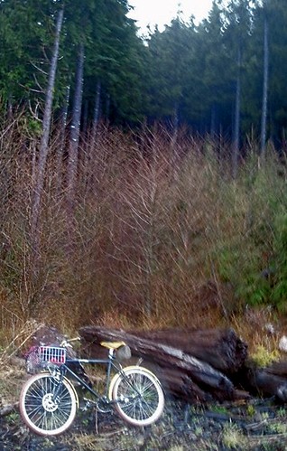
A word about my bike — she’s a mountain bike at heart (Surly 1×1) running fixed. I set her up with 650b wheels and tires (Grand Bois Hetres) and a front basket and modified fork some time ago. She’s a great rain bike for my daily commute, and I wasn’t sure how she’d fare once back in the woods, especially with the slick Hetres. Amazingly well is what I found out. I did loose traction on the rear tire one or twice, and probably a small-block style mountian bike tire would have been better but it’s hard to imagine another tire giving me better overall performance across pavement, gravel (regular sized) and the Great Gnarly Gravel I ran into. On longer, dedicated rough stuff rides maybe I’ll be lucky enough to switch. Maybe I’ll bring a better camera too.