Mountain Loop Highway
I’ve had a much slower than average year of riding, which is why the blog has been so quiet. The snow pack in the mountains surrounding Seattle still hasn’t melted out, so a lot of my favorite terrain isn’t available for riding. I’ve also been spending more time in my kayak than on my bicycle. If you are local, riding routes suitable for this blog, and interested in helping me with articles for the blog please let me know.
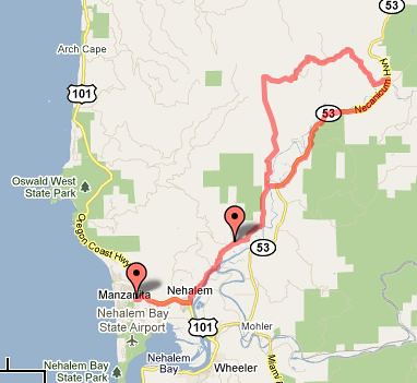
The Mountain Loop Highway is about 50 miles north of Seattle and is a really nice loop through the foothills of the Cascades. The loop itself is about 100 miles, with less than 25 miles of anything that could be called highway, 14 miles of dirt, and the remainder is made up of lightly trafficked nice asphalt. It can be done as a day ride, but it passes so many excellent campgrounds that it is kind of a shame not to make it into a two day ride. Last Thursday 4 friends and I did exactly that, riding the route as a sub-24-hour overnight. Going on two weekdays (Thursday and Friday) allowed us to avoid the higher weekend traffic in this recreational corridor. It is close enough to Seattle that none of us had to take Thursday off, we just had to leave work a couple of hours early.
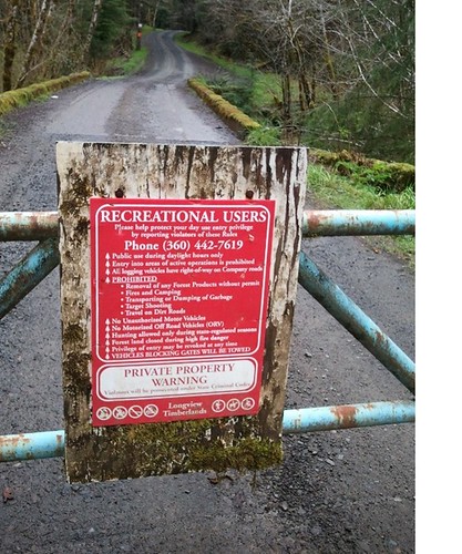
I had proposed making this trip more worthy of the “rough stuff” moniker by trying out a new route that would cut out Granite Falls and go over the mountains in the center of the loop instead of around them. An hour into our ride we had to change plans, it turns out that there is an often unmapped and impassible Navy Base right in the middle of our proposed route. We used my GPS to find an alternative, and I think it turned out to be a nice route going along some farms and then the Stillagaumish River.

Riding along farms between Trafton and Granite Falls

Riding from Granite Falls to Verlot as the sun fades behind the mountains

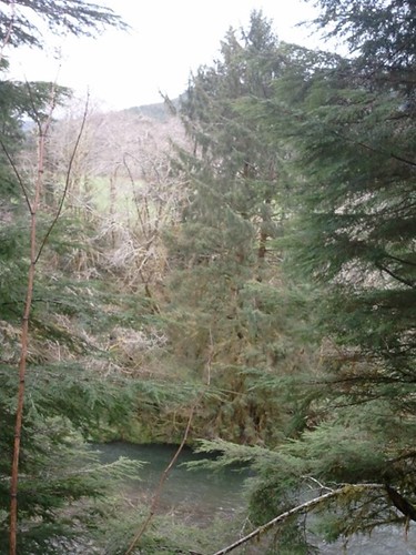
The swimming hole at Wiley Group Site
We reached Granite Falls as the sun was setting and rode up to Verlot (the boundary of the National Forest) as darkness fell over us. Once in Verlot it was good and dark, but just after Verlot there are many NF campgrounds and ad-hoc campsites on the side of the road. We found a nice but unused group camp site and setup there for the night.
The climb from Verlot up to Barlow Pass is really enjoyable. This is not a mountain pass that any cyclist should be nervous about, the grade is rarely steep and the scenery is very pleasant. It is also pretty low at 2361 feet. At the top of the pass the road goes from pavement to gravel and shoots down along the river with some great views. Even though the pass isn’t that high the 1700 feet descent down to Darrington goes by quickly. As Jimmy put it the day was “all smiles”.

A nice marsh on the descent from Barlow Pass

Lee descending from Barlow Pass

You have to stop and turn around to catch this waterfall, but it is worth it.

The road turned back to pavement closer to Darrington. Riding on a weekday kept the traffic light and made it safe to ride side by side. Photo by Jessica.
We reached Darrington (40 miles later) at about lunch time and after a quick lunch our group split into two. Some of us went back to the car, others went up to the Suiattle River for another couple of nights of camping. The Mountain Loop highway could easily be turned into the centerpiece of a very nice multiday camping trip starting in Seattle, going to Arlington, around the Mountain Loop, up to Suiattle, and then back via Whidbey Island. That route would give one mountains, ocean, scenery, great camping, and all on mostly low traffic roads. It also makes a nice way to start a cross-state ride that would go over the North Cascades Highway.

There are good views on SR530 going back towards Arlington too. This was the only section with much traffic, but there was a good shoulder most of the way.
Day 1 Map (43 miles)
Day 2 Map (62 miles)

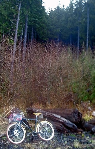
That's me (Alex). Jessica took the photo. Packing reasonably light always makes riding more enjoyable.