Colville Nat’l Forest: S Boulder-Deadman Loop
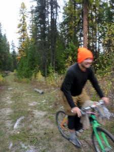 A few weeks ago Patrick, Jon, and I took a ride in the Colville National Forest and slept under the stars on the Kettle River. I kept thinking back on my favorite piece of that ride, which was S. Boulder Creek Road, and I wanted to figure out a loop where I could run the lengthof that road and pop back out on the Kettle River at Barstow.
Here’s the loop I figured out. We rode this loop counter-clock-wise, which is the way I’d do it again.
Yesterday, Patrick and I rode it. Wedging the ride into our busy lives required leaving Spokane at 6 am, driving for 2 hours, doing the ride, then driving back. I was home by 5 pm.
For me, it’s just about a perfect day ride. Patrick was tired and feeling a bit sick so he wasn’t raving about it like I was when we finished.
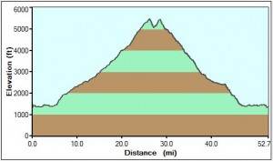
The elevation profile provides a good description of the nature of the ride.
Though the profile makes it look steep, check out the mileage: the climb is about 27 miles, so it’s moderate. It’s the perfect kind of climb in my mind: steady, moderate, smooth forest roads with great scenery. You can get into a good rhythm and just zen your way up the hill.
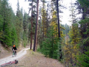
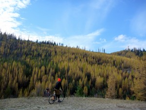
There were a couple sweeping big views, but mostly, this ride is through the forest and doesn’t have any huge-see-forever-views.
Except for about 8 miles of S. Boulder Creek road, which is closed to cars, the entirety of the route is well-used forest roads. There were a number of hunters and firewood gatherers up there. There’s enough use to keep the roads clear but not torn up.
The majority of the descent was smooth with mostly gentle curves. Lots of good sections where you can build up speed and see the long run outs ahead.
If you go:
- Bring a GPS and follow the track to make it easy. Especially on the descent, where there are more established roads that will slow you down if you’re not following a track.
- Bring proper clothes. You go from about 1500 feet to 5400 feet. We were lucky not to get rained on, but it was chilly, and you’re climbing into the cold. So make sure you are happy with your sweating climbing vs cold descenting layering system
- Bring a filter. There’s lots of water on the climb up until about the last 5 miles or so.
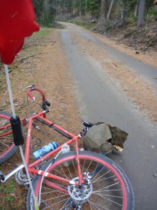
- Huge fatty tires are not required for this loop. Next time I ride it, I may ride my cyclocross bike. There’s no technical stuff. The hardest part is the last 6 miles of the descent where the road is graded, graveled, and washboardy — you don’t want to approach corners too hot on this section.
This loop is a great backbone for exploring the area. I plan on spending a lot of time up there next summer. That gives me all winter to obsess over maps.
